![](https://palinski.org/wp-content/themes/shapely/assets/images/placeholder_wide.jpg)
Półwysep Salentyński
Czyli ten “obcas” na “bucie” Włoch, po włosku “Salento”. Stanowi część regionu Apulia (Puglia).
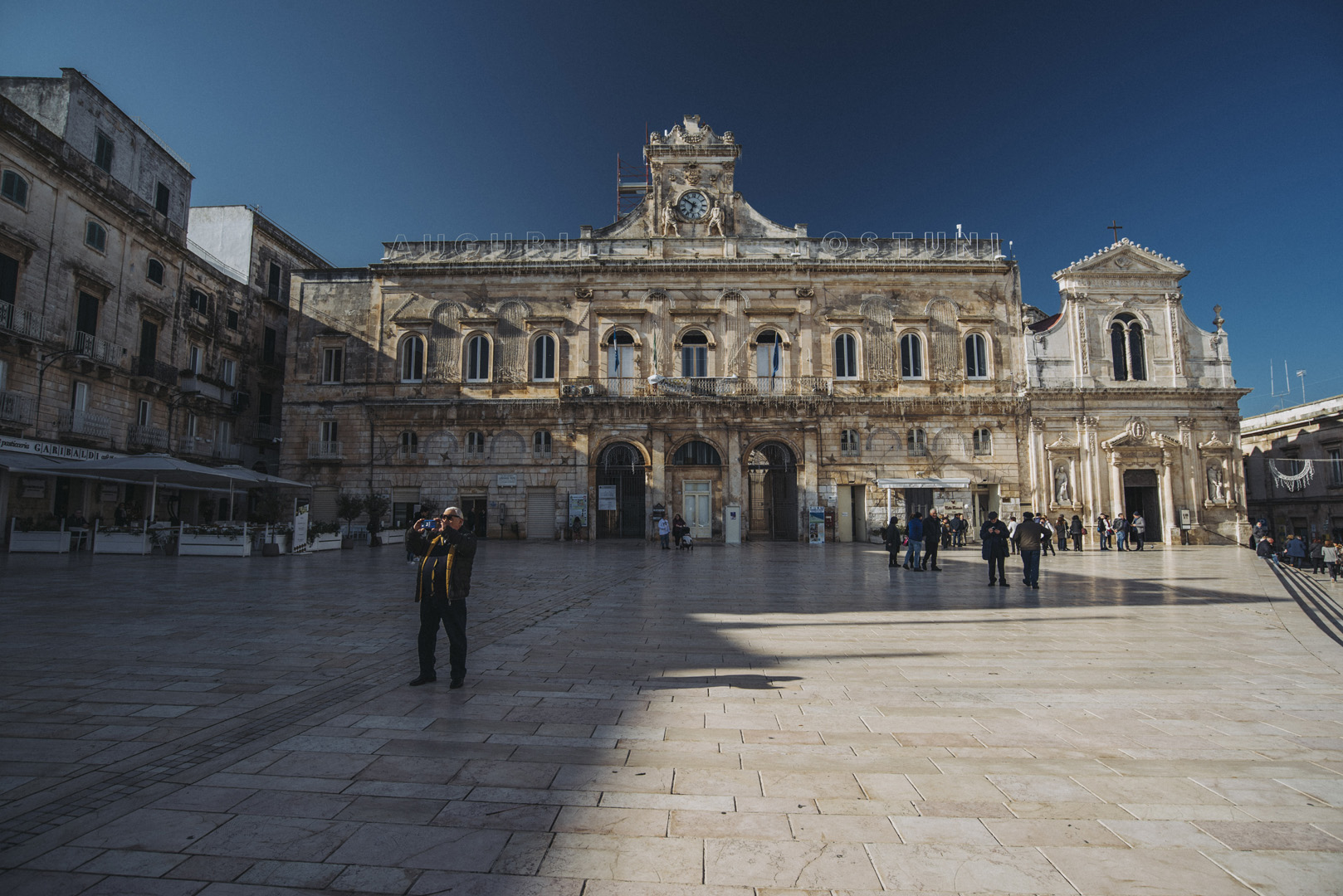
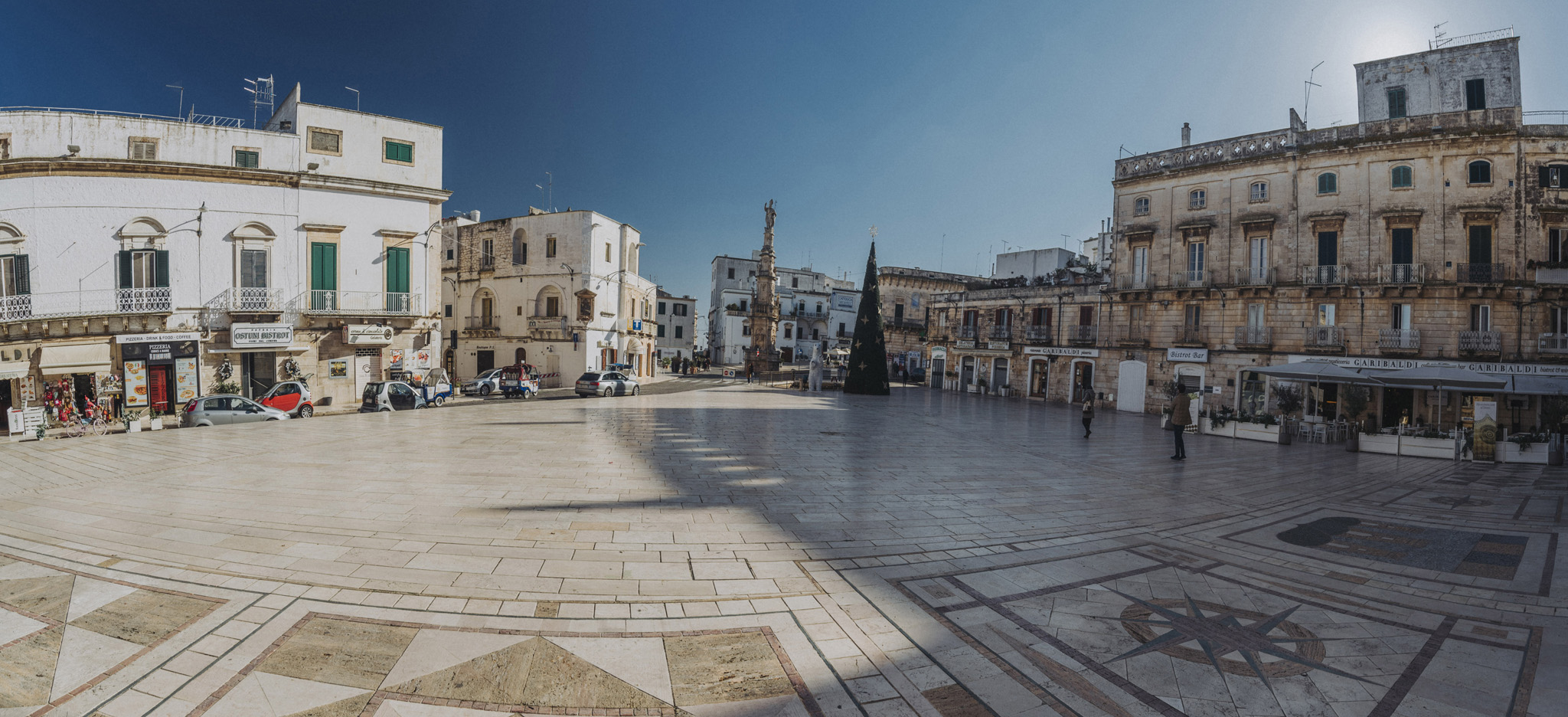
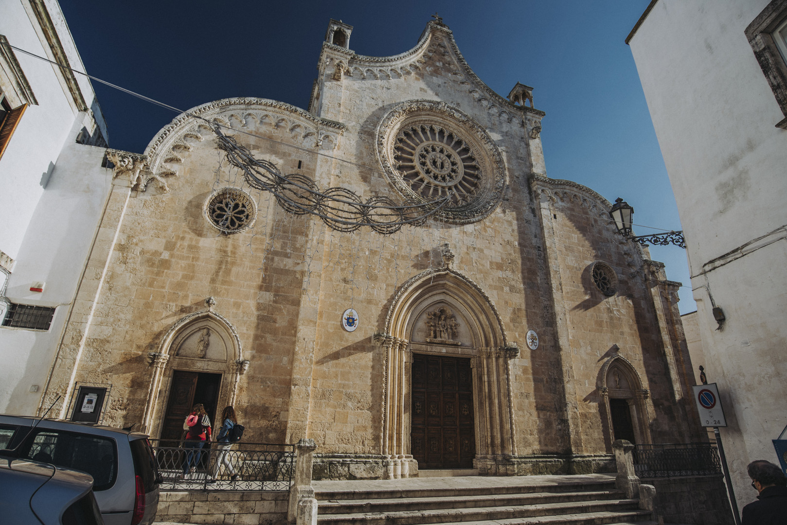
Ostuni
Najciekawszym miejscem w mieście jest Plac Wolności (Piazza della Libertà, 40°43’56″N 17°34’41″E).
![](https://palinski.org/wp-content/uploads/2020/01/DSC7879.jpg)
![](https://palinski.org/wp-content/uploads/2020/01/DSC7849-Pano-2.jpg)
![](https://palinski.org/wp-content/uploads/2020/01/DSC7852.jpg)
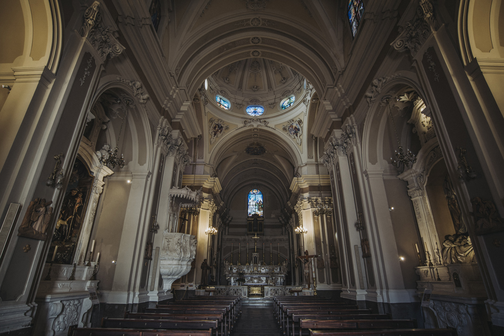
Oraz katedra (Concattedrale di Santa Maria Assunta, 40°44’03″N 17°34’44″E).
![](https://palinski.org/wp-content/uploads/2020/01/DSC7866.jpg)
![](https://palinski.org/wp-content/uploads/2020/01/DSC7877.jpg)
![](https://palinski.org/wp-content/uploads/2020/01/DSC7868.jpg)
![](https://palinski.org/wp-content/uploads/2020/01/DSC7873.jpg)
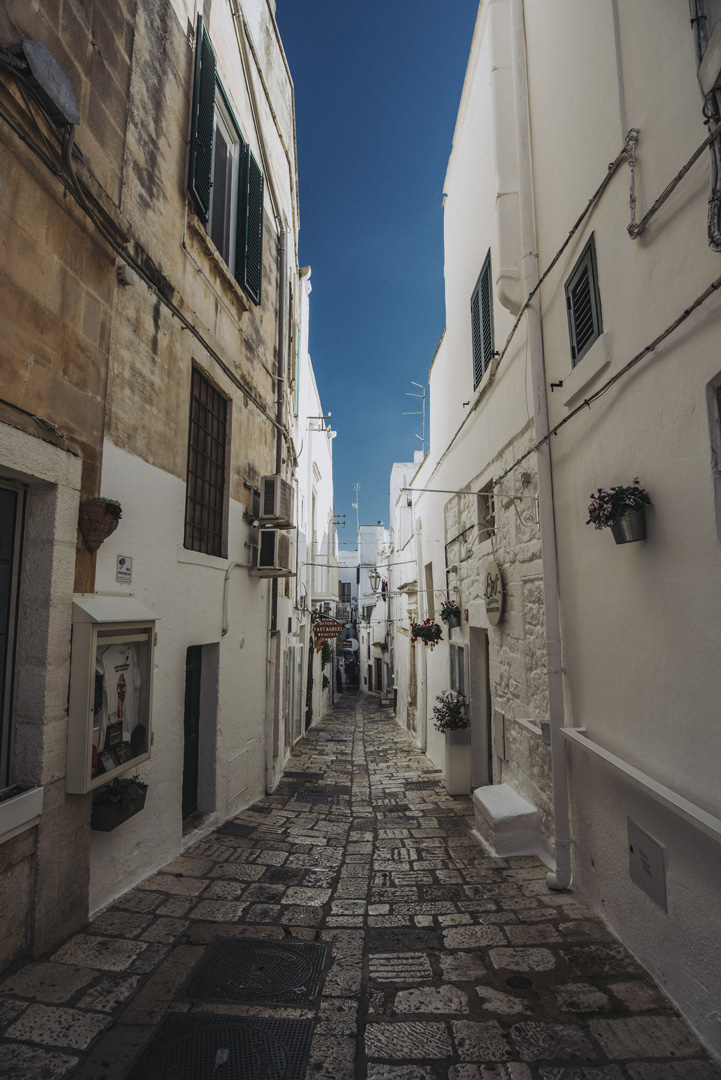
Charakterystyczne dla Ostuni są białe budynki.
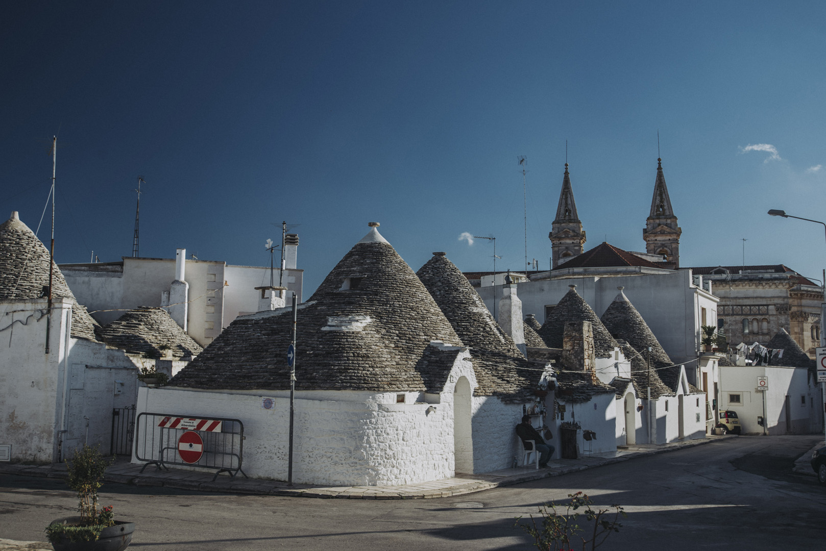
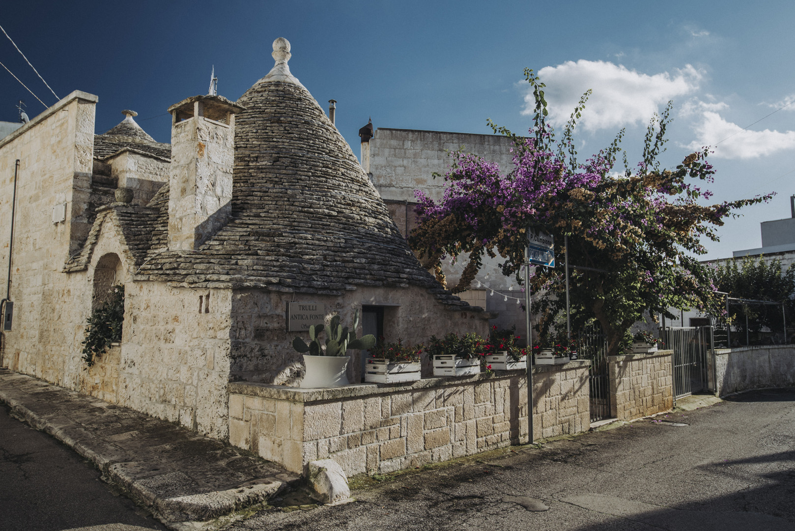
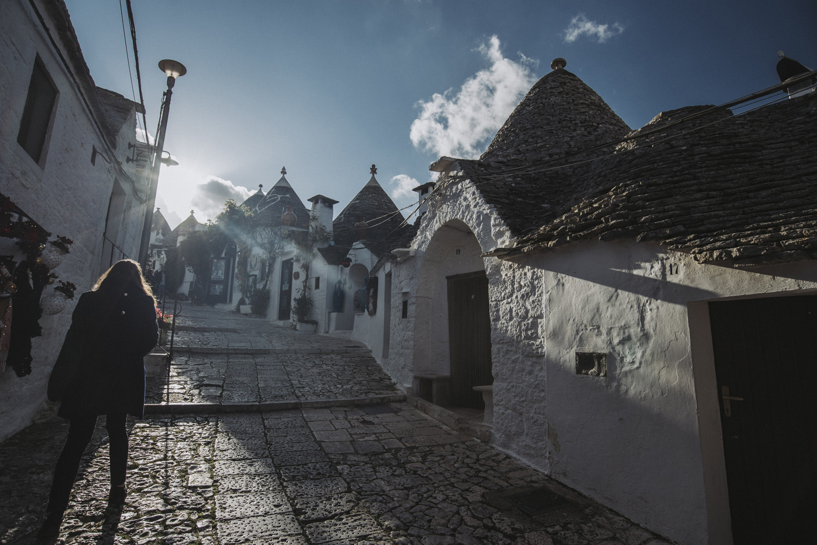
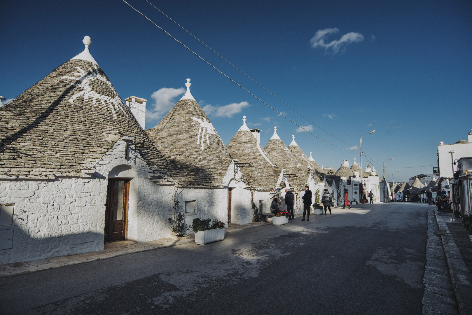
![](https://palinski.org/wp-content/uploads/2020/01/DSC7860.jpg)
Alberobello
Alberobello (40°47’06″N 17°14’10″E) jest miastem znanym głównie z licznie występujących Trulli. Trullo to mały budynek, którego stożkowaty dach jest złożony z kamieni, ponieważ nie jest murowany, to można go łatwo rozebrać przed wizytą urzędnika i nie płacić podatku z powodu nieukończonego domu.
![](https://palinski.org/wp-content/uploads/2020/01/DSC7884.jpg)
![](https://palinski.org/wp-content/uploads/2020/01/DSC7891.jpg)
![](https://palinski.org/wp-content/uploads/2020/01/DSC7894.jpg)
![](https://palinski.org/wp-content/uploads/2020/01/DSC7899.jpg)
![](https://palinski.org/wp-content/uploads/2020/01/DSC7906.jpg)
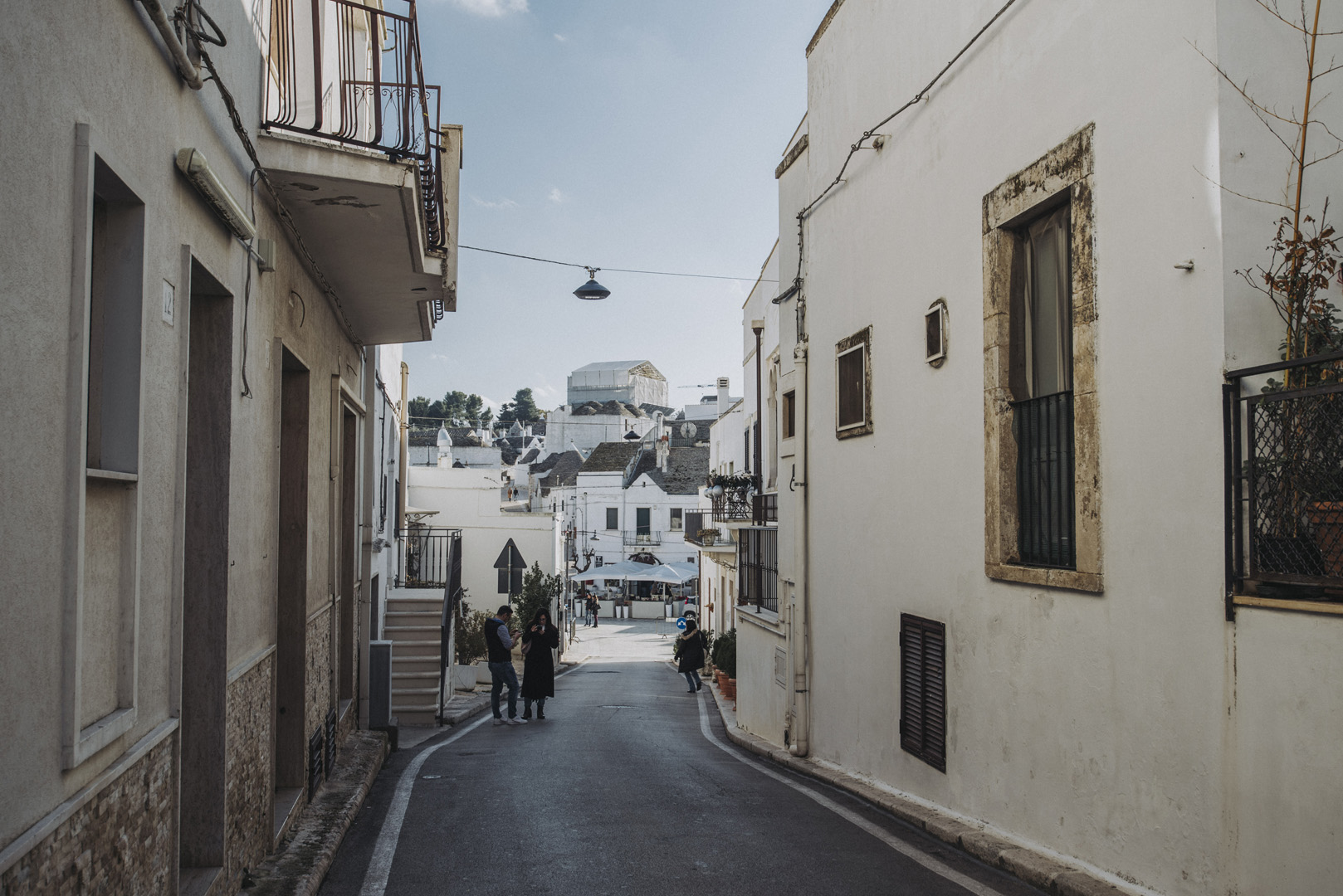
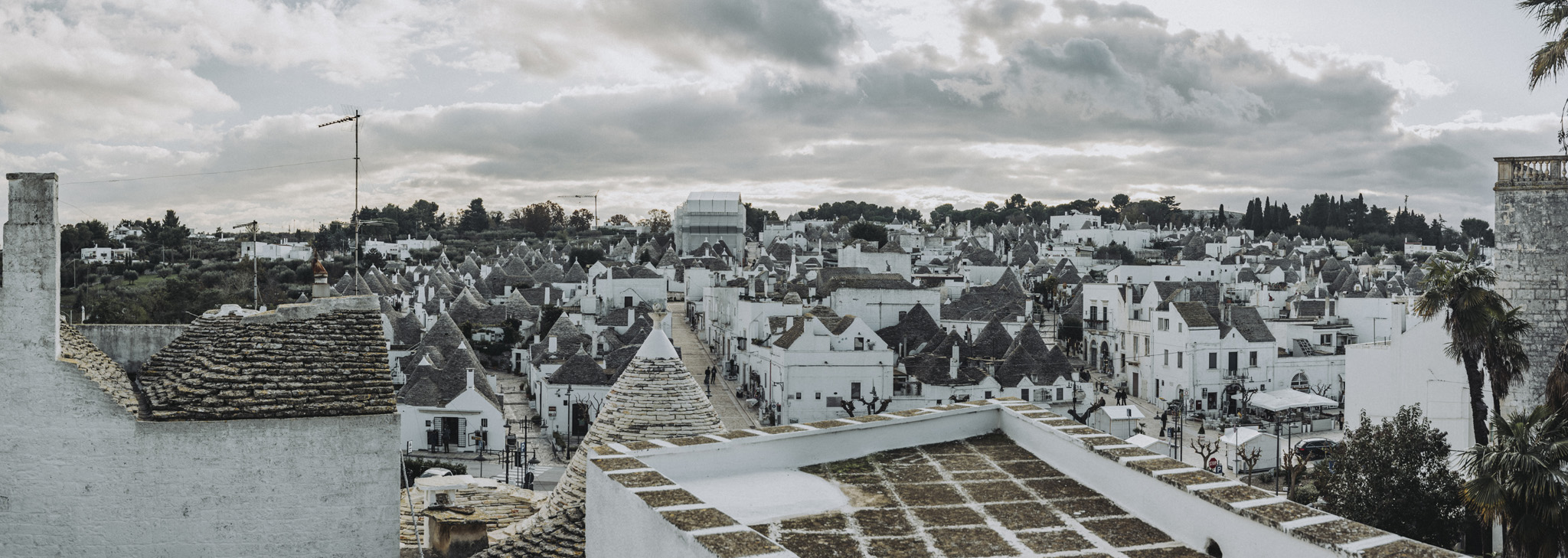
Widok na panoramę trulli z tarasu Belvedere (40°47’00.5″N 17°14’17″E)
![](https://palinski.org/wp-content/uploads/2020/01/DSC7912-Pano.jpg)
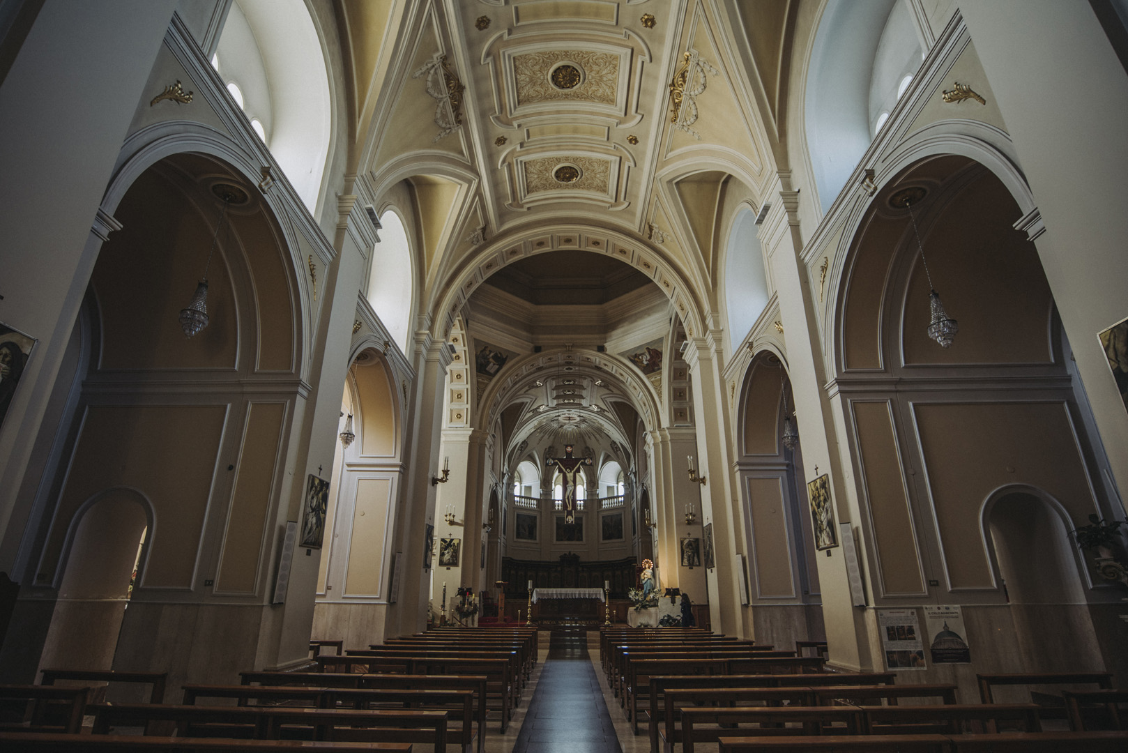
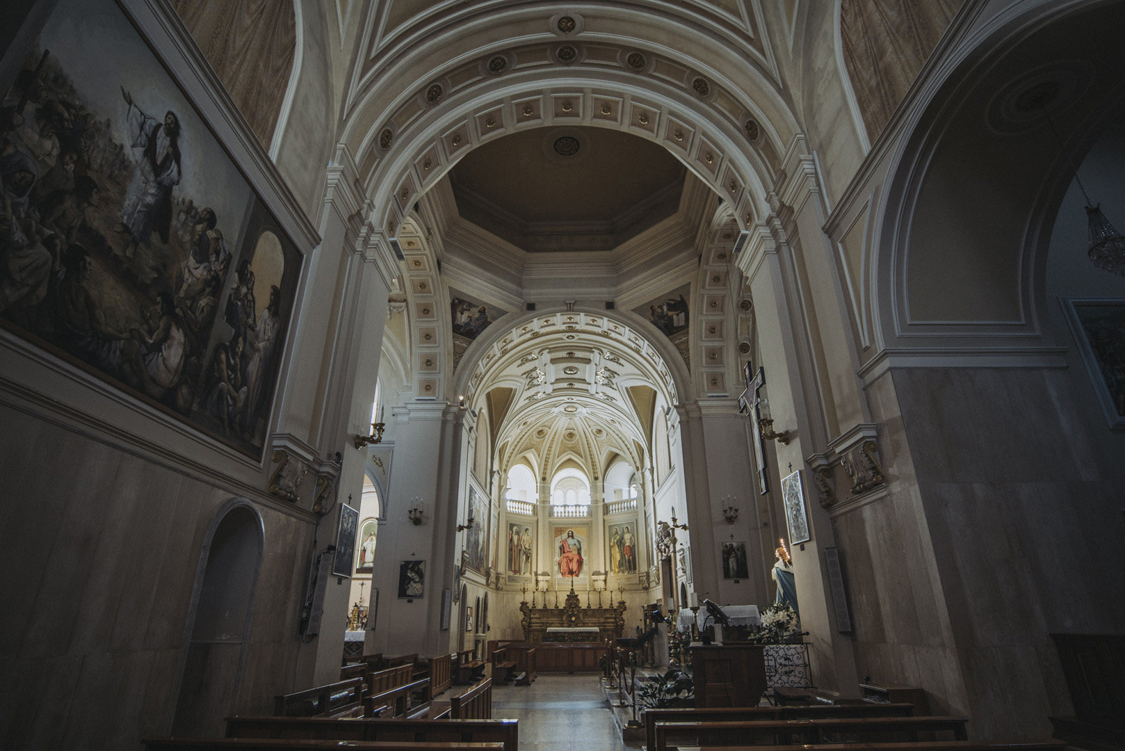
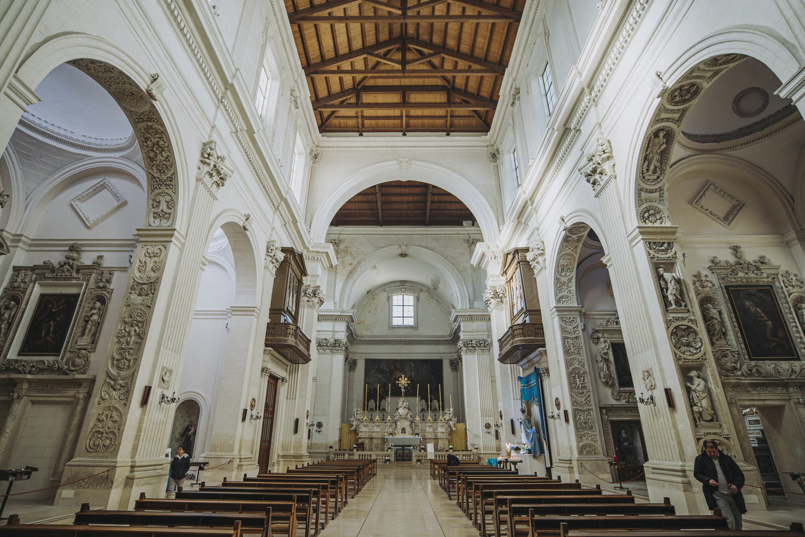
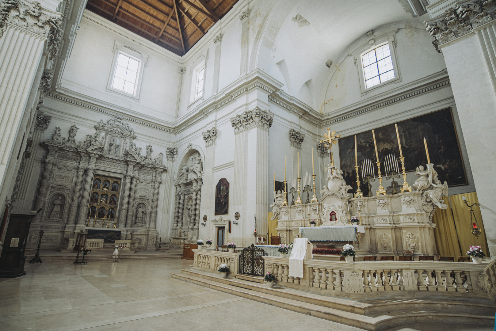
Warto też zobaczyć bazylikę (Chiesa Basilica pontificia dei Santi Medici San Damiano e San Cosma, 40°47’12″N 17°14’09″E).
![](https://palinski.org/wp-content/uploads/2020/01/DSC7882.jpg)
![](https://palinski.org/wp-content/uploads/2020/01/DSC7883.jpg)
Lecce
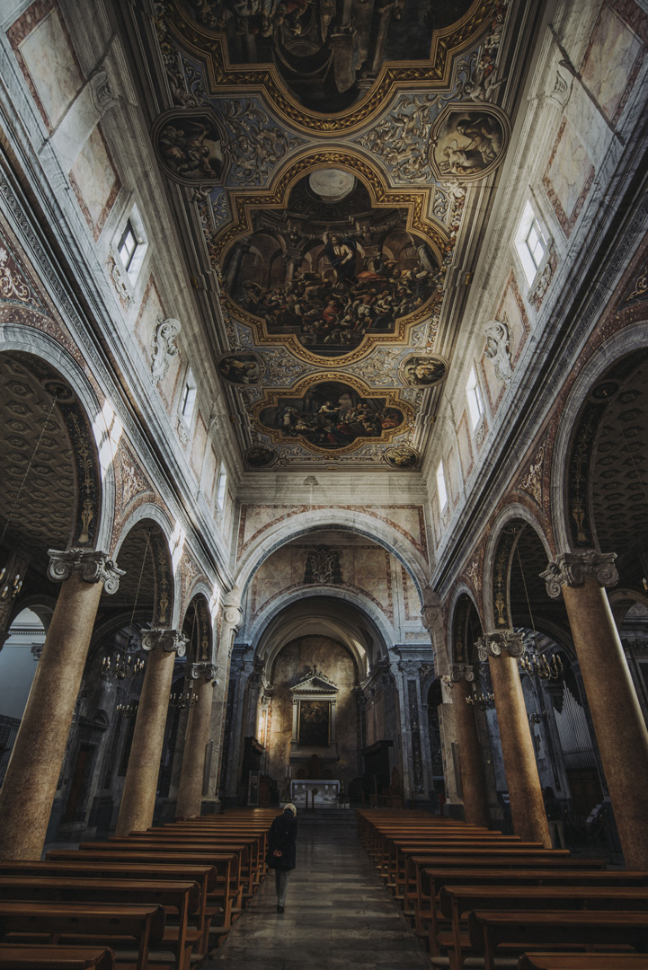
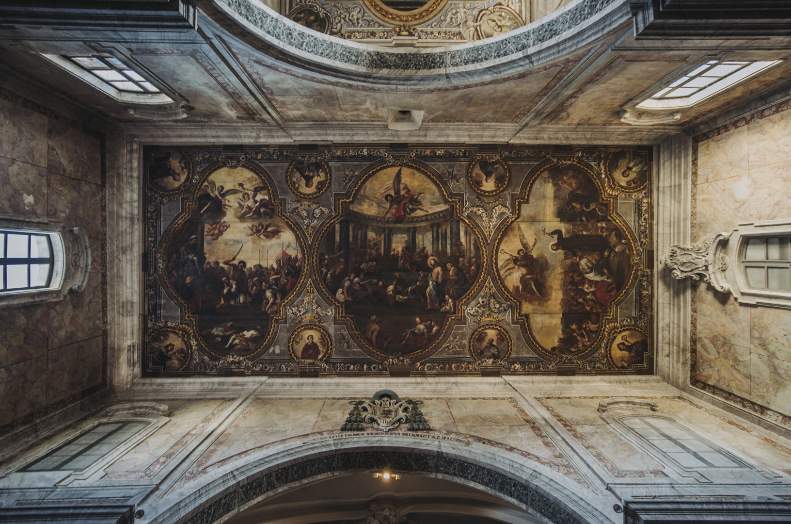
Lecce (40°21’13″N 18°10’22″E) jest zdecydowanie największym i najciekawszym miastem na półwyspie Salentyńskim, posiada wiele pięknych kościołów wartych zwiedzenia.
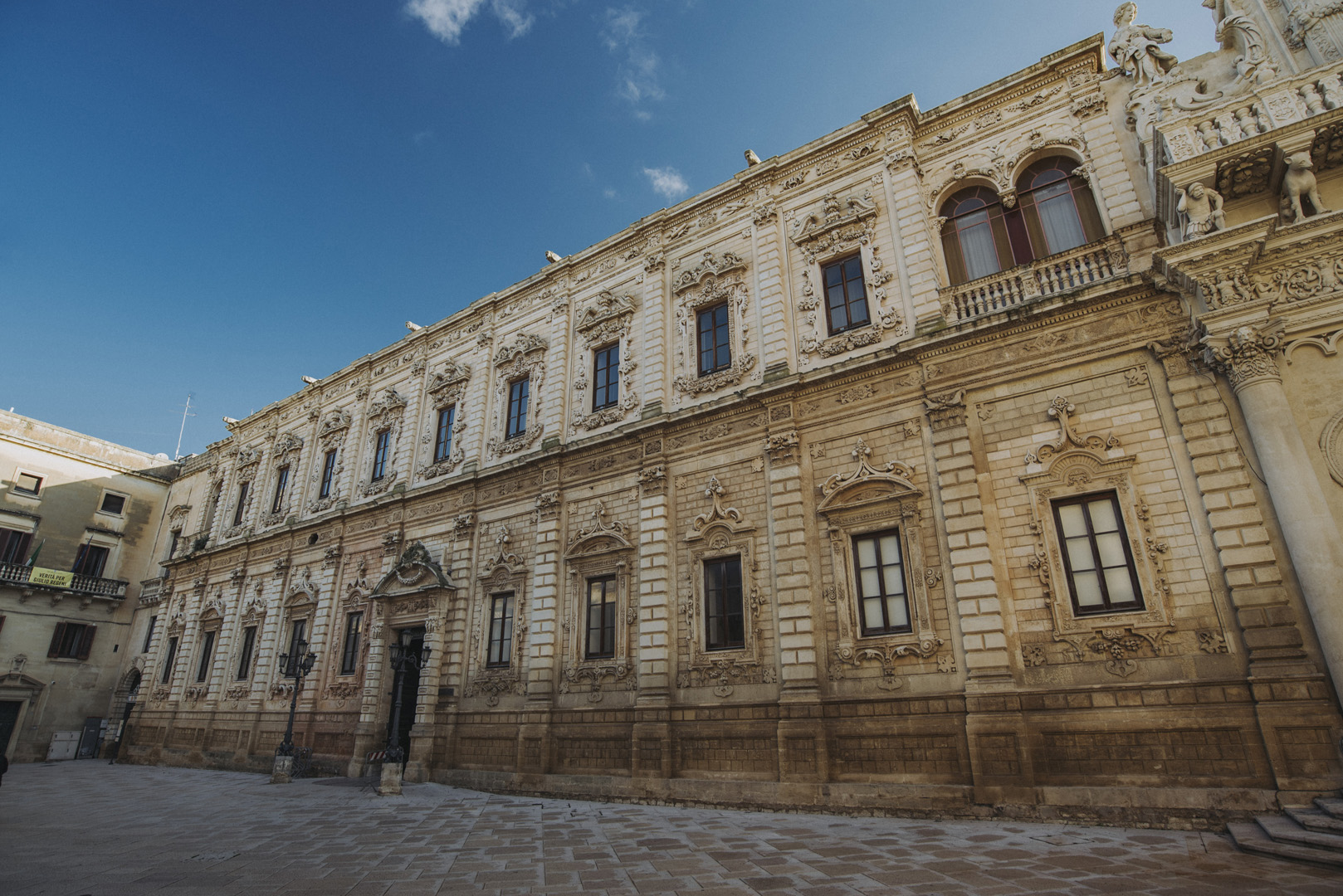
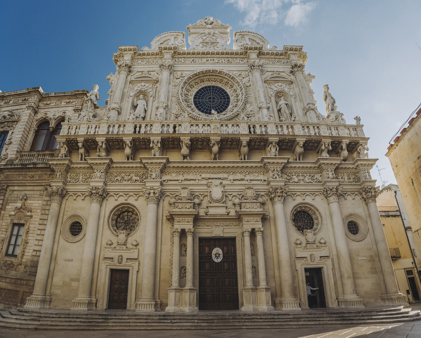
Palazzo dei Celestini (40°21’18″N 18°10’23″E) i stojąca zaraz obok Bazylika (Basilica di Santa Croce, 40°21’17″N 18°10’23″E).
![](https://palinski.org/wp-content/uploads/2020/01/DSC7946.jpg)
![](https://palinski.org/wp-content/uploads/2020/01/DSC7948-Pano.jpg)
![](https://palinski.org/wp-content/uploads/2020/01/DSC7951.jpg)
![](https://palinski.org/wp-content/uploads/2020/01/DSC7954.jpg)
![](https://palinski.org/wp-content/uploads/2020/01/DSC7955.jpg)
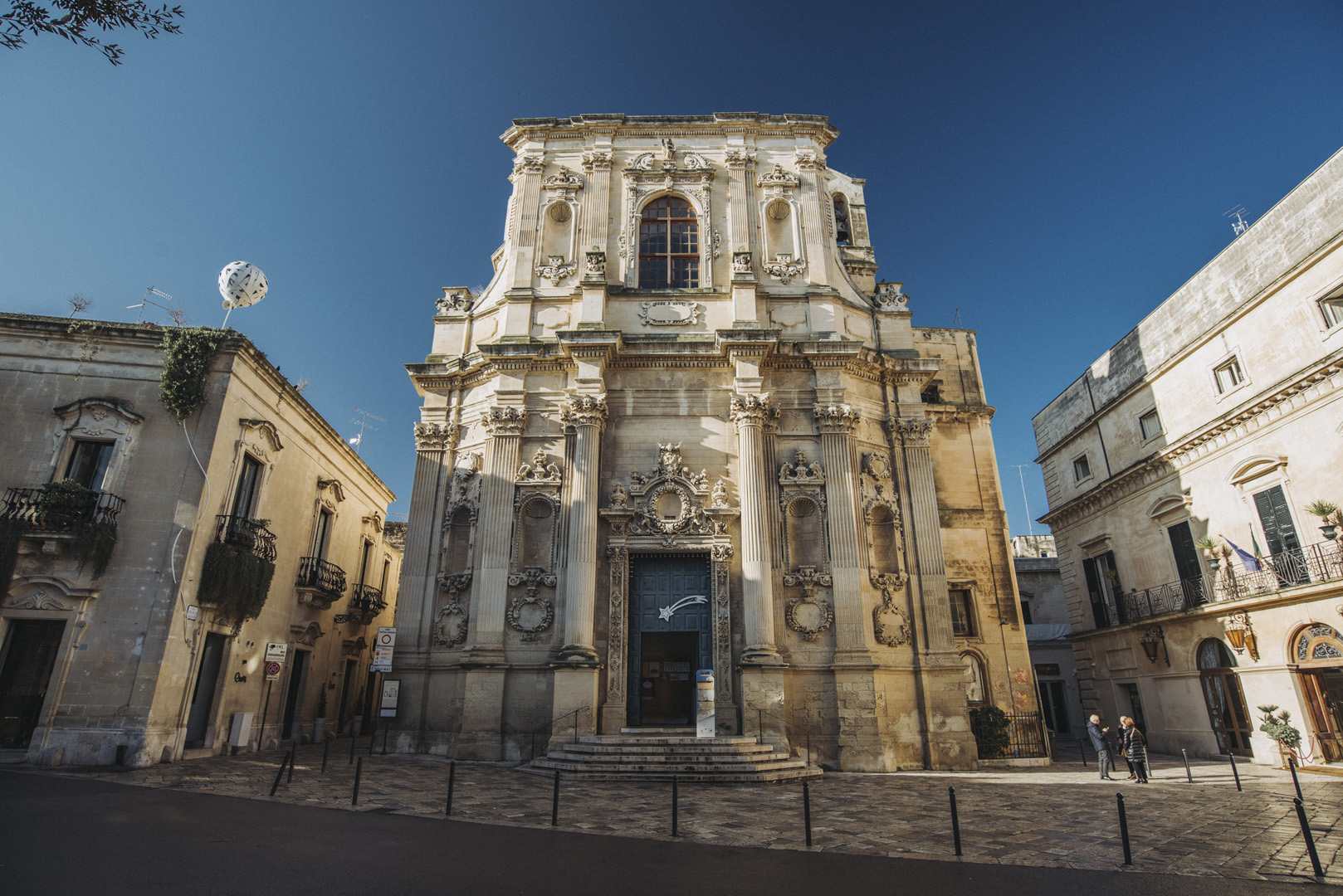
Kościół św. Klary (Chiesa di Santa Chiara, 40°21’07″N 18°10’17″E).
![](https://palinski.org/wp-content/uploads/2020/01/DSC7957.jpg)
![](https://palinski.org/wp-content/uploads/2020/01/DSC7960-Pano.jpg)
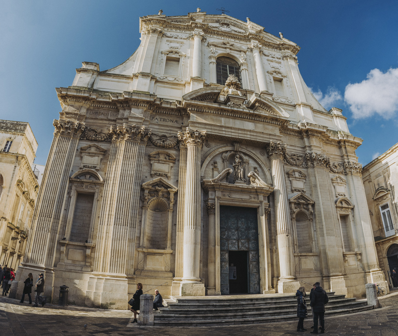
Kościół św. Ireny (Chiesa di Sant’Irene, 40°21’11″N 18°10’13″E).
![](https://palinski.org/wp-content/uploads/2020/01/DSC7971-Pano.jpg)
![](https://palinski.org/wp-content/uploads/2020/01/DSC7972.jpg)
![](https://palinski.org/wp-content/uploads/2020/01/DSC7974.jpg)
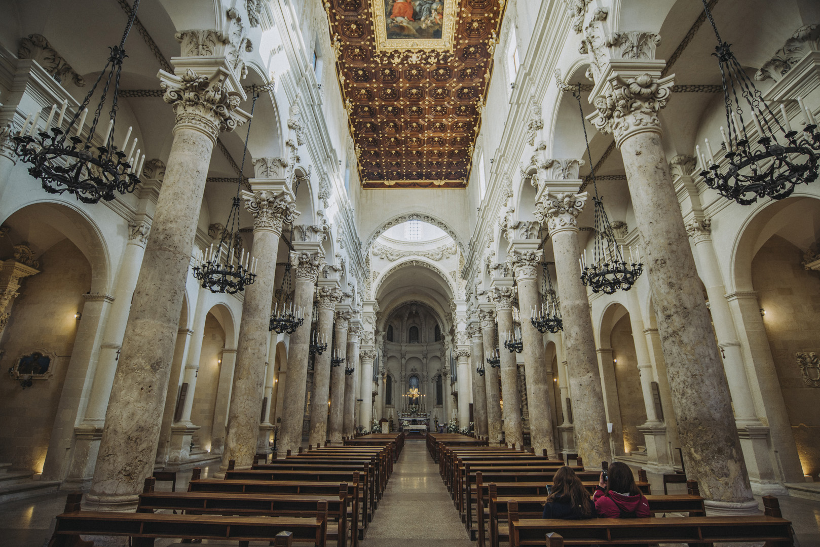
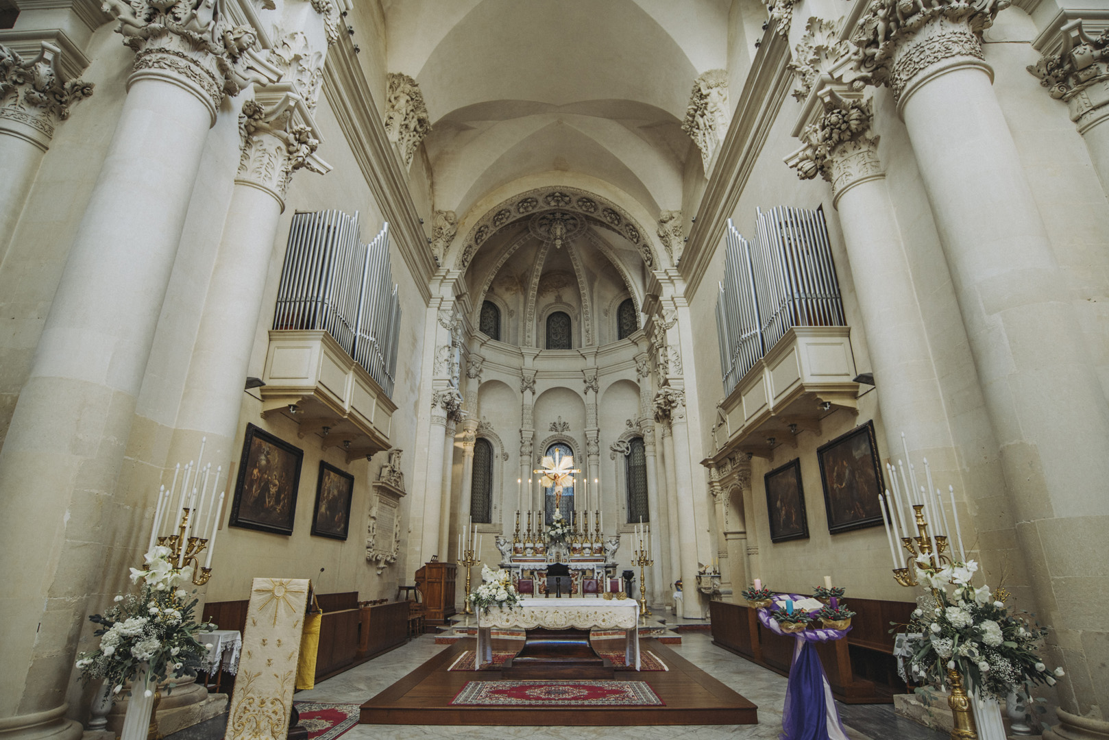
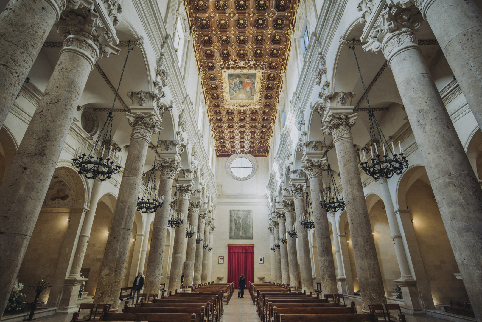
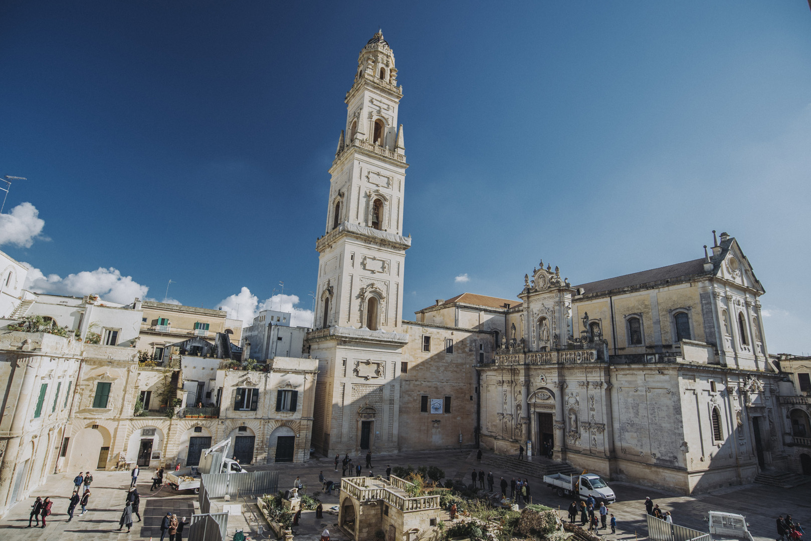
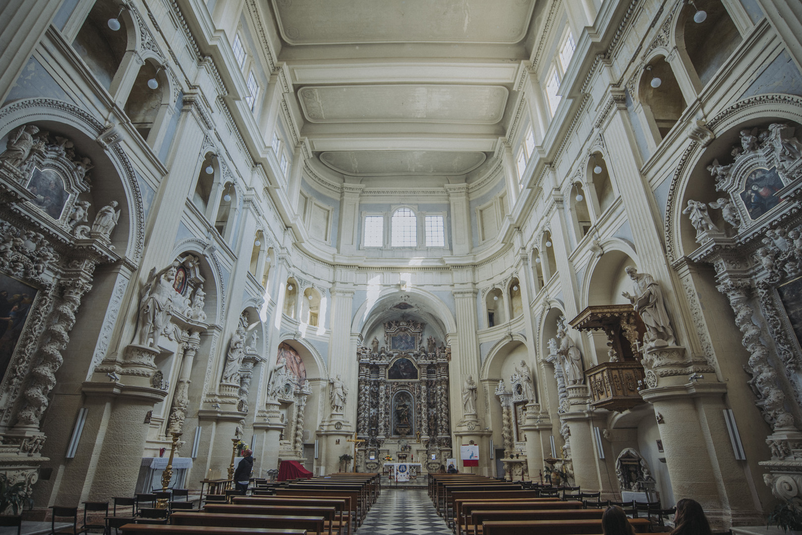
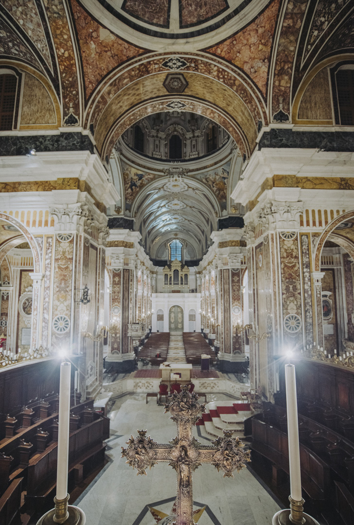
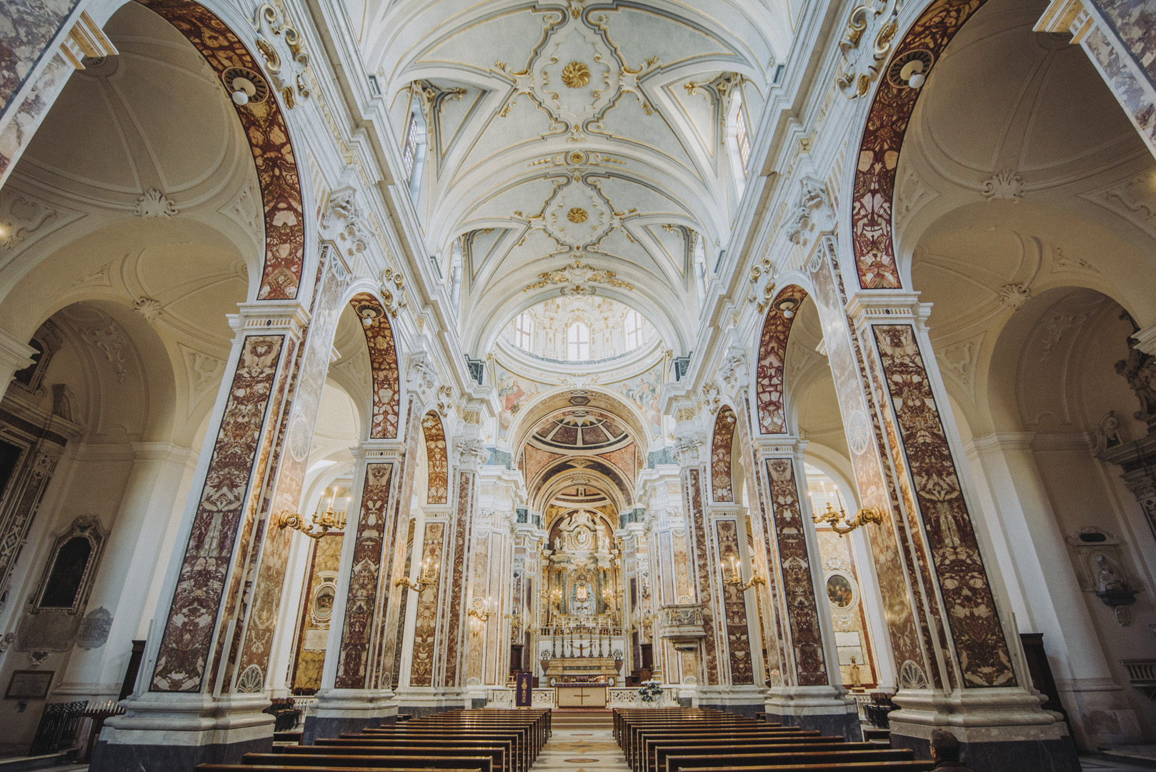
Katedra w Lecce (Duomo di Lecce, 40°21’06″N 18°10’09″E).
![](https://palinski.org/wp-content/uploads/2020/01/DSC7976.jpg)
![](https://palinski.org/wp-content/uploads/2020/01/DSC7977.jpg)
![](https://palinski.org/wp-content/uploads/2020/01/DSC7979.jpg)
![](https://palinski.org/wp-content/uploads/2020/01/DSC7985.jpg)
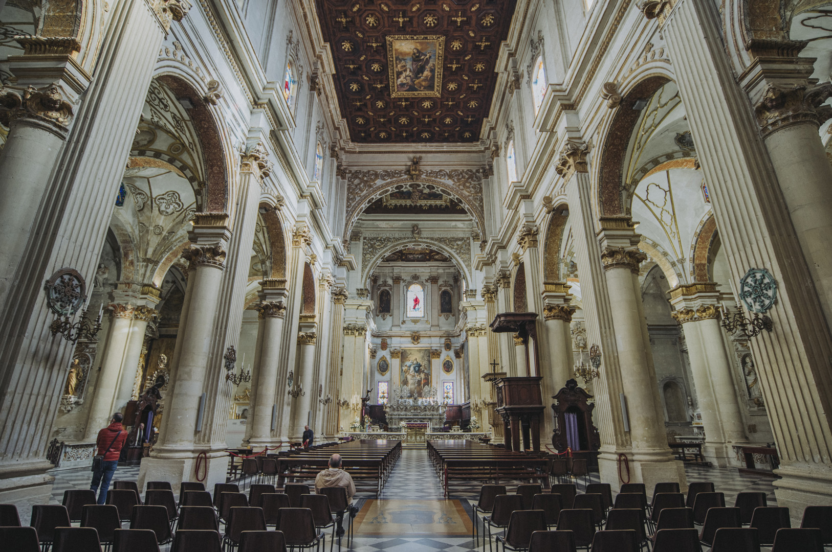
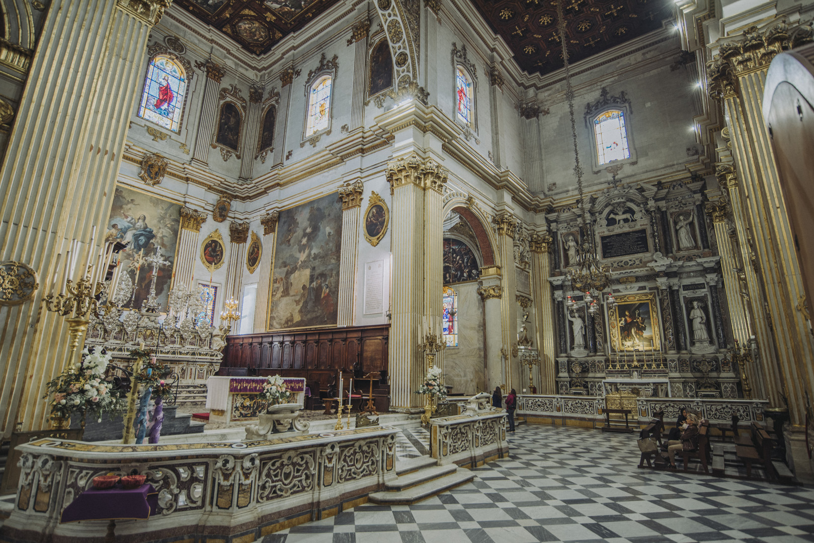
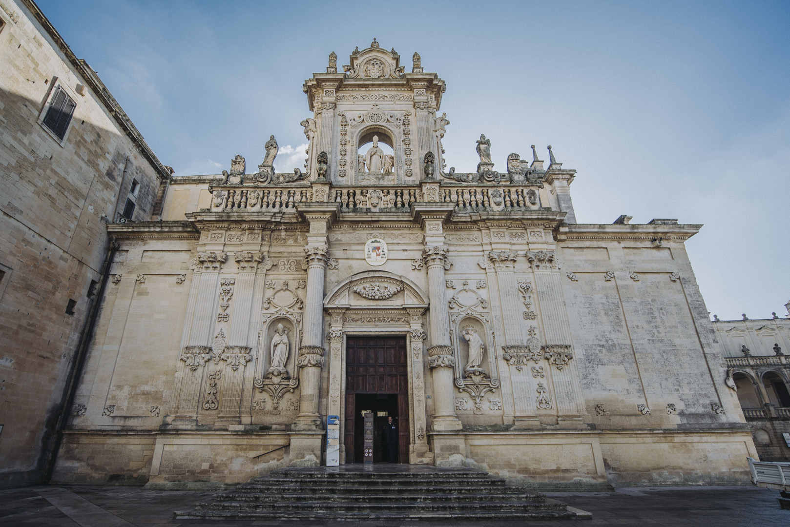
Katedra w Lecce jest połączona murami z kościołem z lewej strony a od prawej z pałacem Arcivescovile.
![](https://palinski.org/wp-content/uploads/2020/01/DSC7986.jpg)
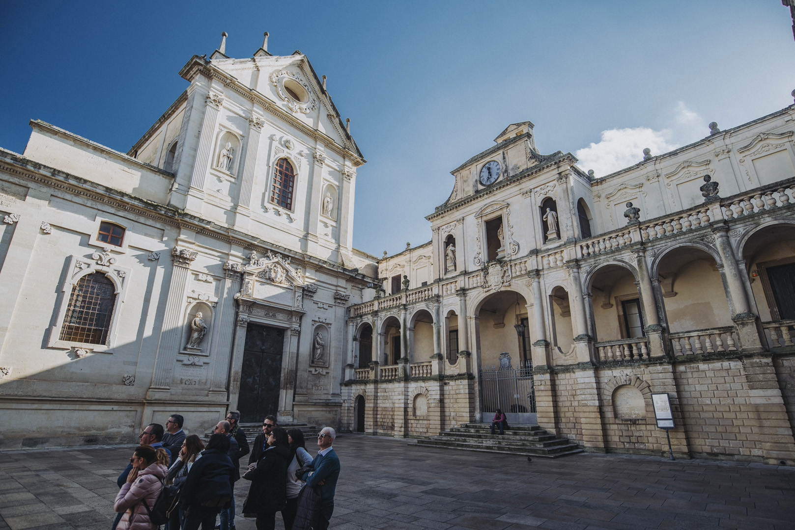
Widok na katedrę i plac katedralny (Piazza del Duomo) z okna seminarium przekształconego w muzeum.
![](https://palinski.org/wp-content/uploads/2020/01/DSC7993.jpg)
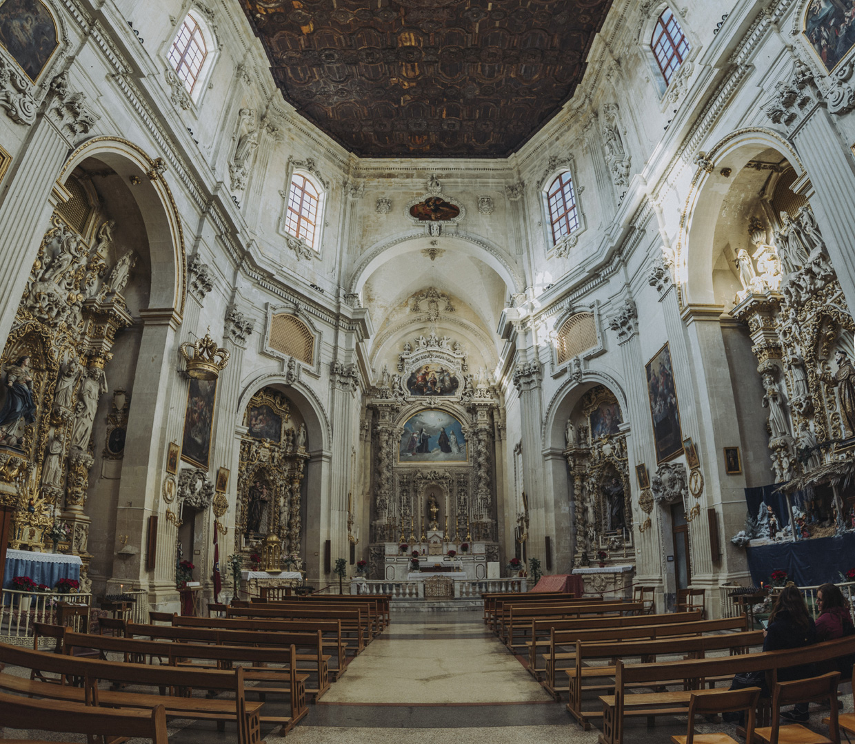
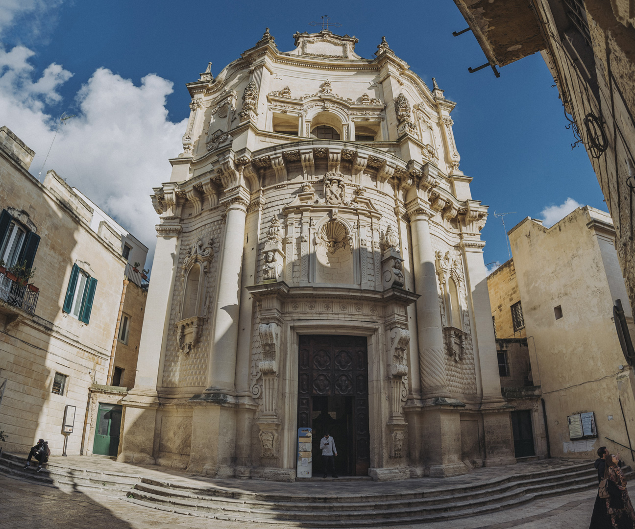
Kościół św. Mateusza (Chiesa di San Matteo, 40°21’02″N 18°10’19″E).
![](https://palinski.org/wp-content/uploads/2020/01/DSC8007-Pano.jpg)
![](https://palinski.org/wp-content/uploads/2020/01/DSC8011.jpg)
Półwysep Salentyński
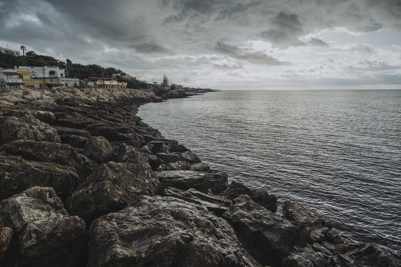
Okolice zrujnowanej wieży Uluzzo (40°09’31″N 17°57’24″E).
![](https://palinski.org/wp-content/uploads/2020/01/DSC8012.jpg)
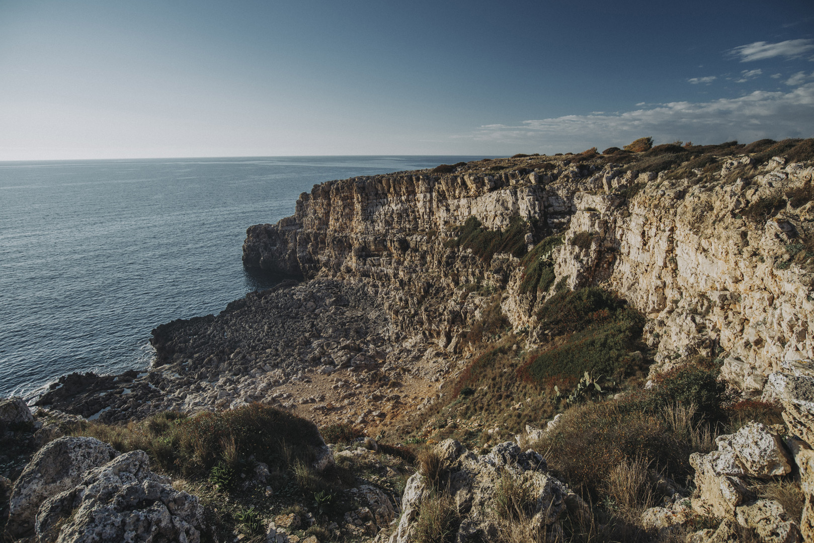
Oraz kawałek dalej (40°10’26″N 17°56’59″E).
![](https://palinski.org/wp-content/uploads/2020/01/DSC8023.jpg)
![](https://palinski.org/wp-content/uploads/2020/01/DSC8024.jpg)
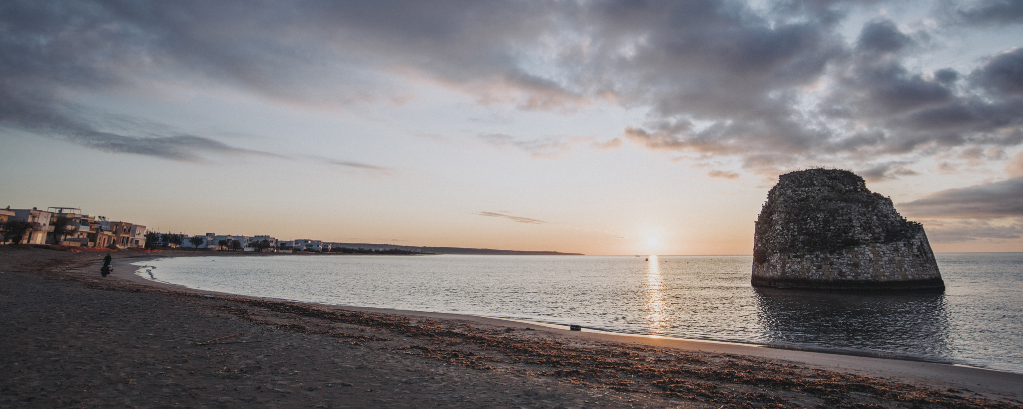
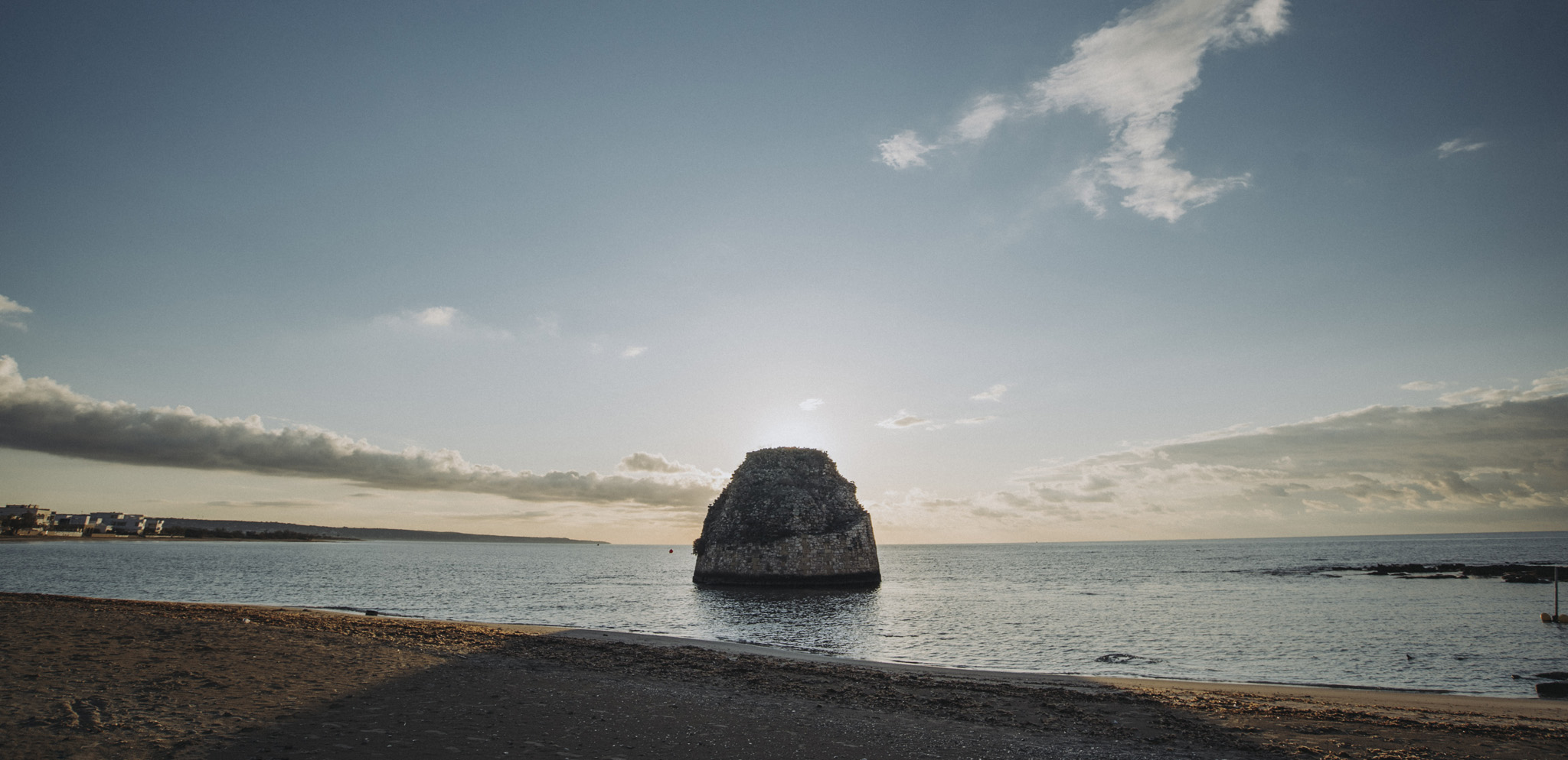
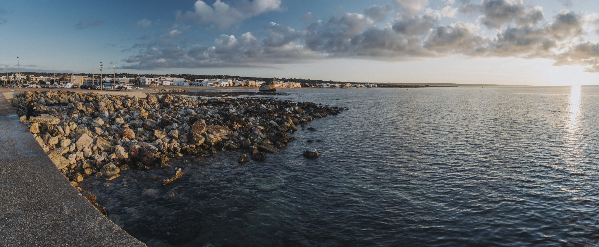
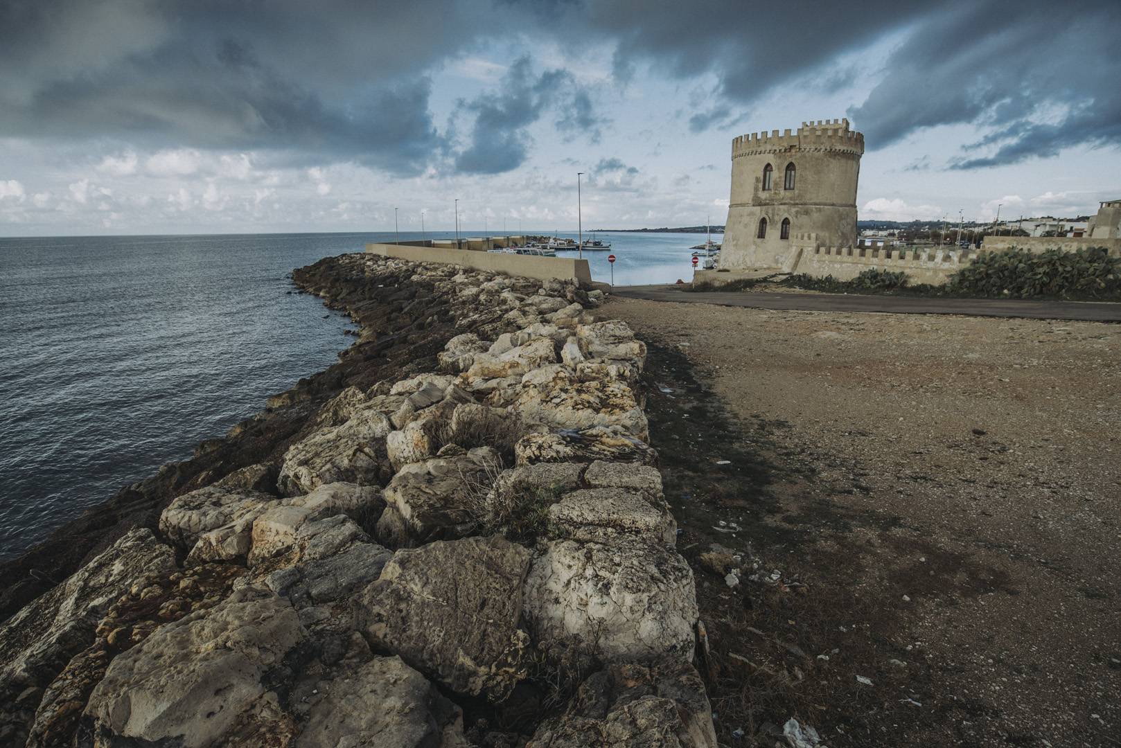
Torre Pali (39°50’16″N 18°12’33″E), czyli wieża zbudowana w XVI wieku, z biegiem czasu plaża zaczęła się cofać, więc aktualnie ruiny wieży znajdują się w wodzie.
![](https://palinski.org/wp-content/uploads/2020/01/DSC8028.jpg)
![](https://palinski.org/wp-content/uploads/2020/01/DSC8041.jpg)
![](https://palinski.org/wp-content/uploads/2020/01/DSC8031-Pano.jpg)
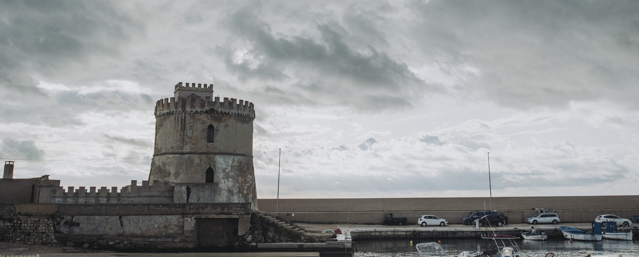
Torre Vado (39°49’50″N 18°16’37″E), inna wieża w XVI wieku.
![](https://palinski.org/wp-content/uploads/2020/01/DSC8043.jpg)
![](https://palinski.org/wp-content/uploads/2020/01/DSC8049.jpg)
I widok po drugiej stronie wieży.
![](https://palinski.org/wp-content/uploads/2020/01/DSC8051.jpg)
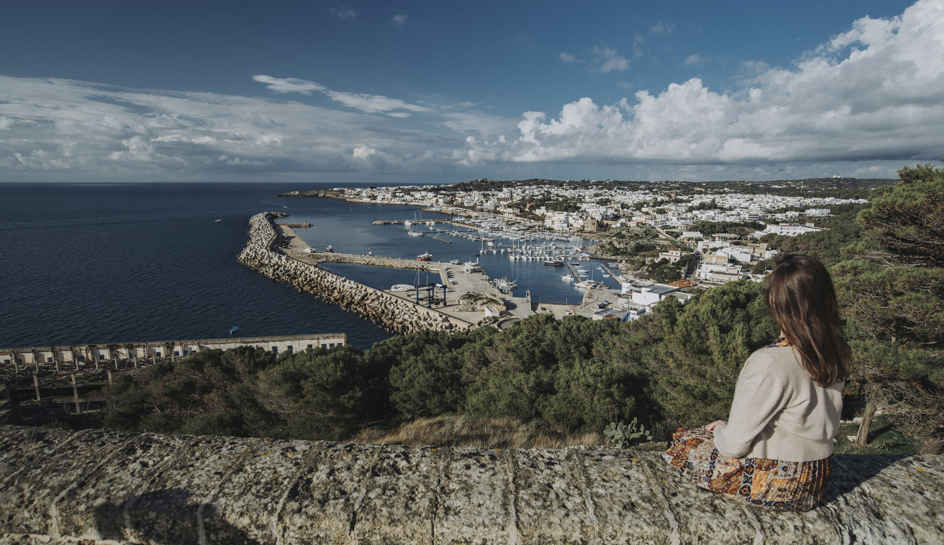
Widok na port w mieście Leuca (39°47’46″N 18°22’04″E).
![](https://palinski.org/wp-content/uploads/2020/01/DSC8066.jpg)
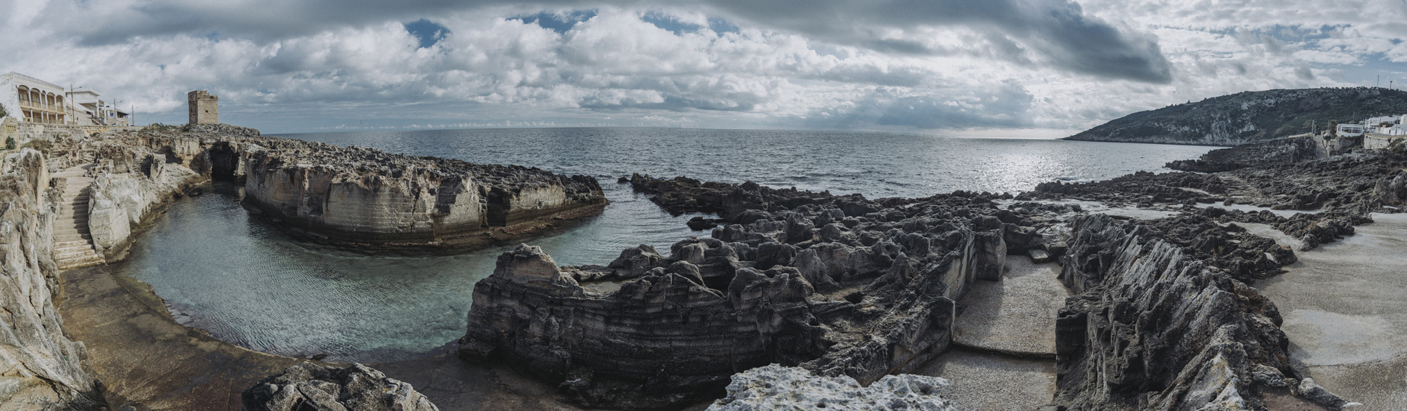
Naturalny basen w Marina Serra (39°54’42″N 18°23’37″E).
![](https://palinski.org/wp-content/uploads/2020/01/DSC8080.jpg)
![](https://palinski.org/wp-content/uploads/2020/01/DSC8089-Pano.jpg)
Latarnia morska na przylądku Palascìa (40°06’27″N 18°31’12″E). Na drugim brzegu można zobaczyć Albanię (choć może niekoniecznie na tym zdjęciu), odległość do jej brzegu to tylko 75 km.
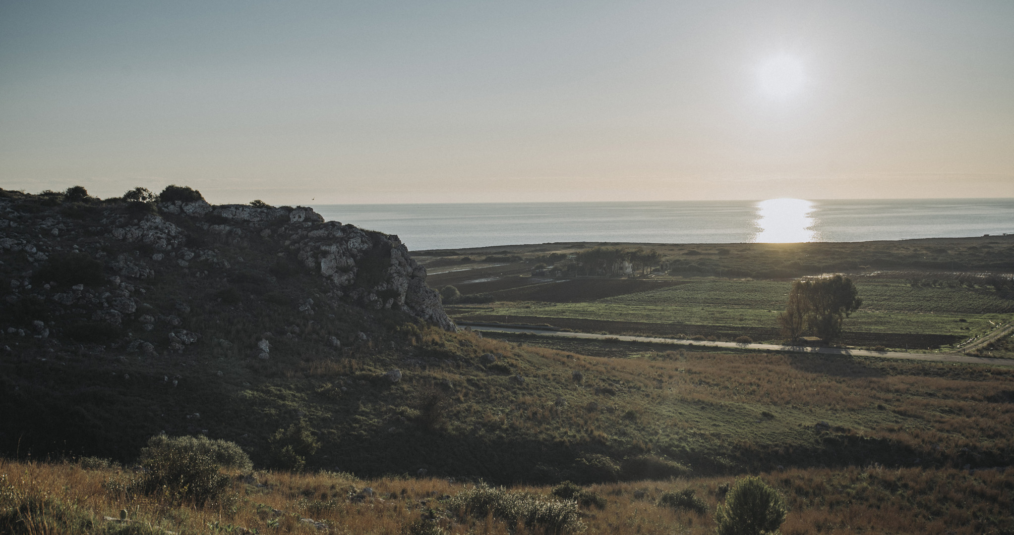
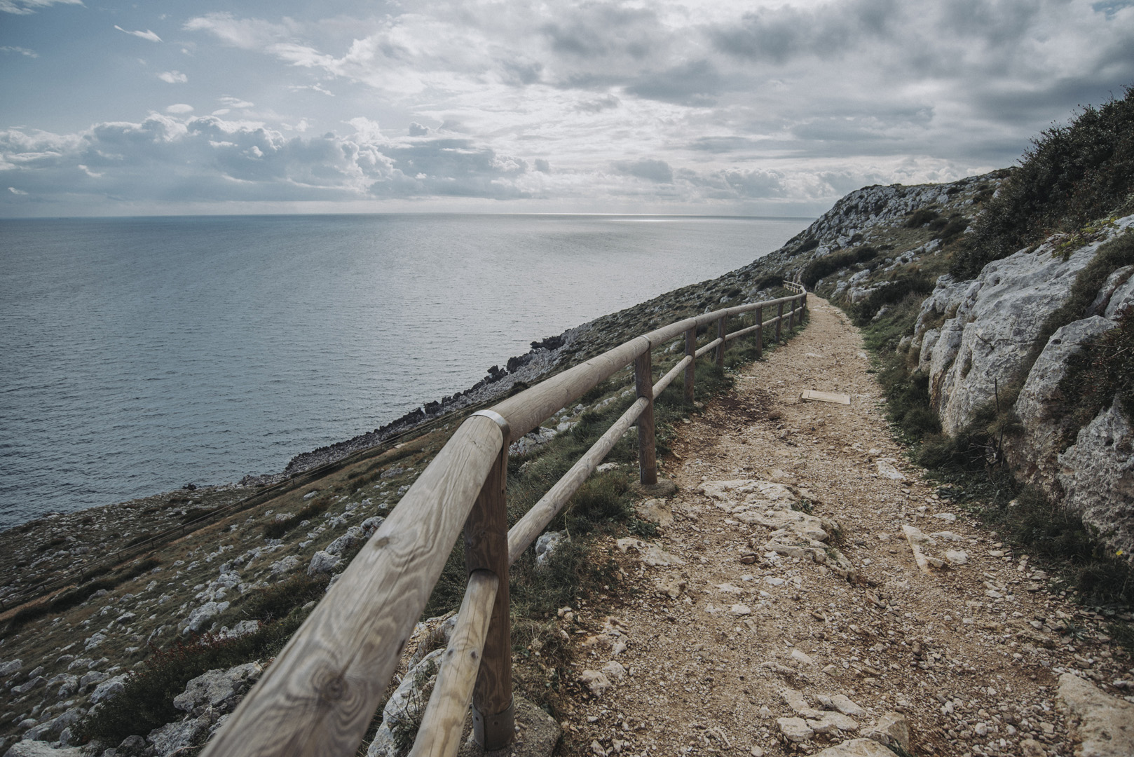
![](https://palinski.org/wp-content/uploads/2020/01/DSC8101.jpg)
Droga do latarni.
![](https://palinski.org/wp-content/uploads/2020/01/DSC8103.jpg)
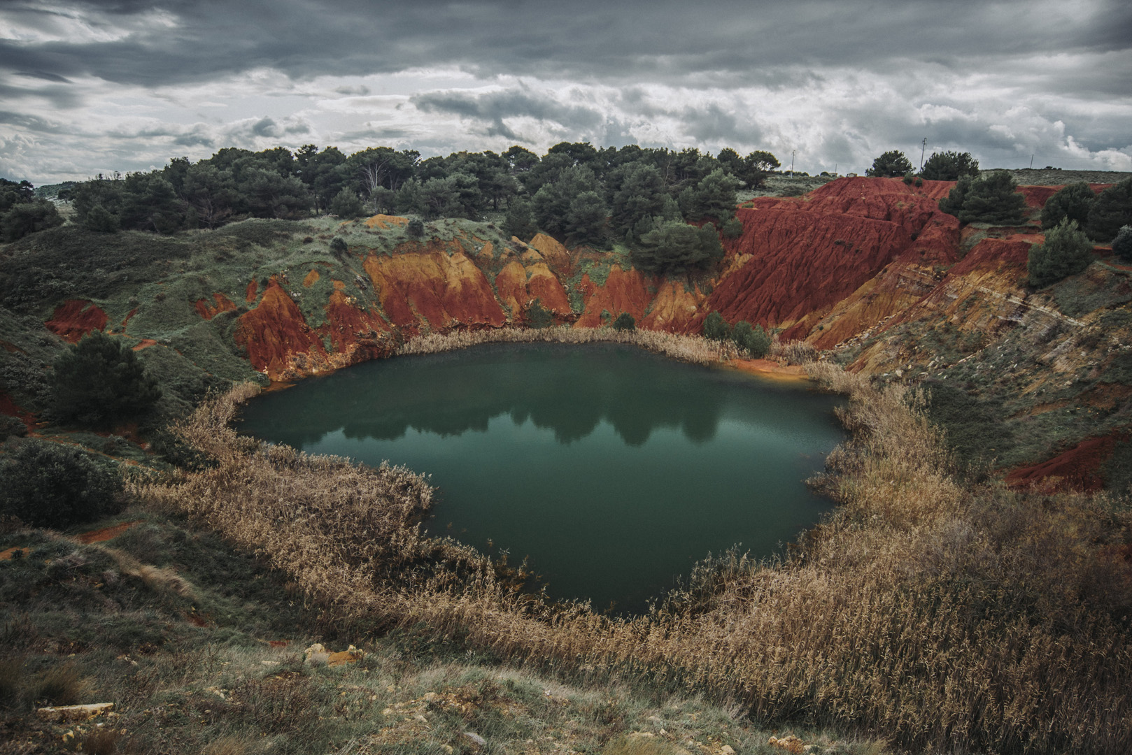
Była kopalnia boksytu niedaleko Otranto (40°07’55″N 18°30’02″E).
![](https://palinski.org/wp-content/uploads/2020/01/DSC8115.jpg)
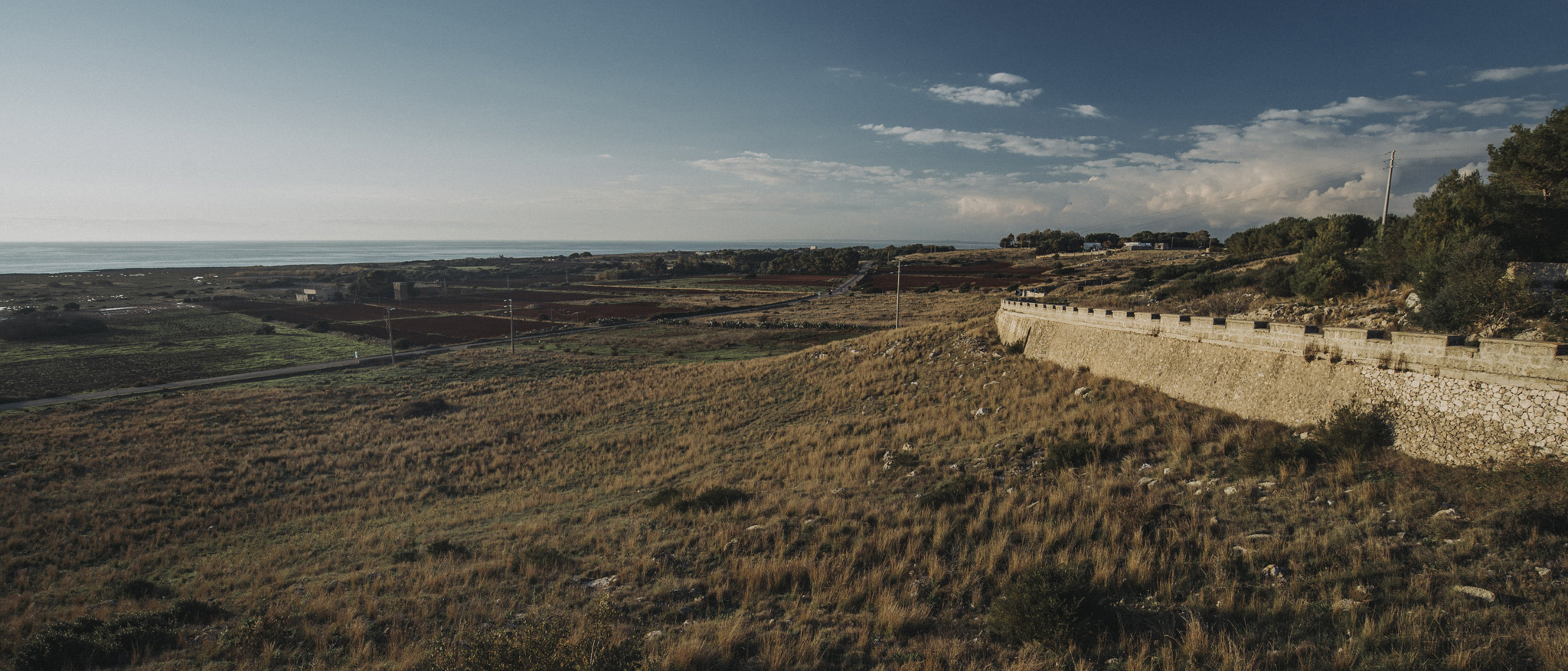
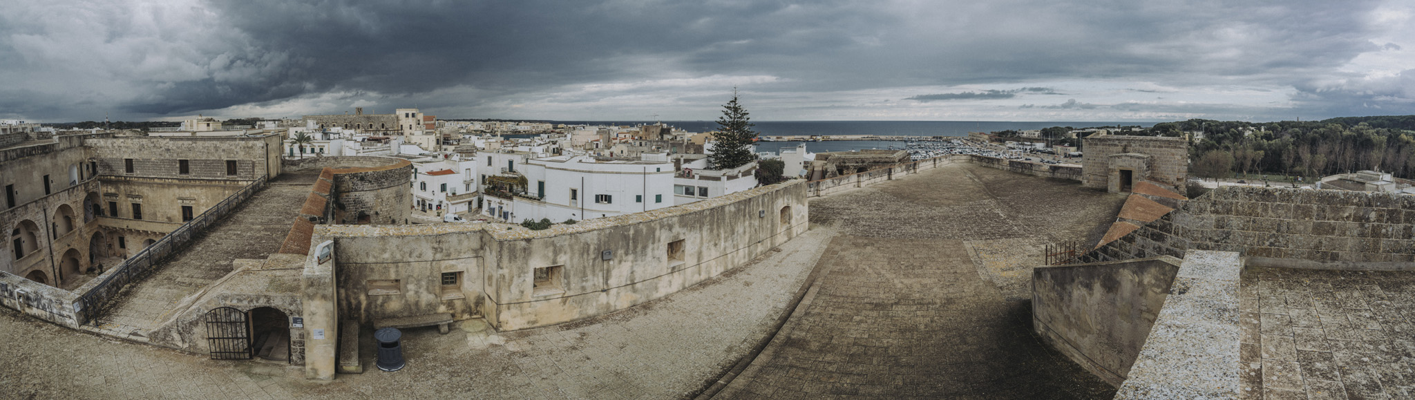
Panorama z zamku w Otranto (40°08’40″N 18°29’33″E). Niestety zamek nie był zbyt wysoki, więc widać głównie tereny zamkowe.
![](https://palinski.org/wp-content/uploads/2020/01/DSC8117-Pano.jpg)
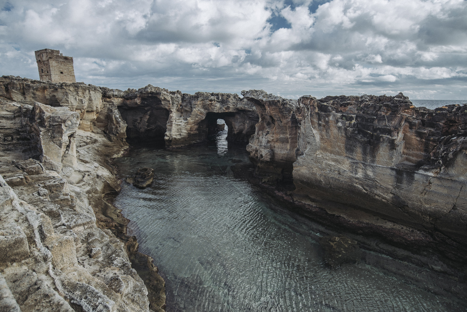
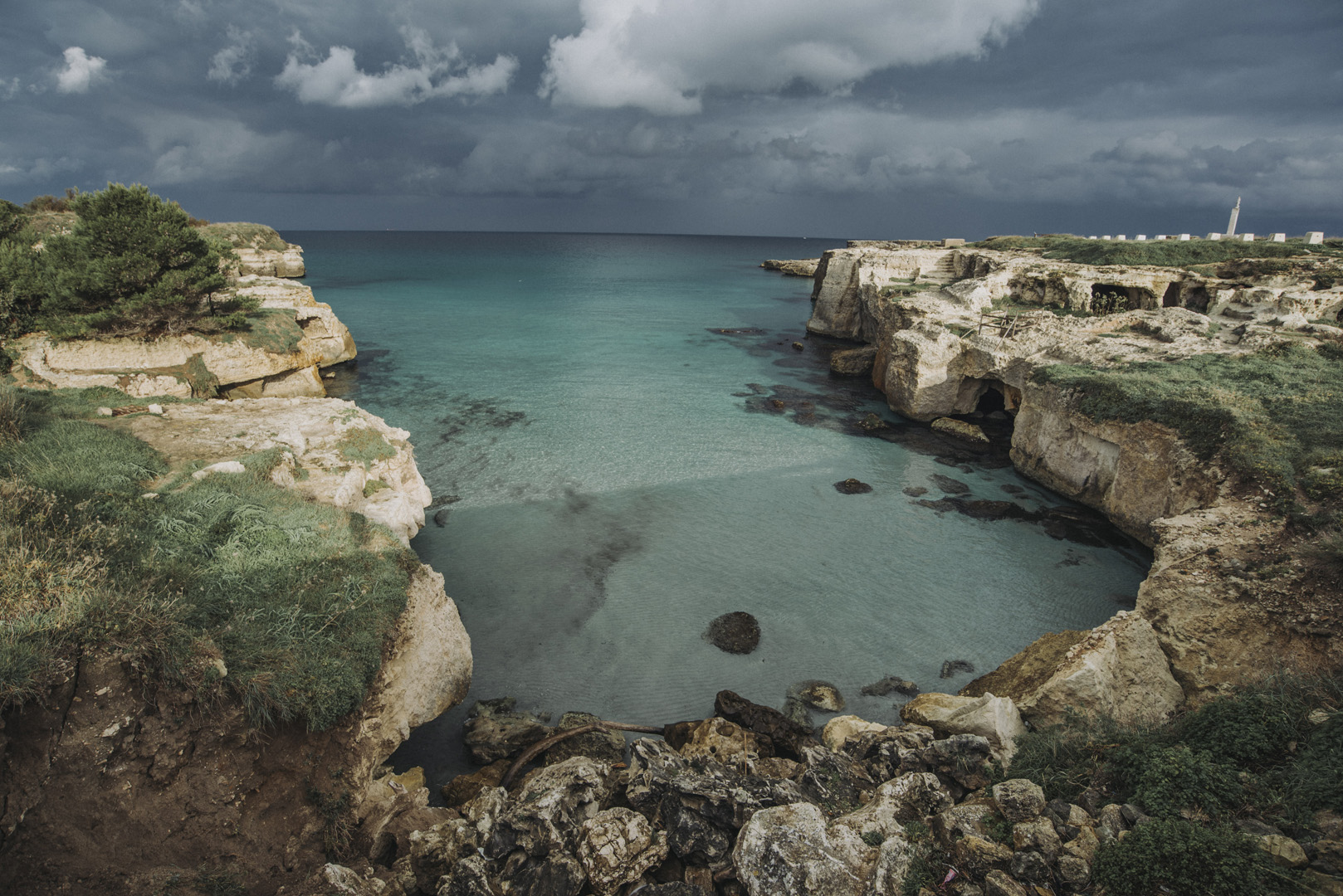
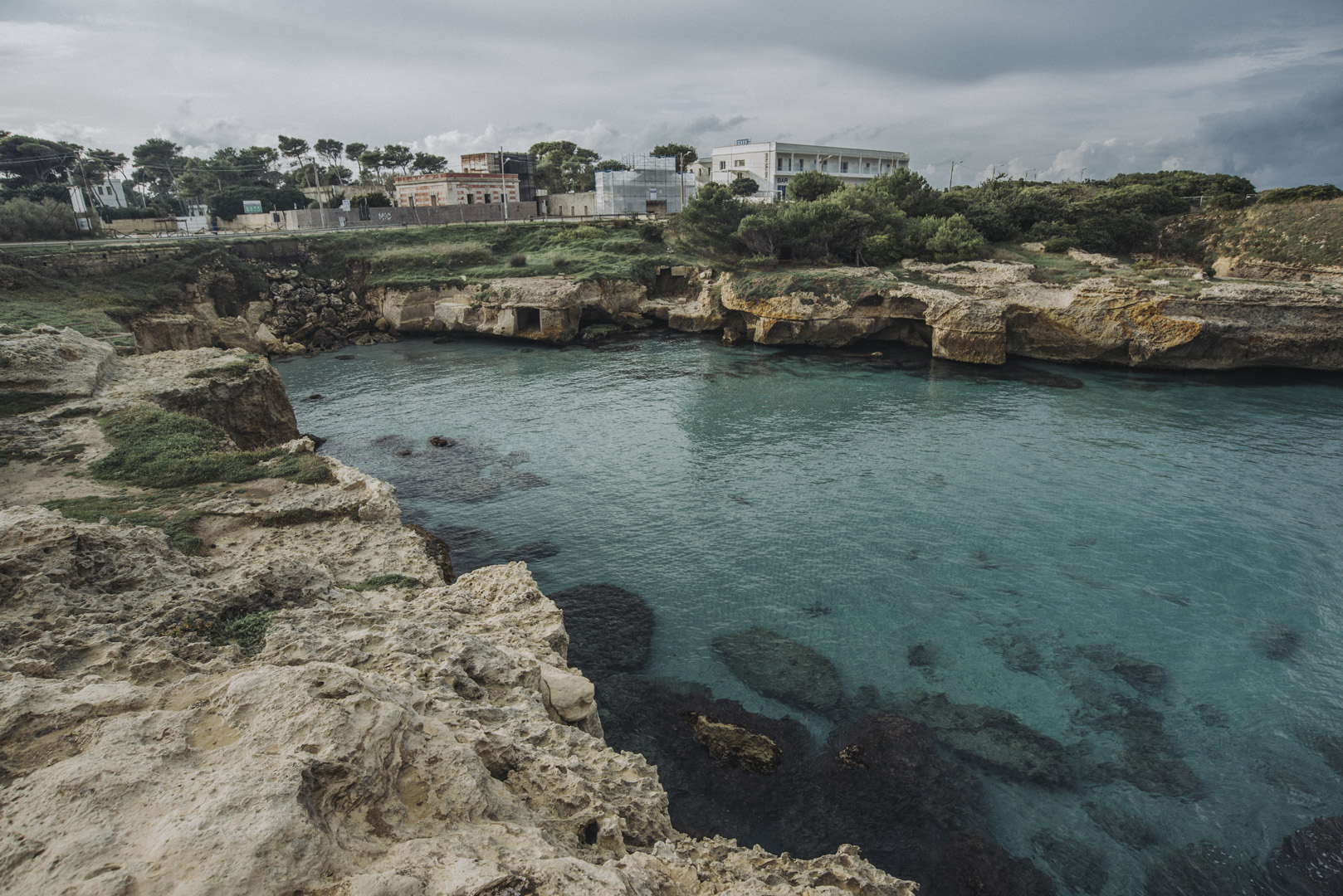
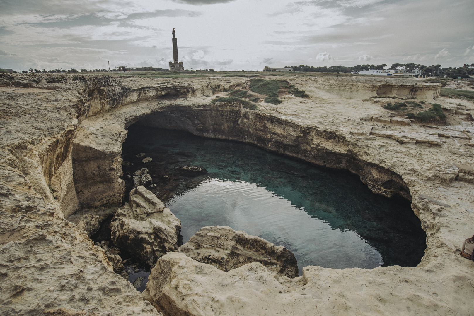
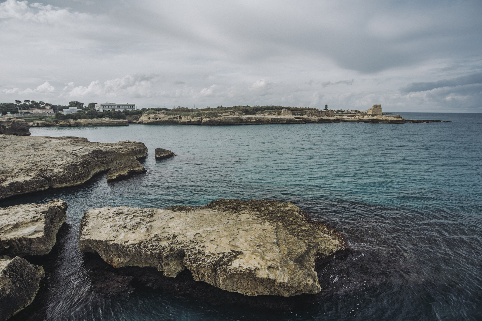
Grotta della Poesia (40°17’09″N 18°25’46″E) i skaliste wybrzeże przy Roca Vecchia.
![](https://palinski.org/wp-content/uploads/2020/01/DSC8136.jpg)
![](https://palinski.org/wp-content/uploads/2020/01/DSC8138.jpg)
![](https://palinski.org/wp-content/uploads/2020/01/DSC8147.jpg)
![](https://palinski.org/wp-content/uploads/2020/01/DSC8148.jpg)
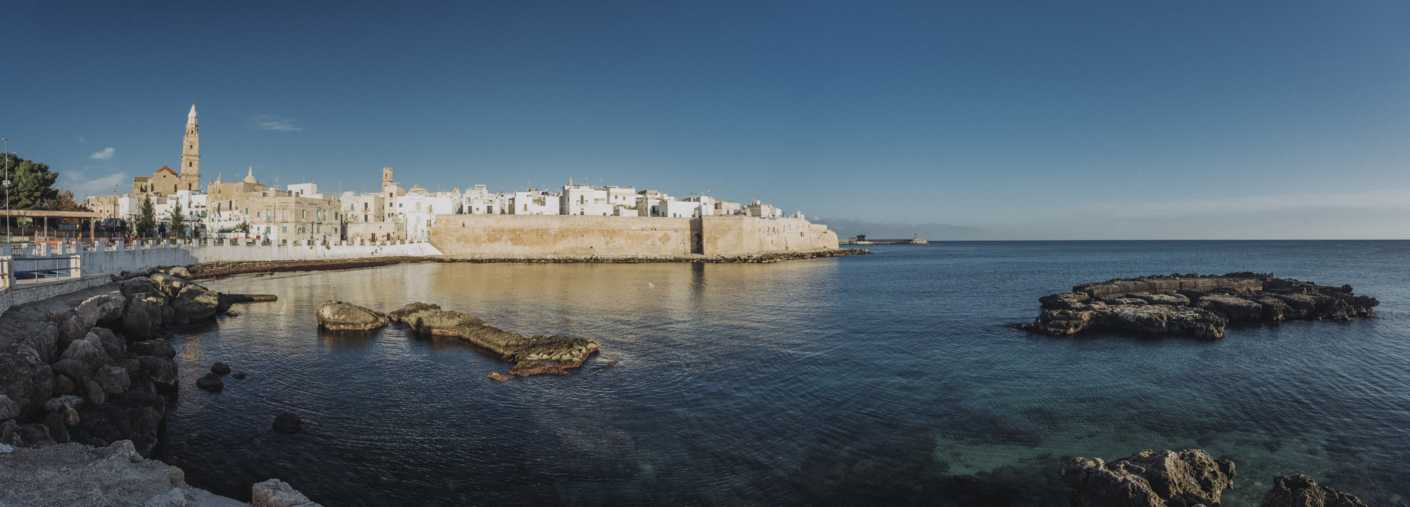
Katedra w Monopoli (Cattedrale Maria Santissima della Madia, 40°57’03″N 17°18’12″E). Niestety było mało czasu i jedno zdjęcie jest z nocy a drugie z rana.
![](https://palinski.org/wp-content/uploads/2020/01/DSC8152.jpg)
![](https://palinski.org/wp-content/uploads/2020/01/DSC8161.jpg)
Panorama Monopoli z punktu widokowego (40°57’01″N 17°18’23″E).
![](https://palinski.org/wp-content/uploads/2020/01/DSC8156-Pano.jpg)
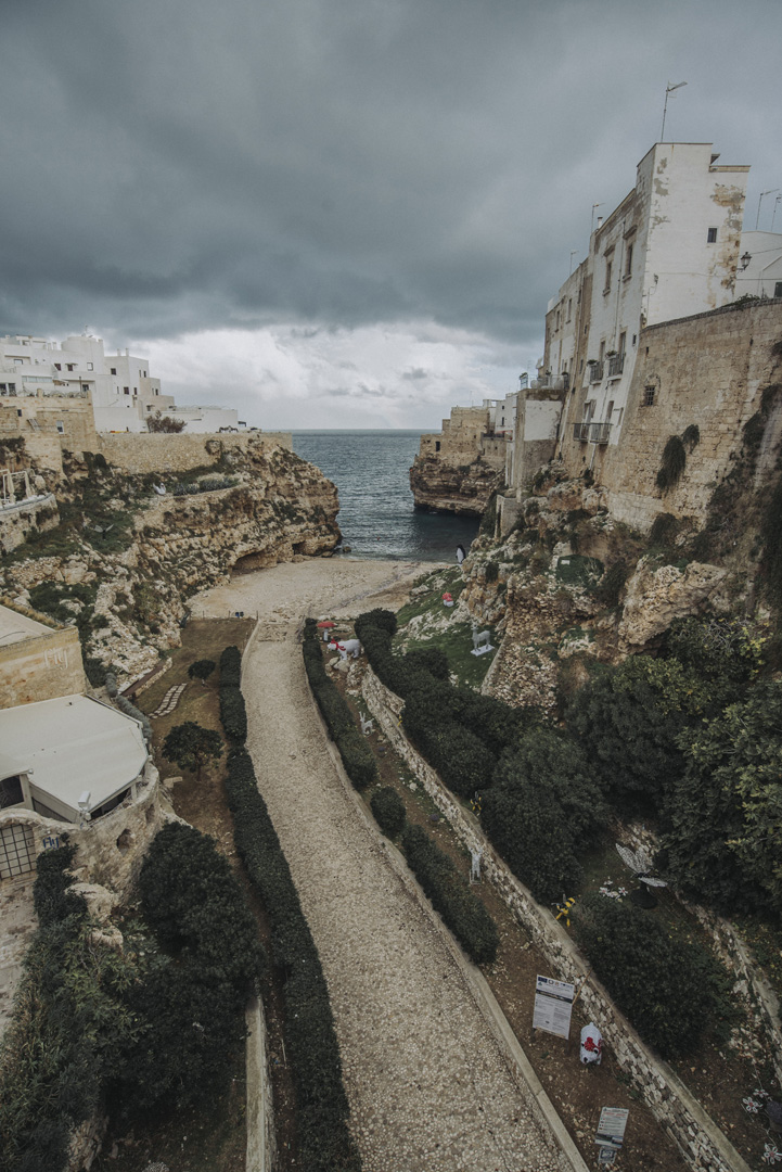
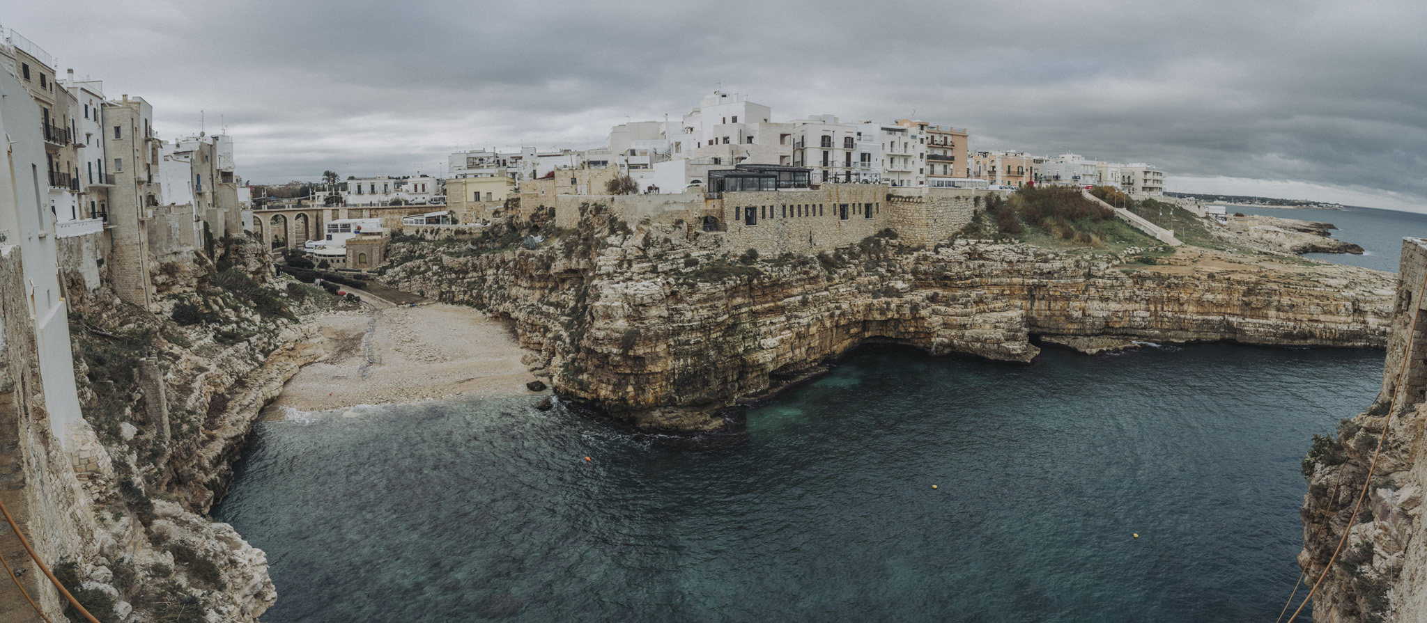
Widoki na Polignano A Mare od strony klifów (40°59’52″N 17°13’04″E) .
![](https://palinski.org/wp-content/uploads/2020/01/DSC8168.jpg)
Kolejny punkt widokowy (40°59’50″N 17°13’09″E). Takich punktów widokowych było całkiem sporo, prawie każda uliczka się kończyła nad klifem jakimś.
![](https://palinski.org/wp-content/uploads/2020/01/DSC8183.jpg)
Jeden z ciekawszych punktów widokowych (40°59’49″N 17°13’07″E) z widokiem na most i zatokę.
![](https://palinski.org/wp-content/uploads/2020/01/DSC8197-Pano.jpg)
I widok z mostu na zatokę (40°59’44″N 17°13’05″E).
![](https://palinski.org/wp-content/uploads/2020/01/DSC8199.jpg)