 Nude
Nude
Landscape
Nude
Nude
Landscape
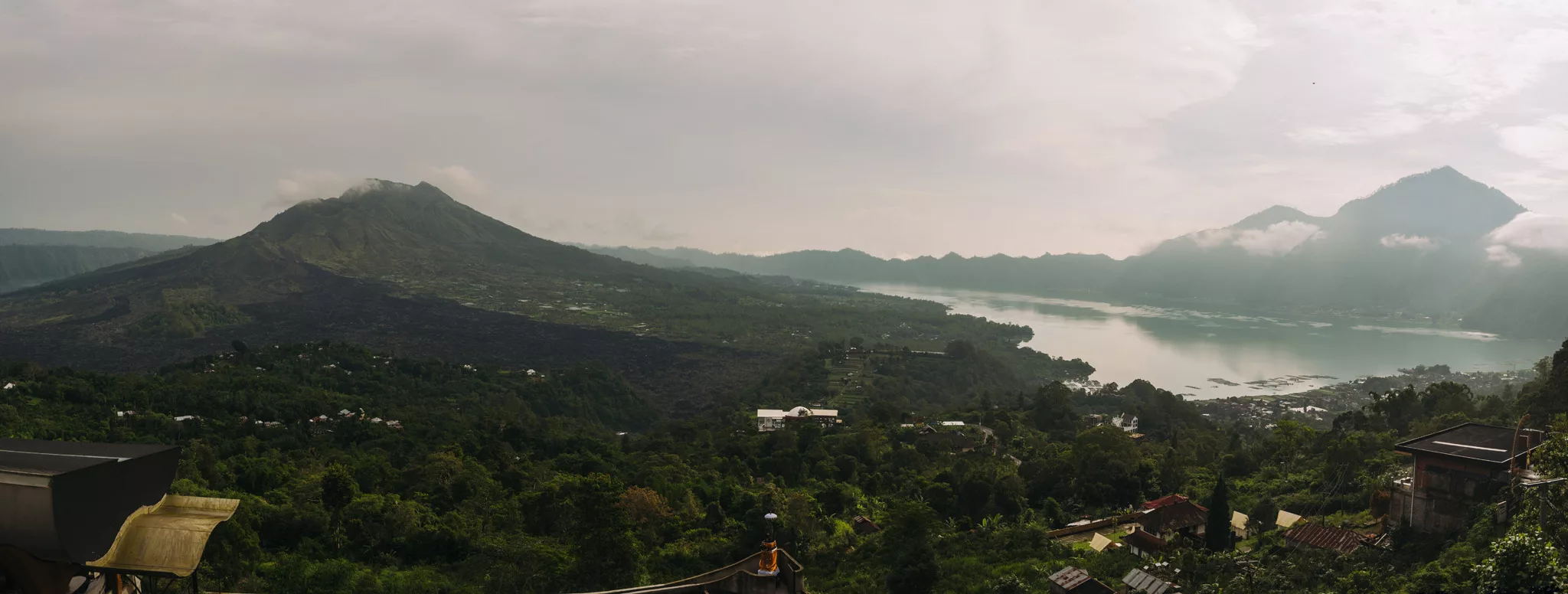
Mount Batur (8°14′20″S 115°22′39″E) is located in the center of the largest caldera in northern Bali.
View from mount Batur on mount Abang (8°16′49″S 115°25′46″E) and mount Agung (8°20′27″S 115°30′12″E, just behind mount Abang, so it looks like it’s shadow or some kind of camera’s error).
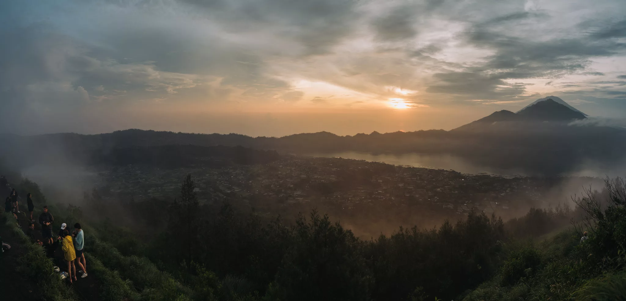
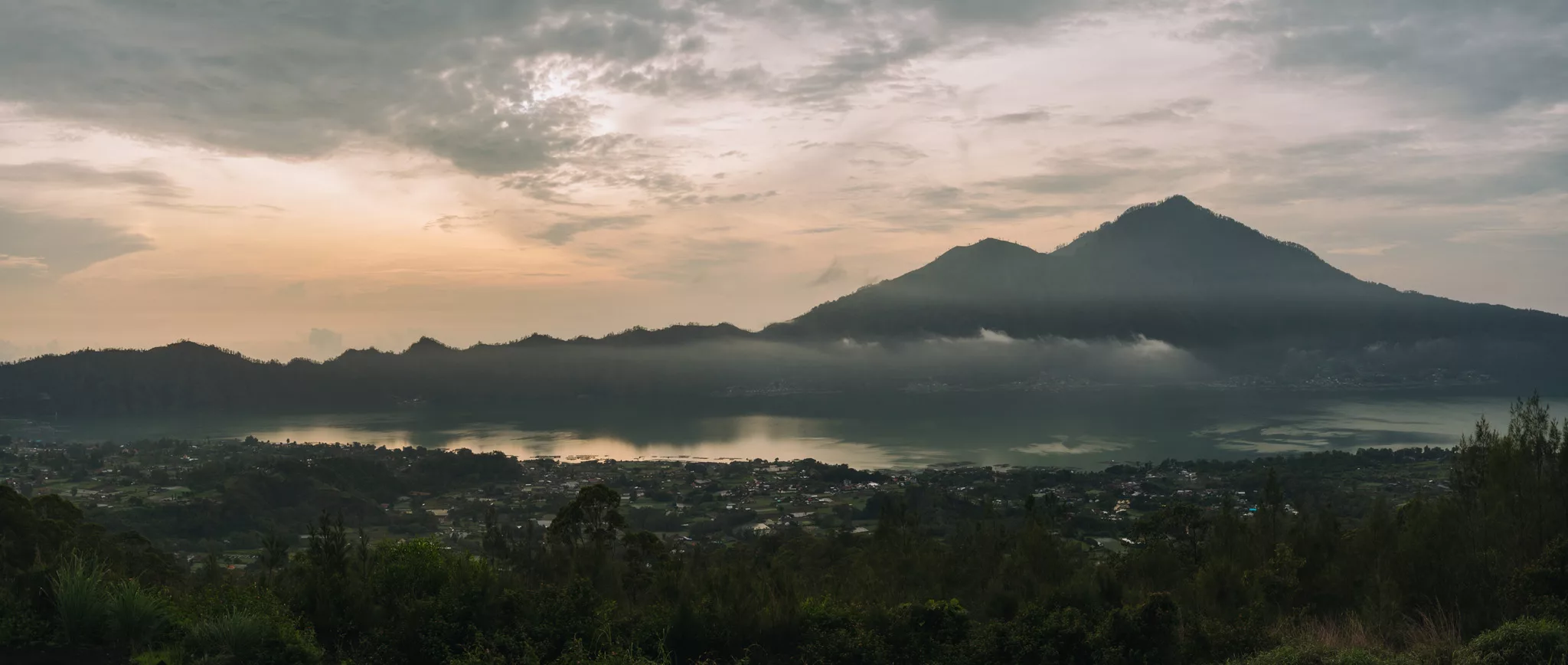
View from mount Batur viewpoint (8°16′57″S 115°21′51″E) on mount Batur (left), lake Batur and mount Abang (right).
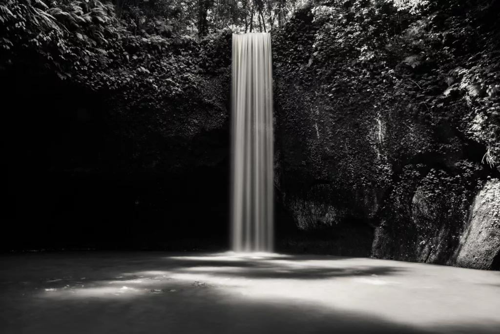
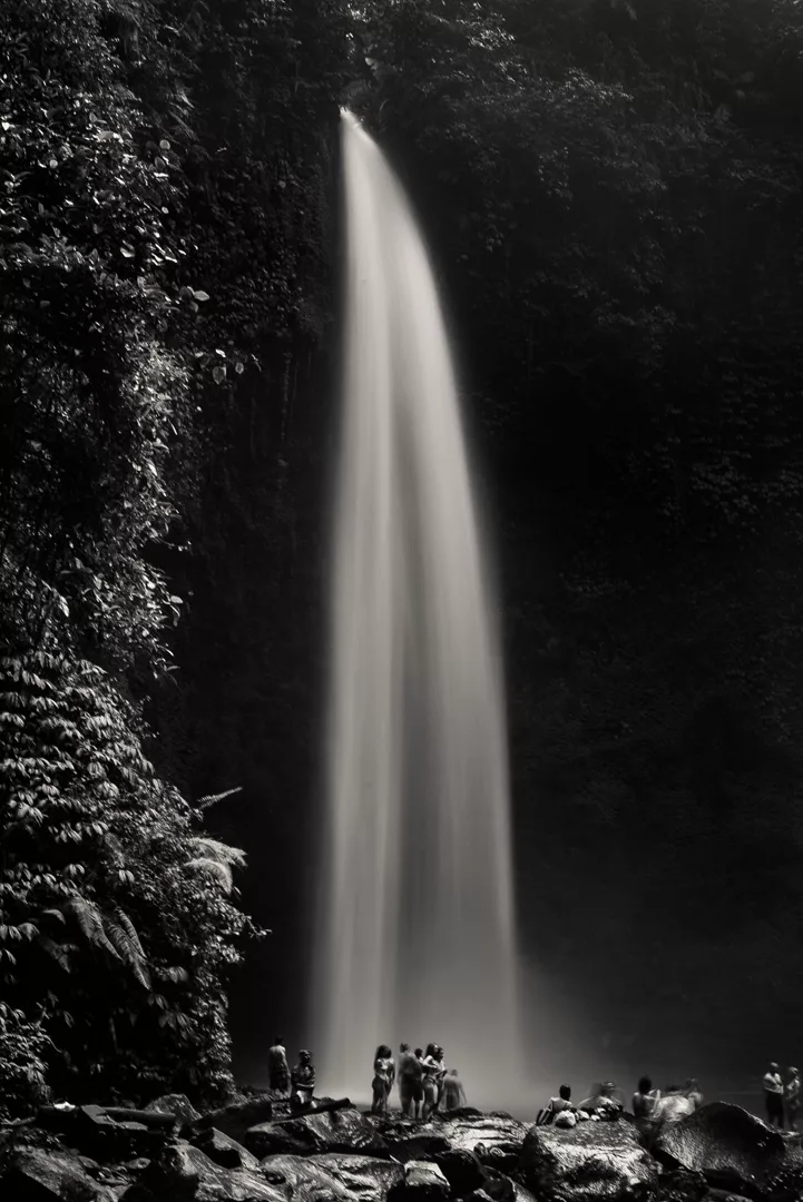
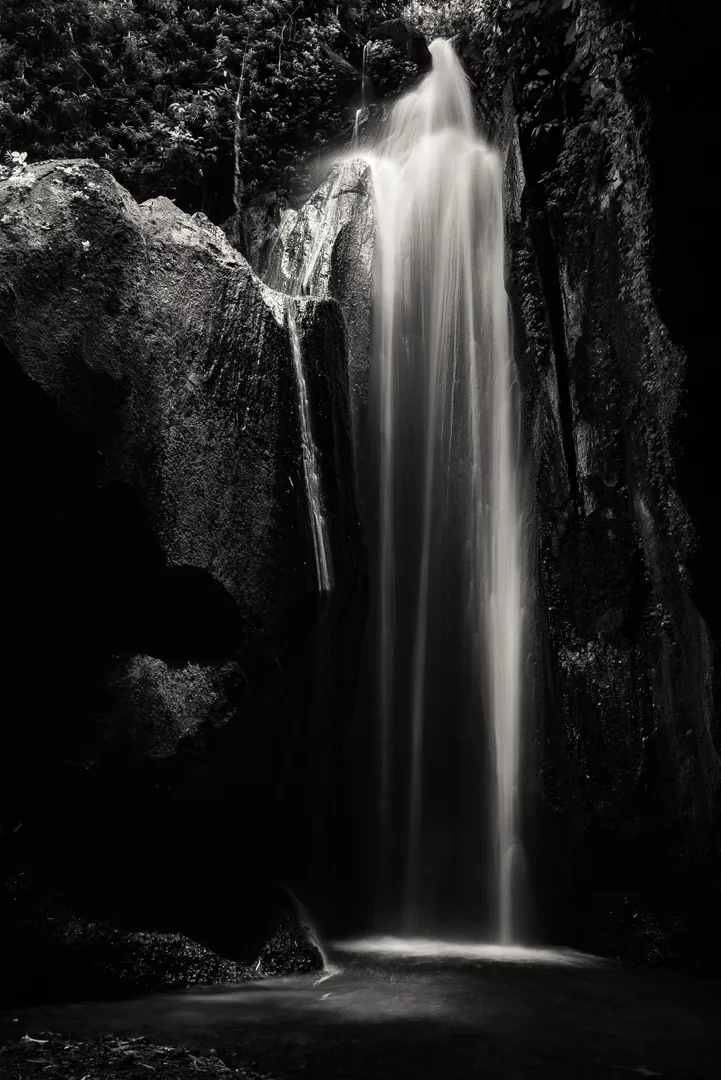
Nungnung Waterfall (8°19′47″S 115°13′46″E)
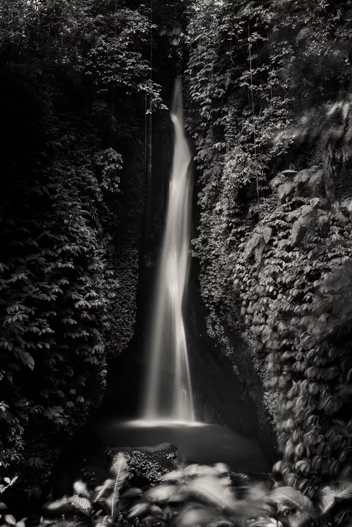
Leke Leke Waterfall (8°21′52″S 115°11′50″E)
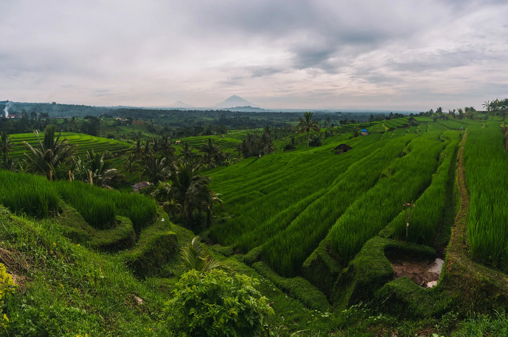
Jatiluwih Rice Terraces (8°22′11″S 115°07′55″E) are located at the southeastern slope of mount Batukaru, you can see mount Agung in the background.
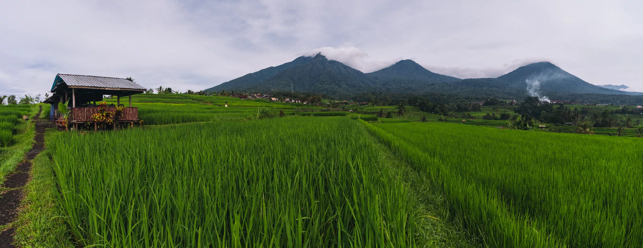
You can see mounts Batukaru (8°20′05″S 115°05′18″E), Sengayang (8°18′41″S 115°06′11″E) and Adeng (8°19′10″S 115°08′25″E).
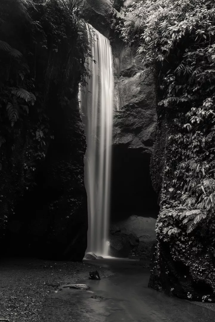
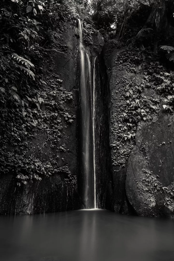
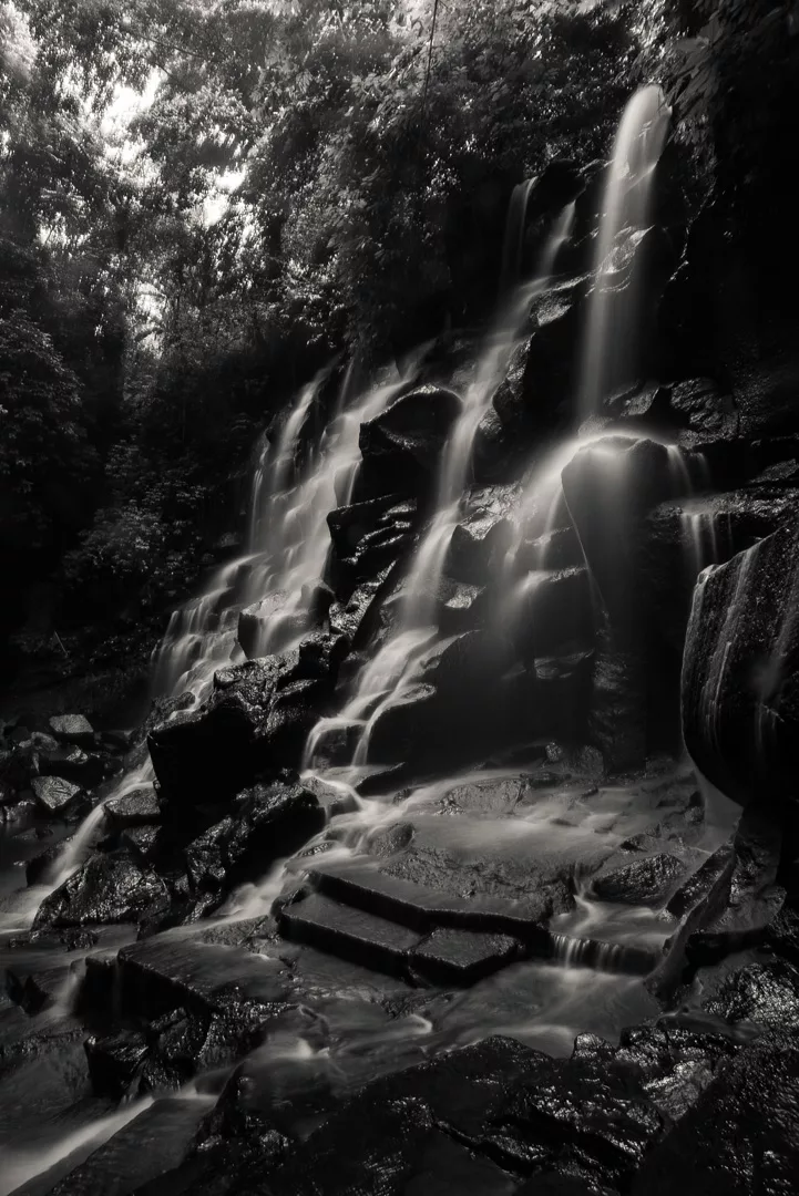
Tibu Sampi waterfall (8°26′05″S 115°03′57″E)
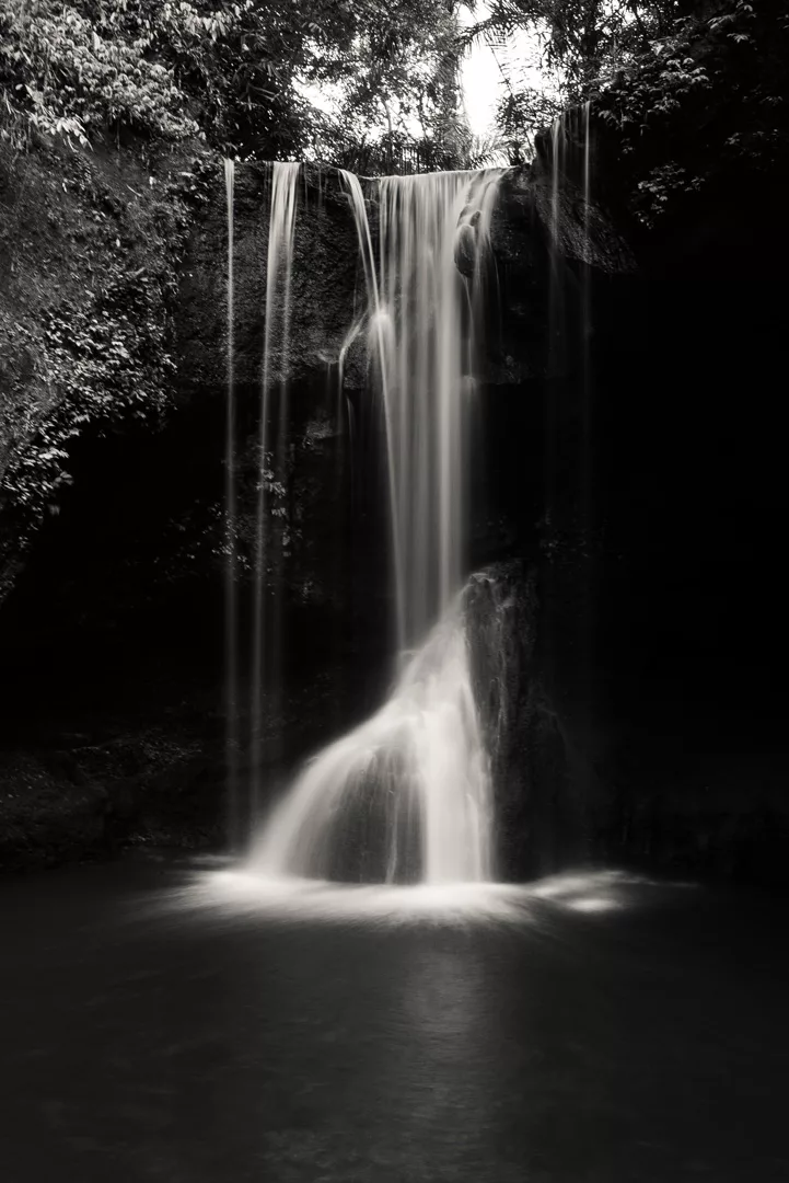
Juwuk Manis waterfall (8°23′28″S 114°54′29″E)
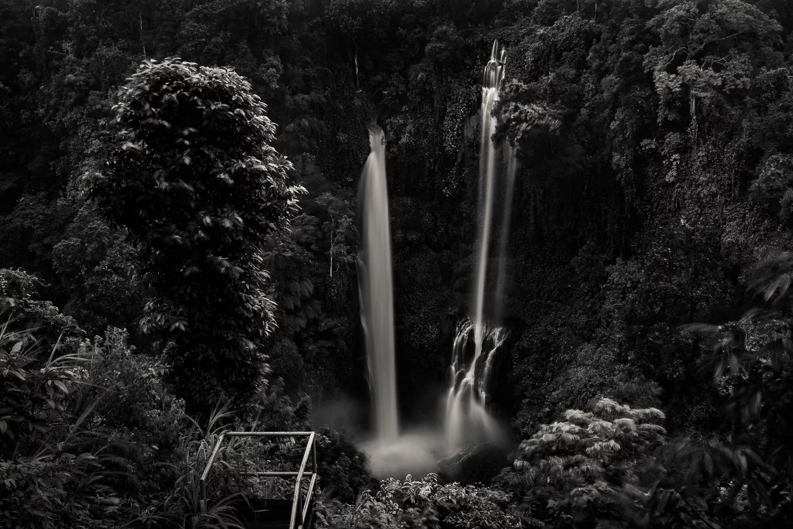
Red Coral Munduk waterfall (8°15′29″S 115°04′12″E)
Banyumala waterfall (8°13′02″S 115°06′06″E)
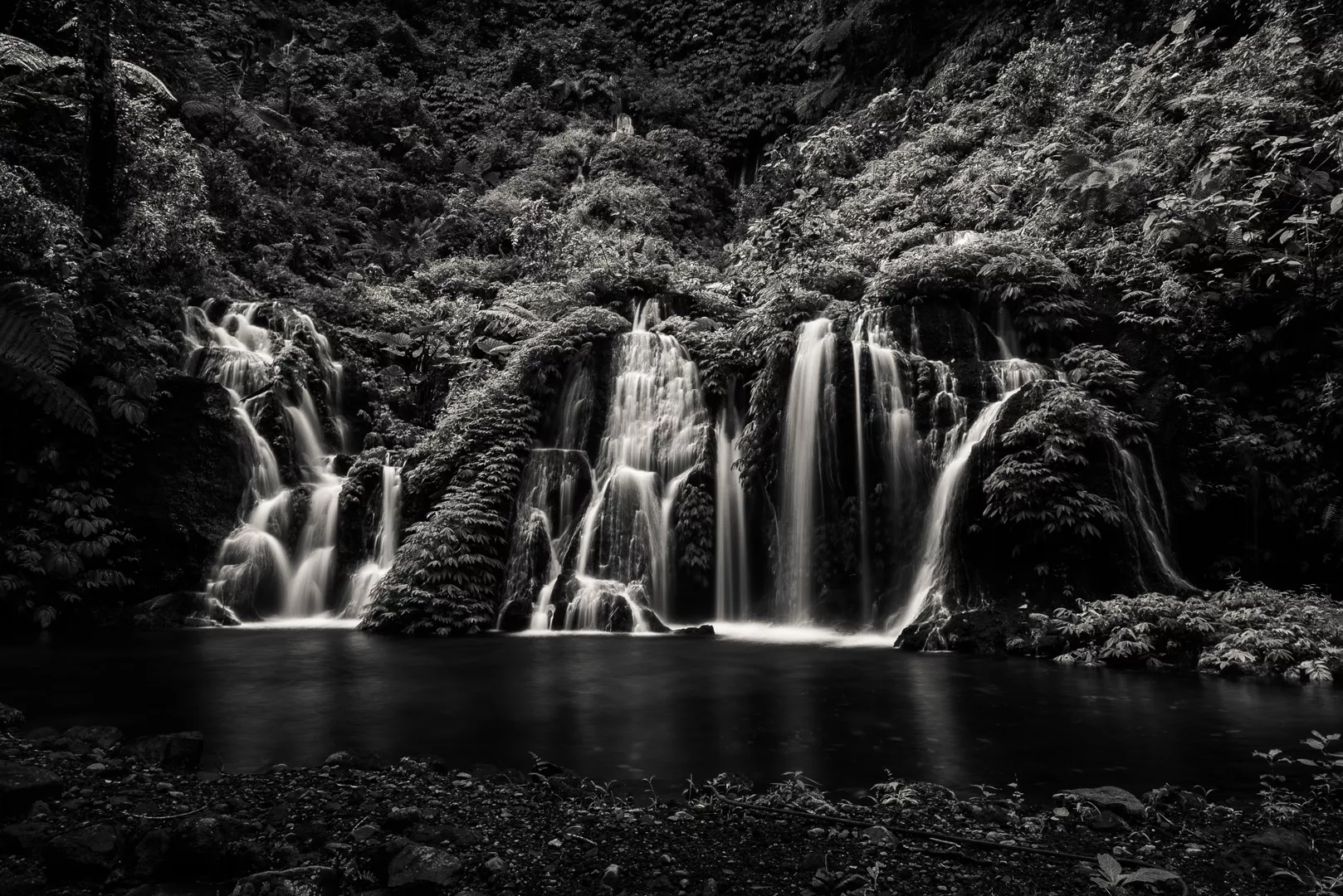
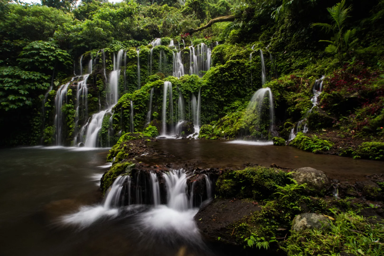
Pucak Manik waterfall (8°12′43″S 115°06′36″E, few different waterfalls at the same place)
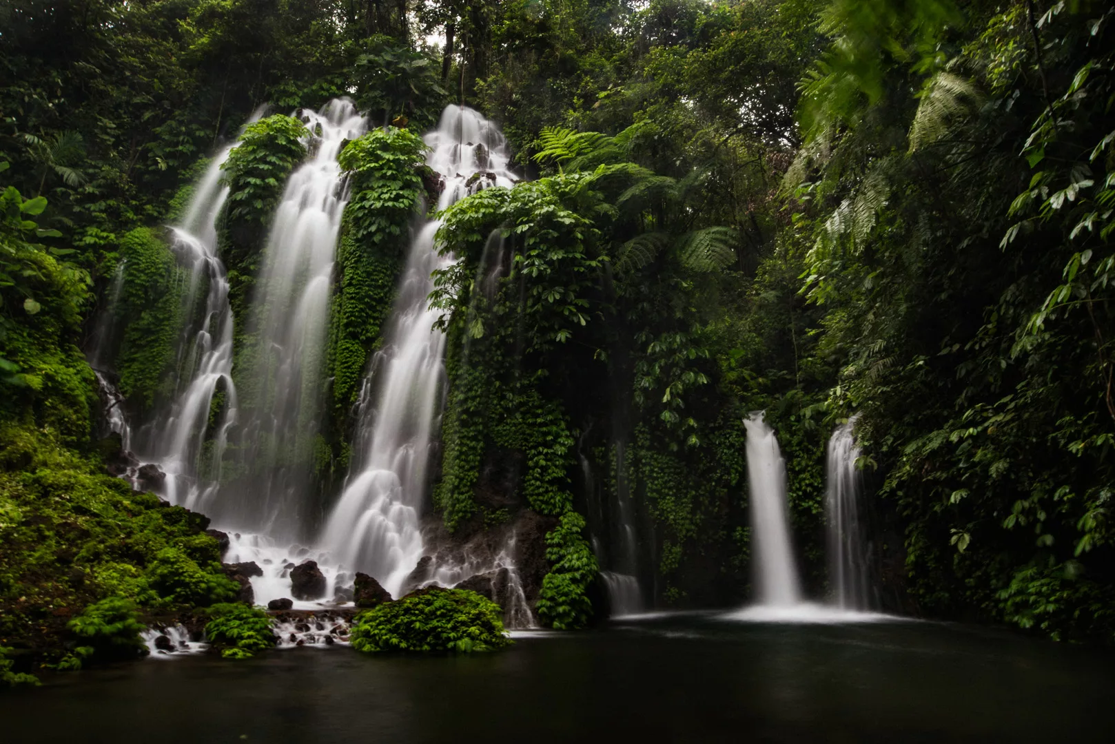
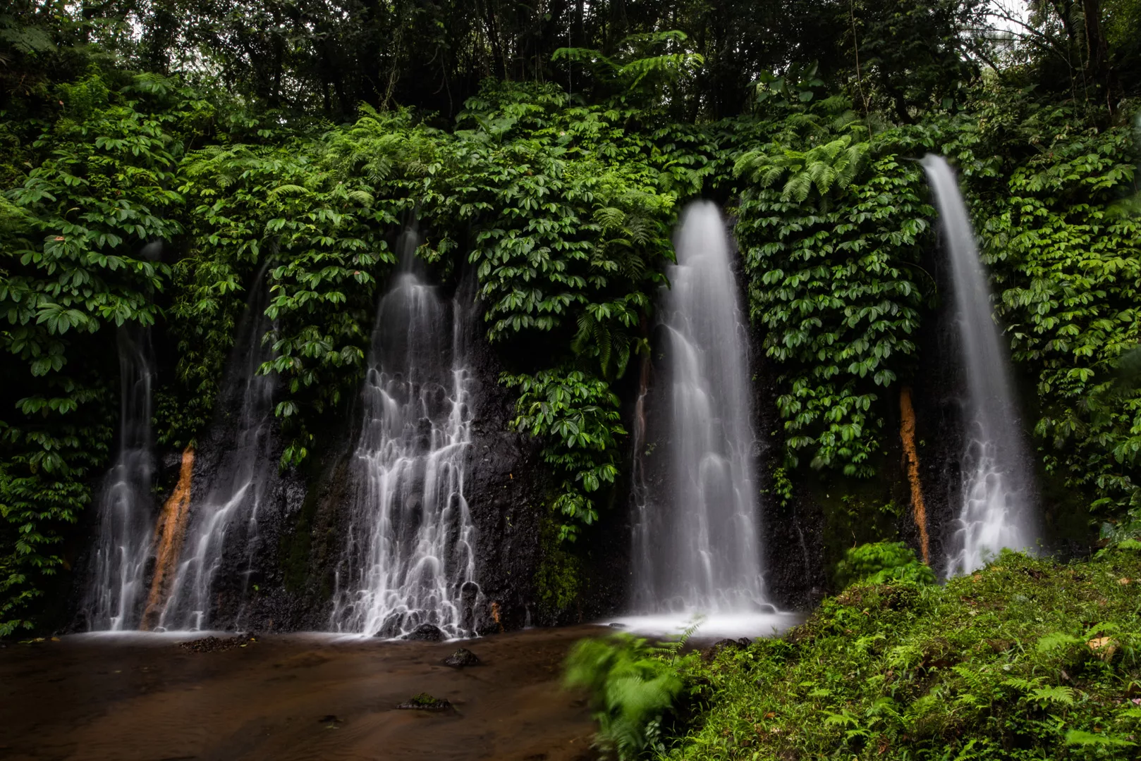
Banyu Wana Amertha waterfall (8°12′46″S 115°07′19″E, few different waterfalls in the same place under the same name)
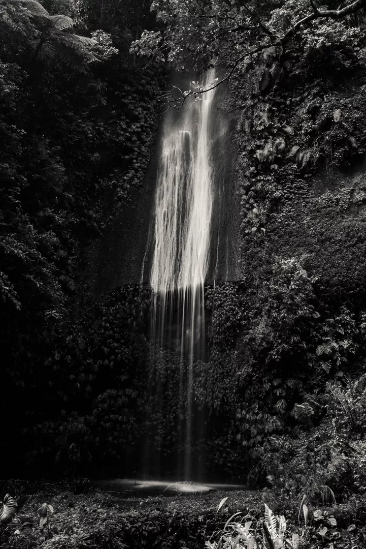
Campuhan waterfall (8°12′14″S 115°08′18″E)
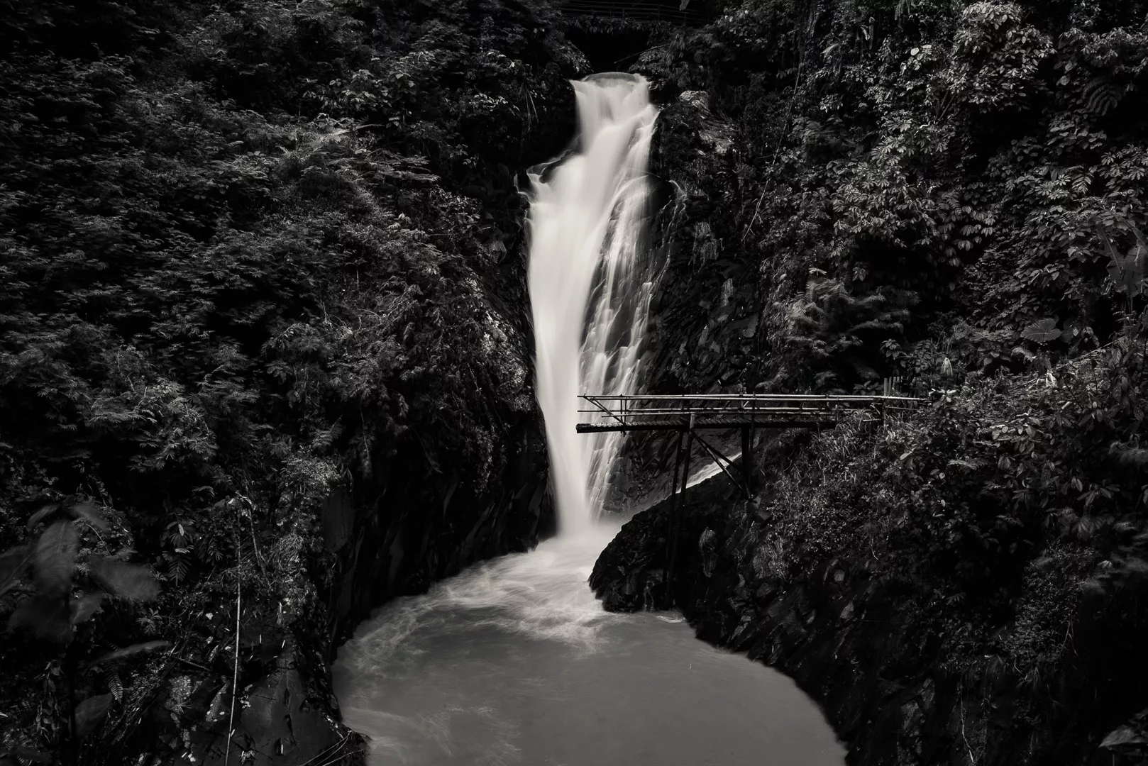
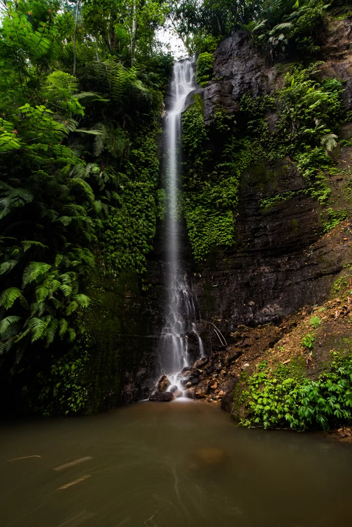
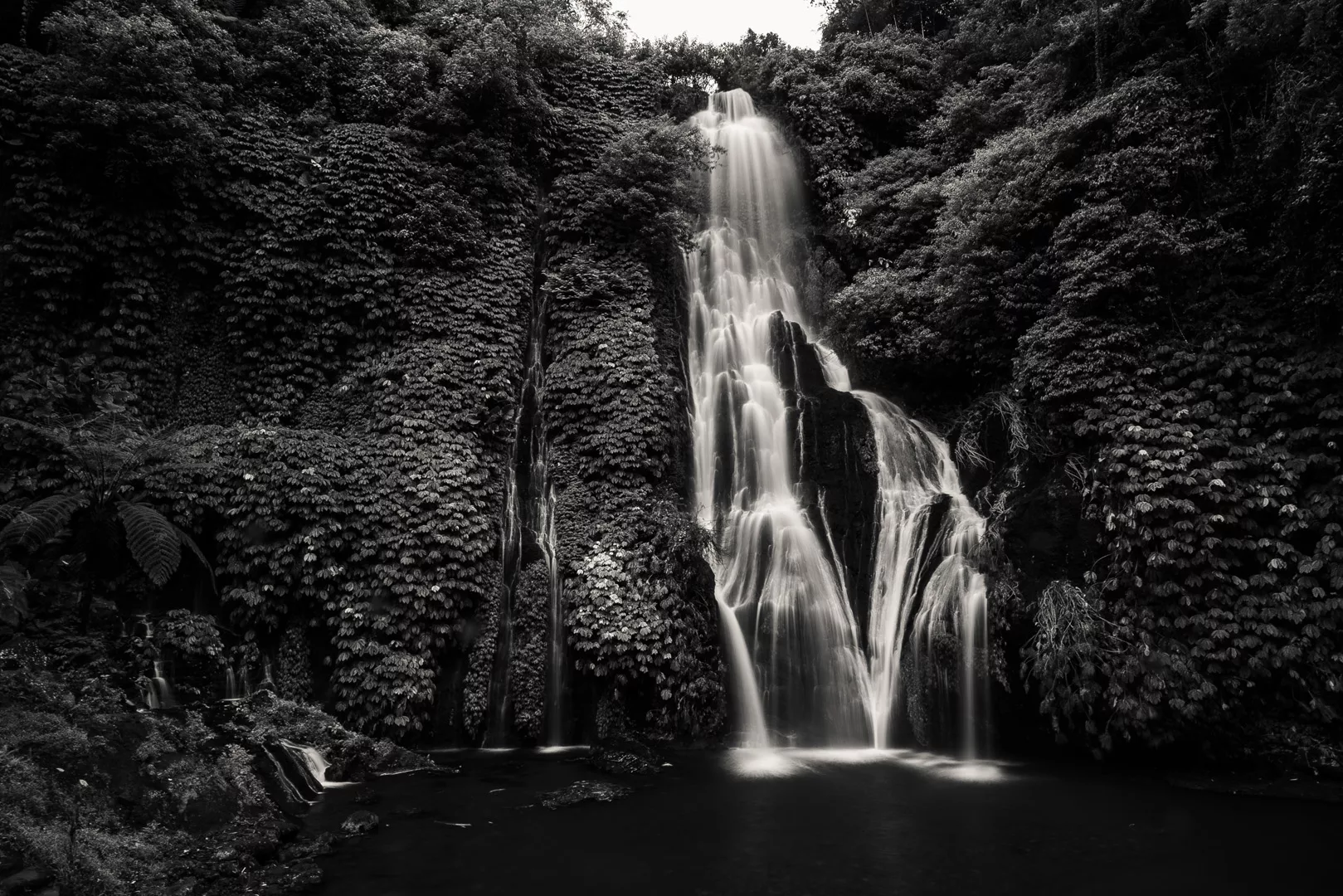
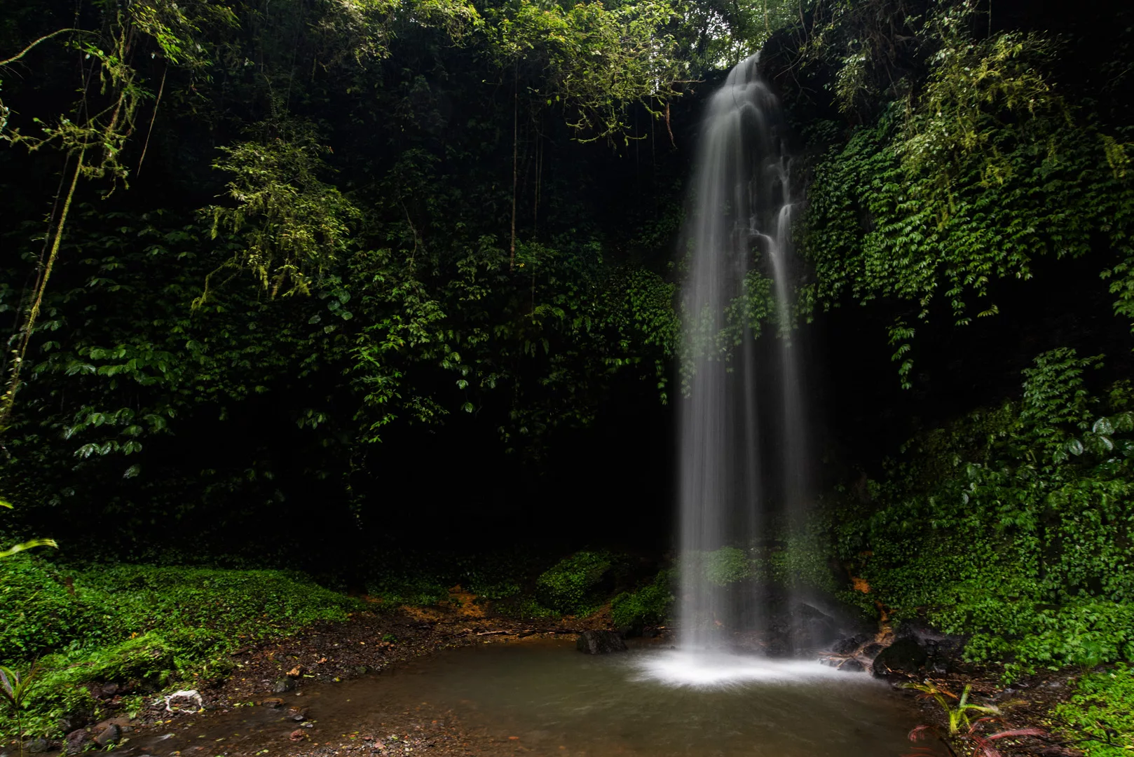
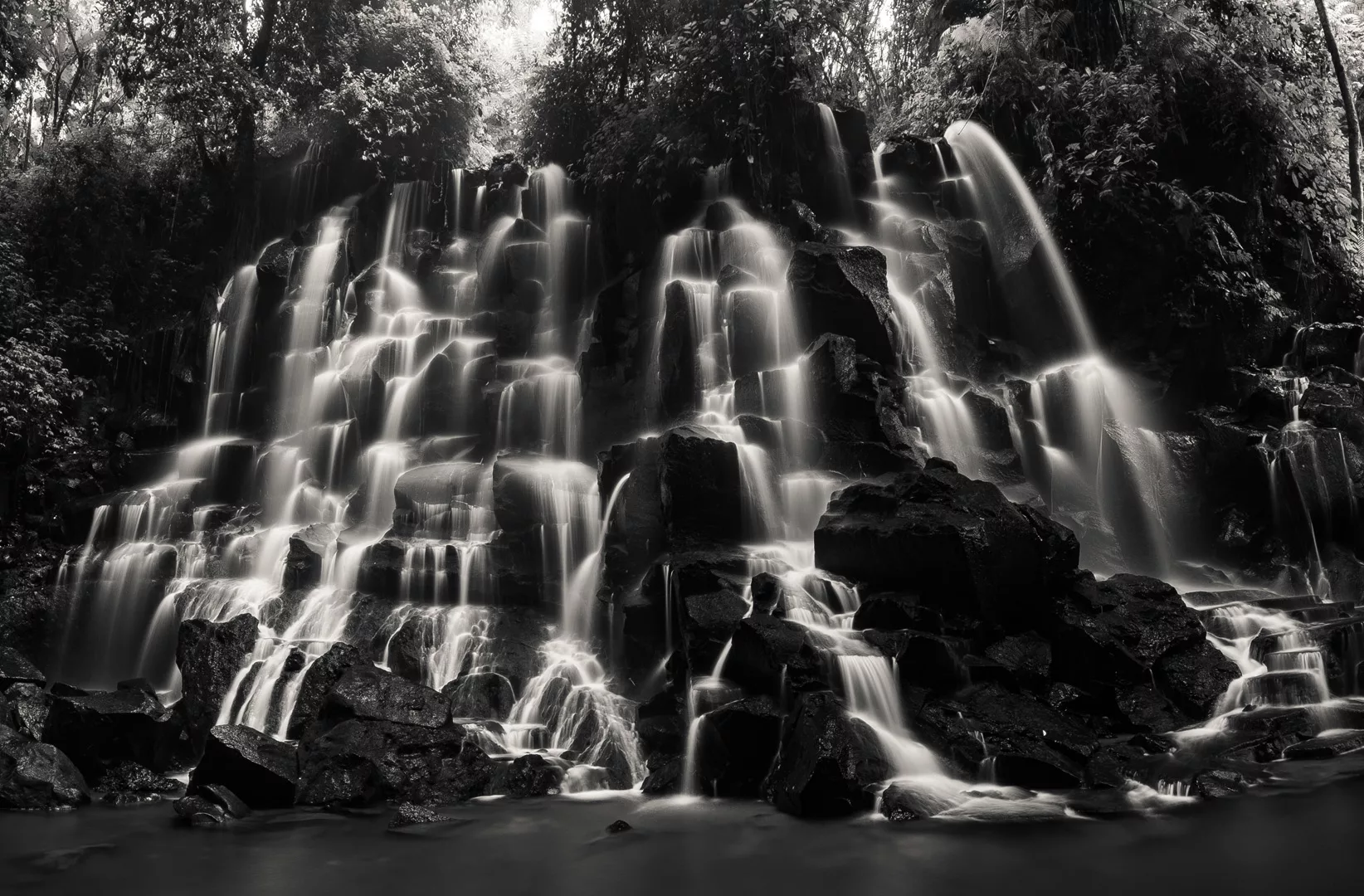
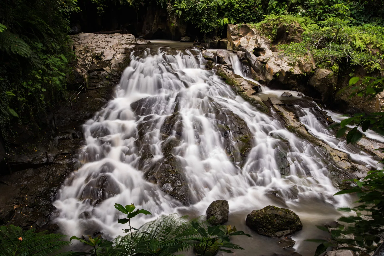
Sekumpul waterfall (8°10′39″S 115°10′57″E)
 Landscape
Ubud (8°31’ S 115°16’ E) is a city in south-central Bali, it is considered a cultural central of the island and is the most northern place most tourist go and thus the most northern place where you can use Grab.
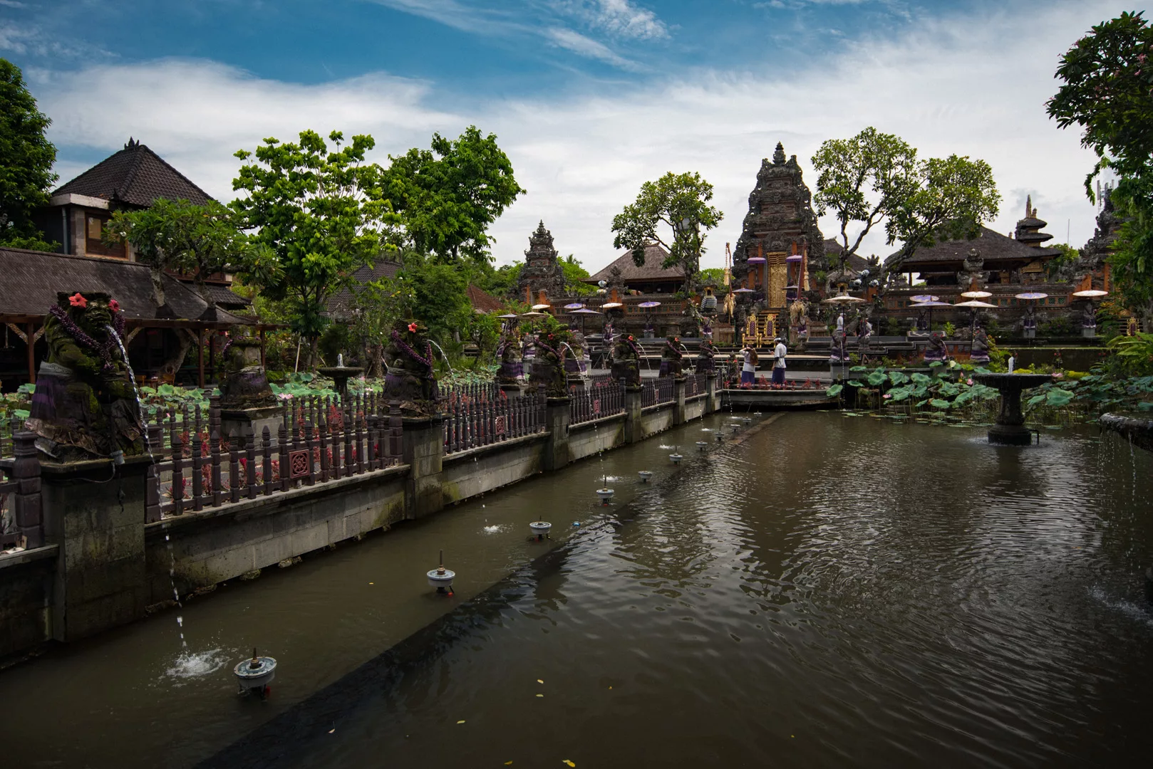
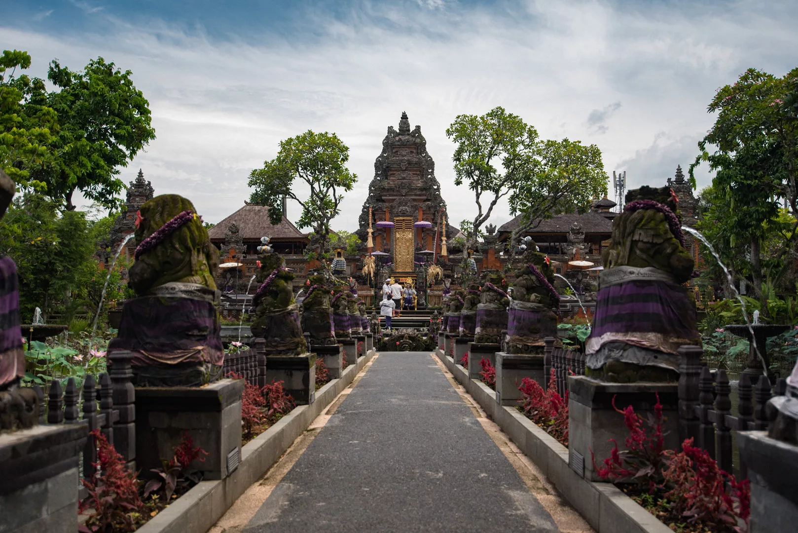
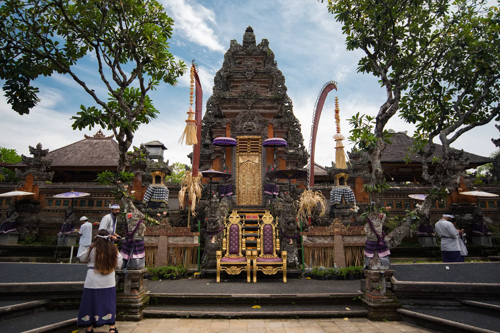
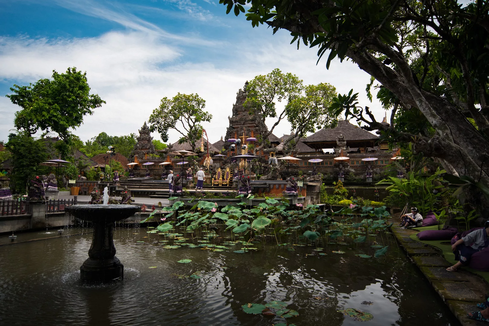
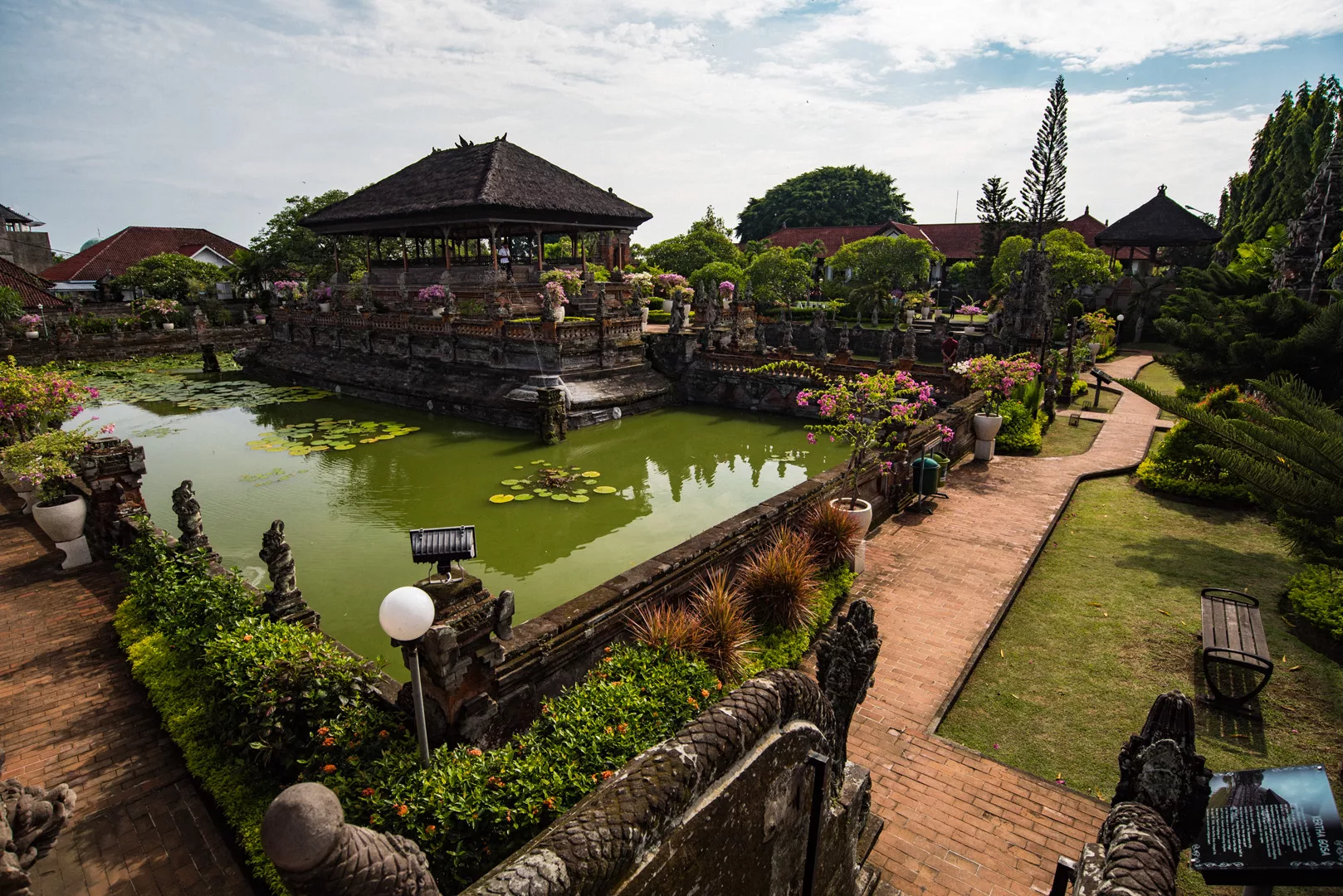
Ubud Palace (8°30’24″ S 115°15’46″ E)
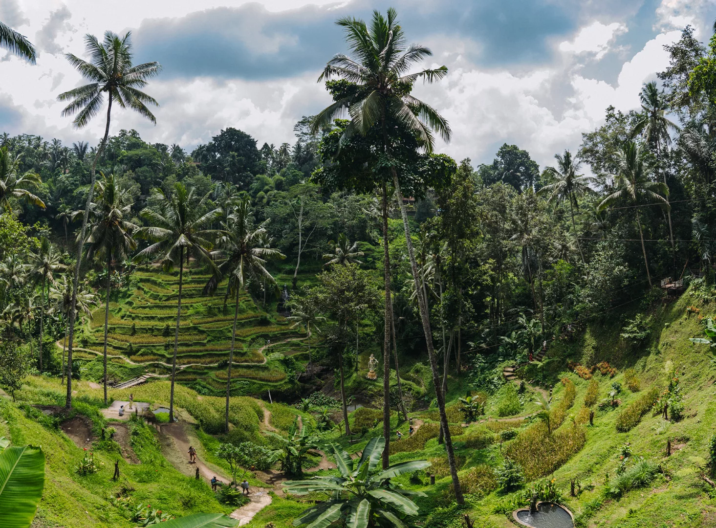
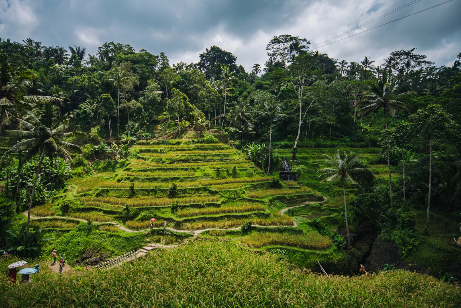
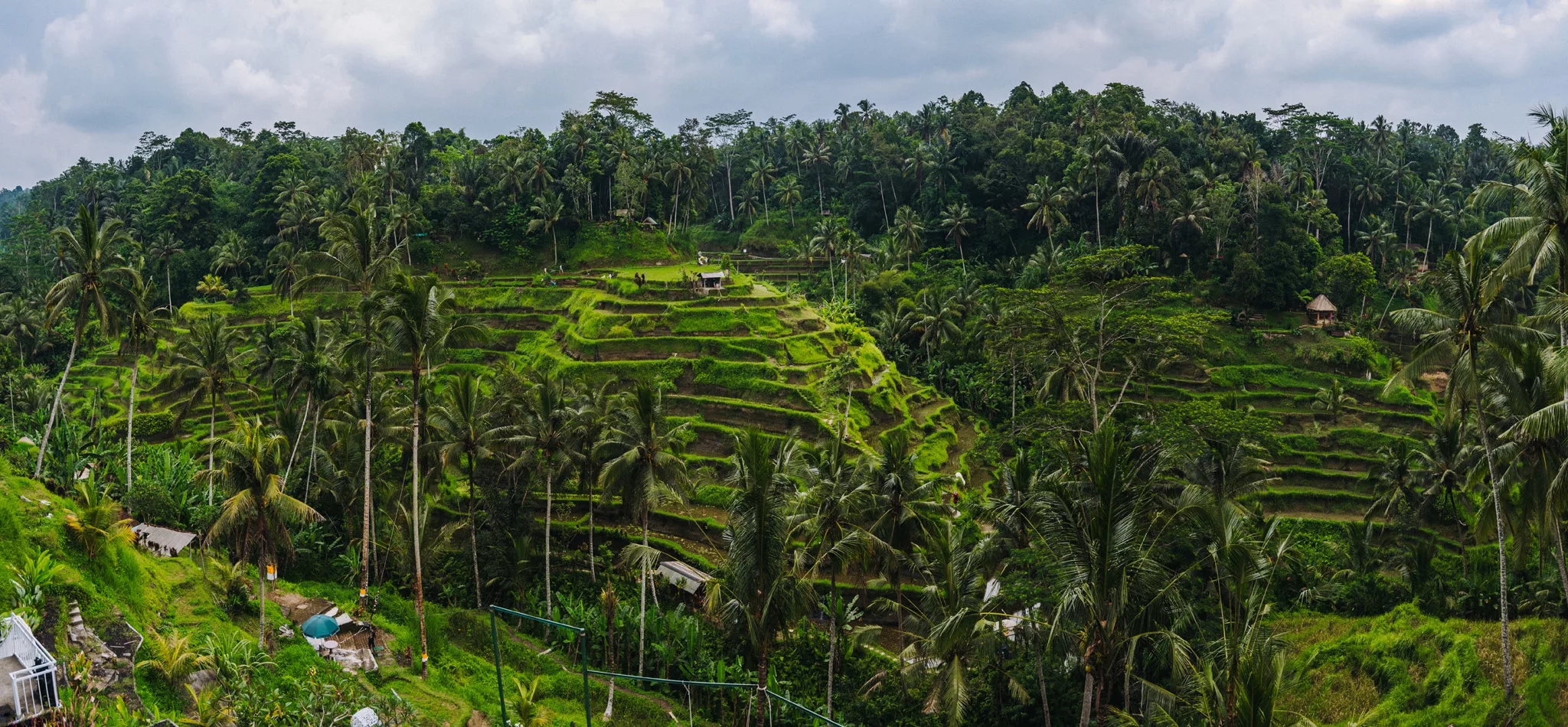
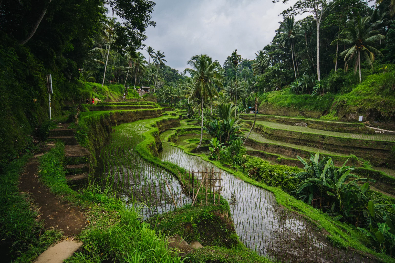
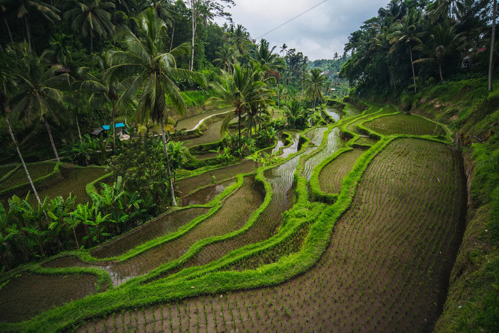
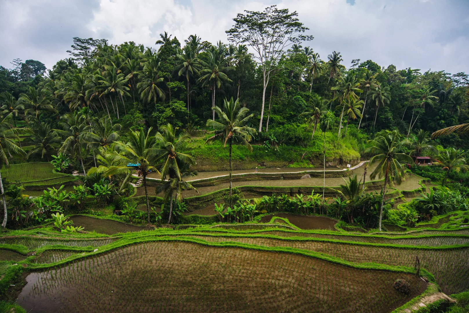
Tegalalang Rice Terrace (8°25’57″ S 115°16’46″ E)
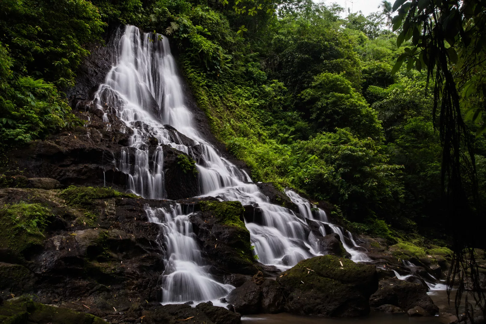
Goa Raja waterfall (8°26’31″ S 115°22’27″ E)
Yeh Bulan waterfall (8°26’59″ S 115°22’28″ E)
Dedari waterfall (8°30’02″ S 115°21’24″ E)
Suwat waterfall (8°29’11″ S 115°19’05″ E)
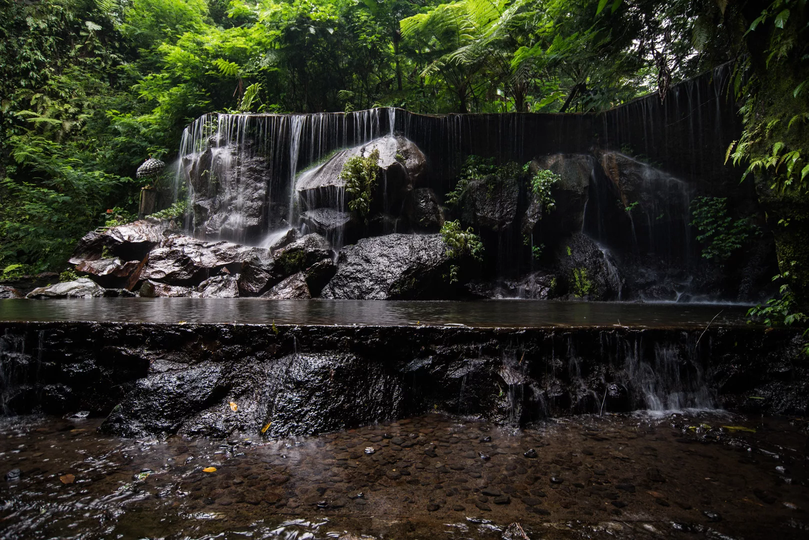
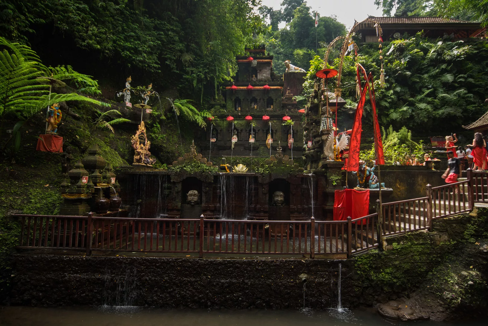
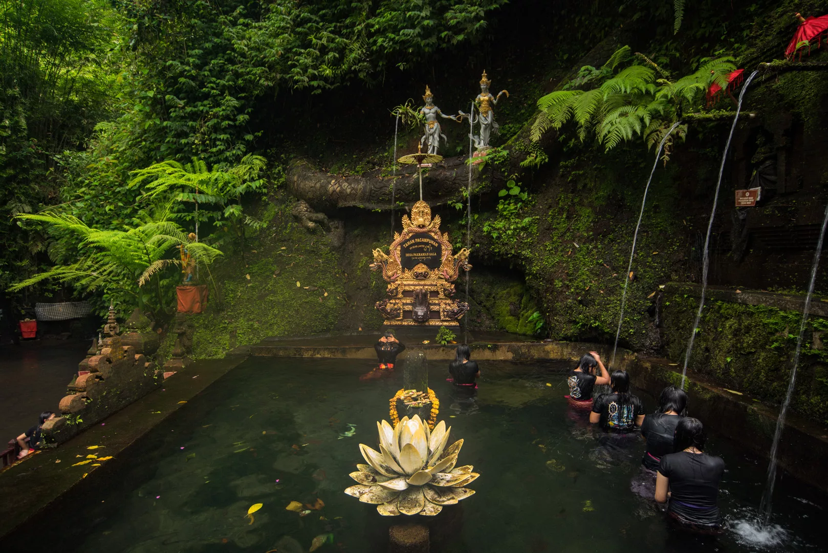
Taman Pecampuhan Sala Temple (8°27’05″ S 115°19’37″ E)
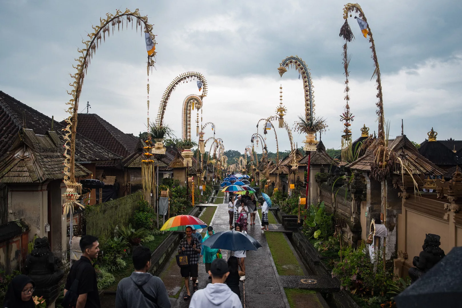
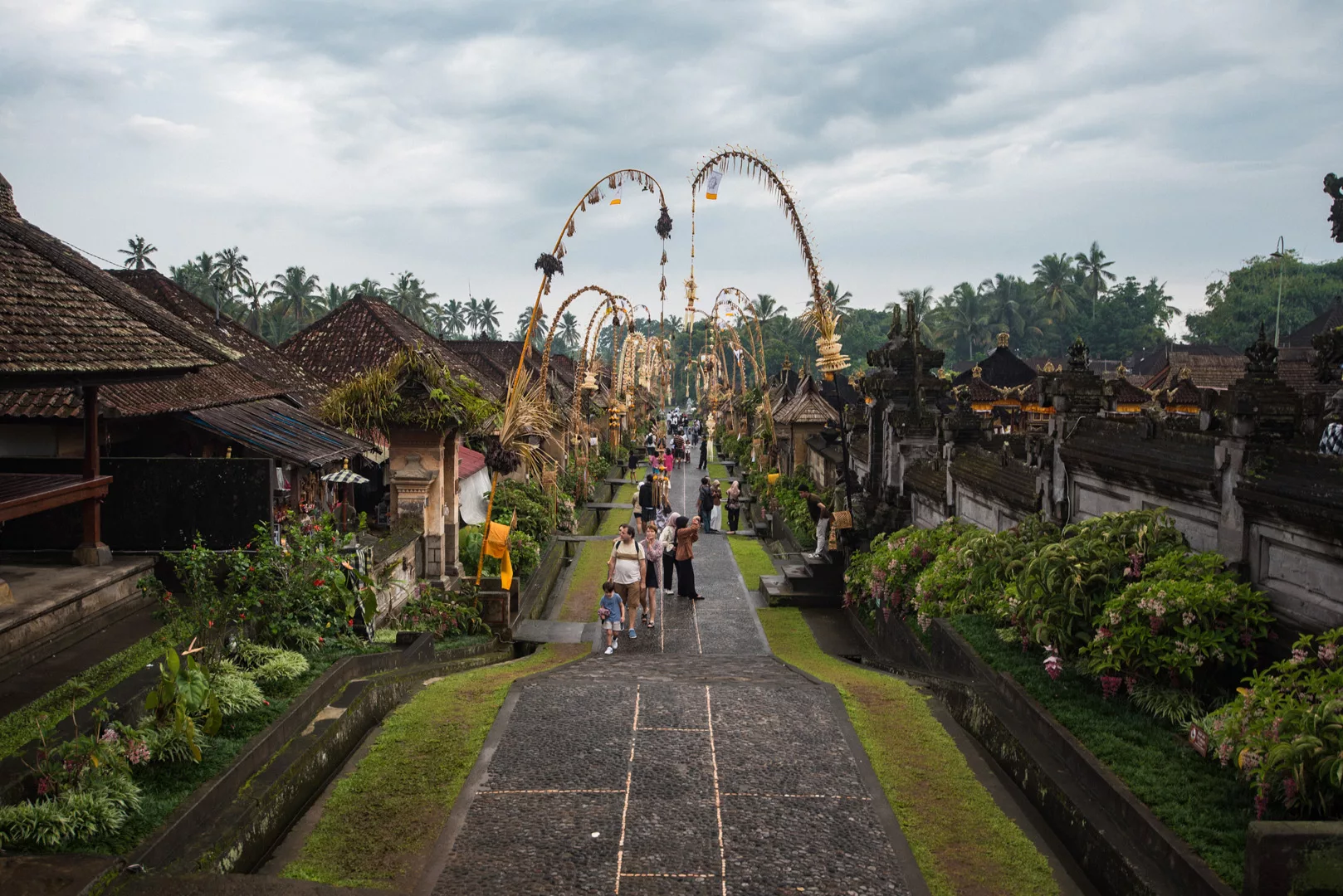
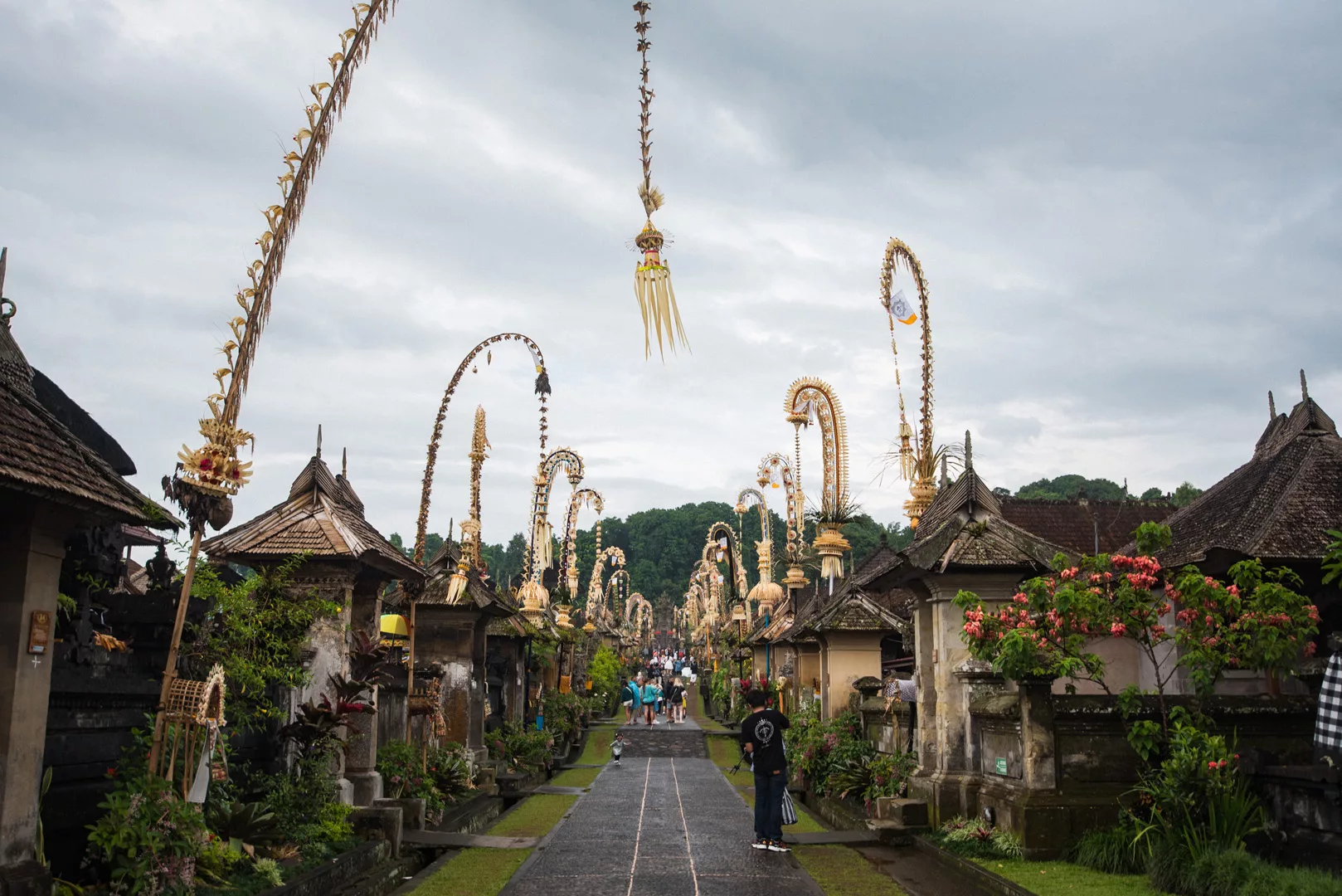
Penglipuran traditional village (8°25’18″ S 115°21’34″ E)
Kanto Lampo waterfall (8°31′55″S 115°19′58″E)
Krisik waterfall (8°27′27″S 115°23′16″E)
Goa Giri Campuhan waterfall (8°27′50″S 115°23′19″E)
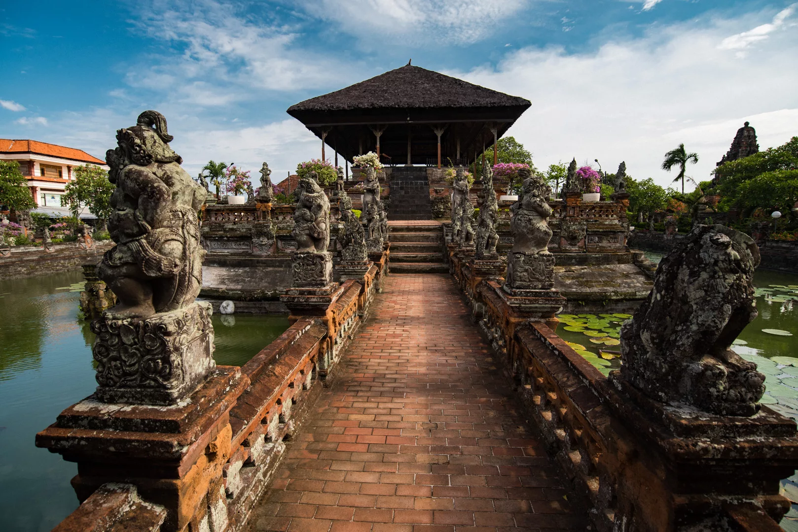
Klungkung Palace (8°32′08″S 115°24′12″E)
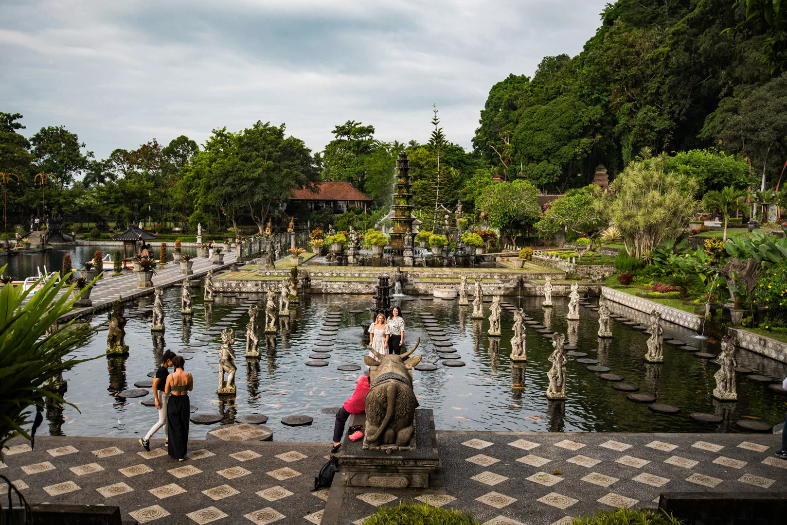
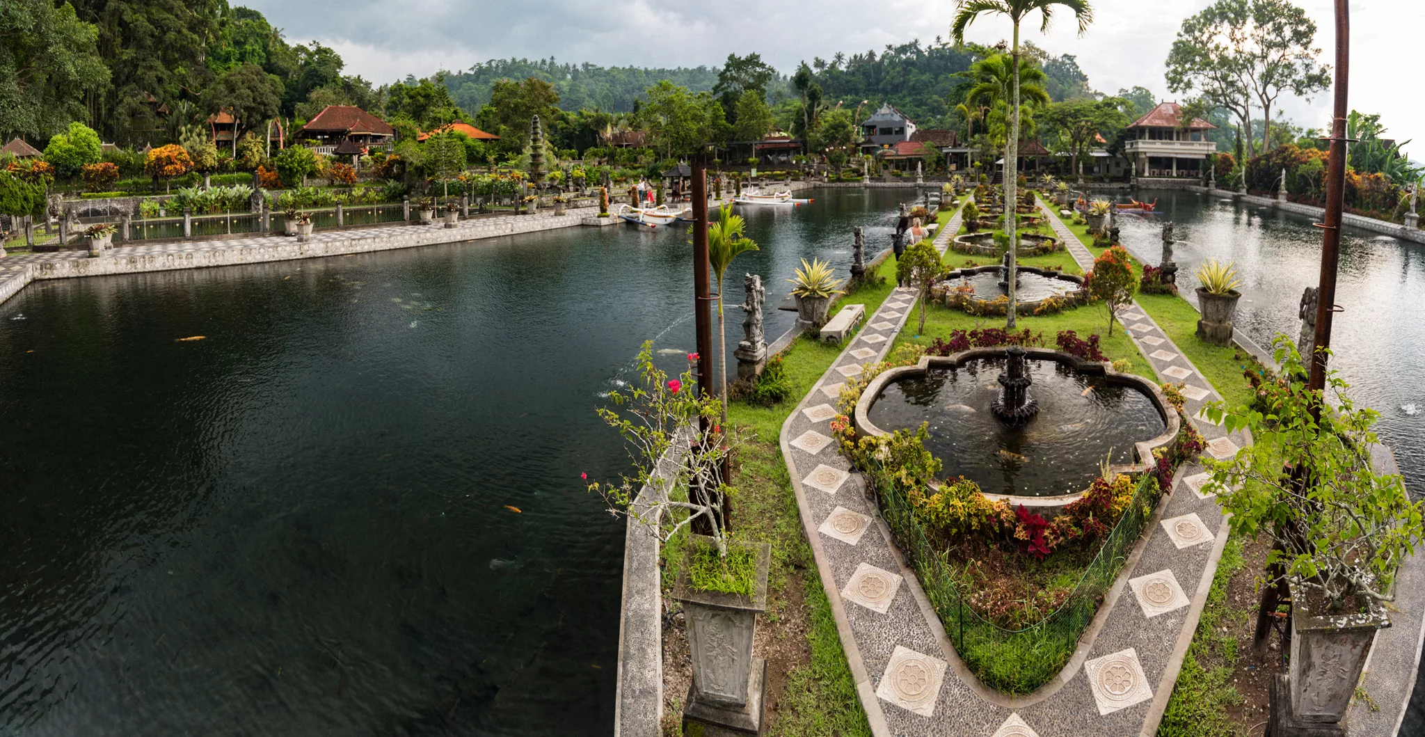
Tirta Gangga (8°24′45″S 115°35′14″E)
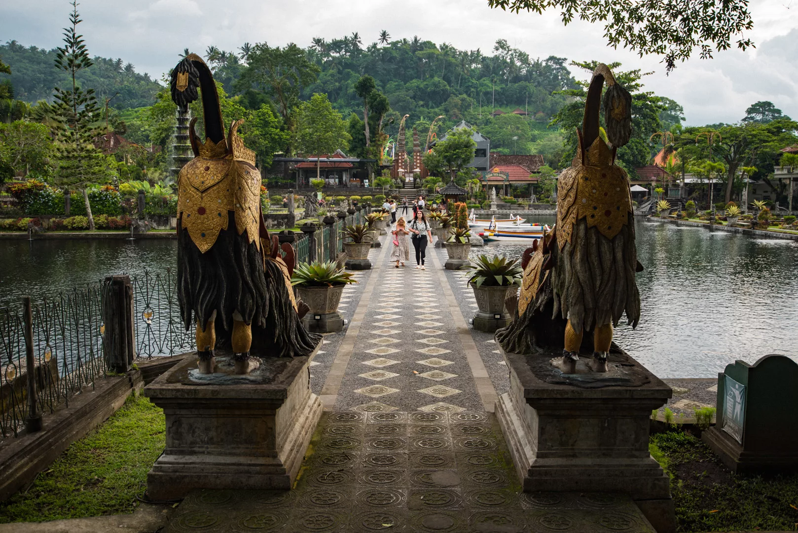
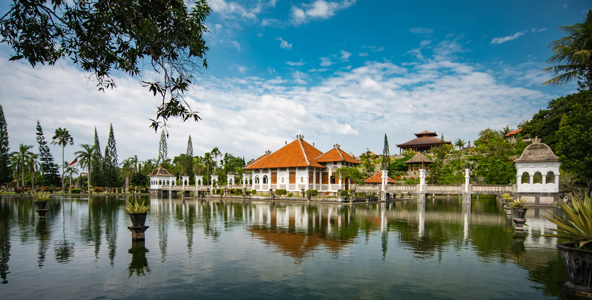
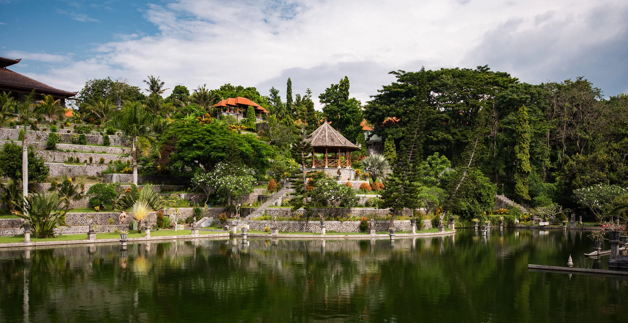
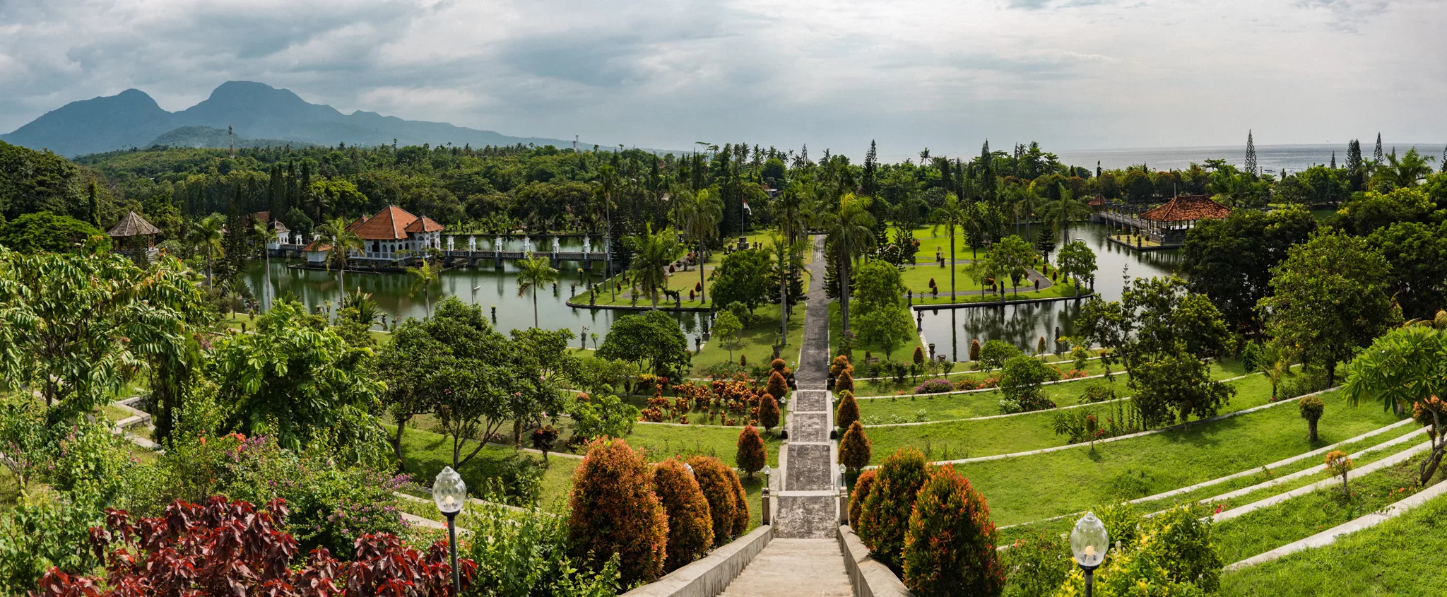
Taman Ujung (8°27′52″S 115°37′51″E)
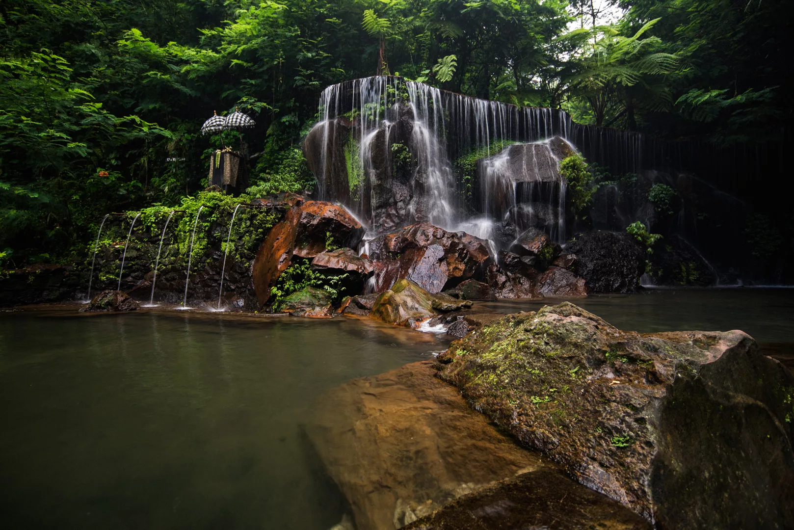
Goa Rang Reng waterfall (8°30′56″S 115°19′53″E)
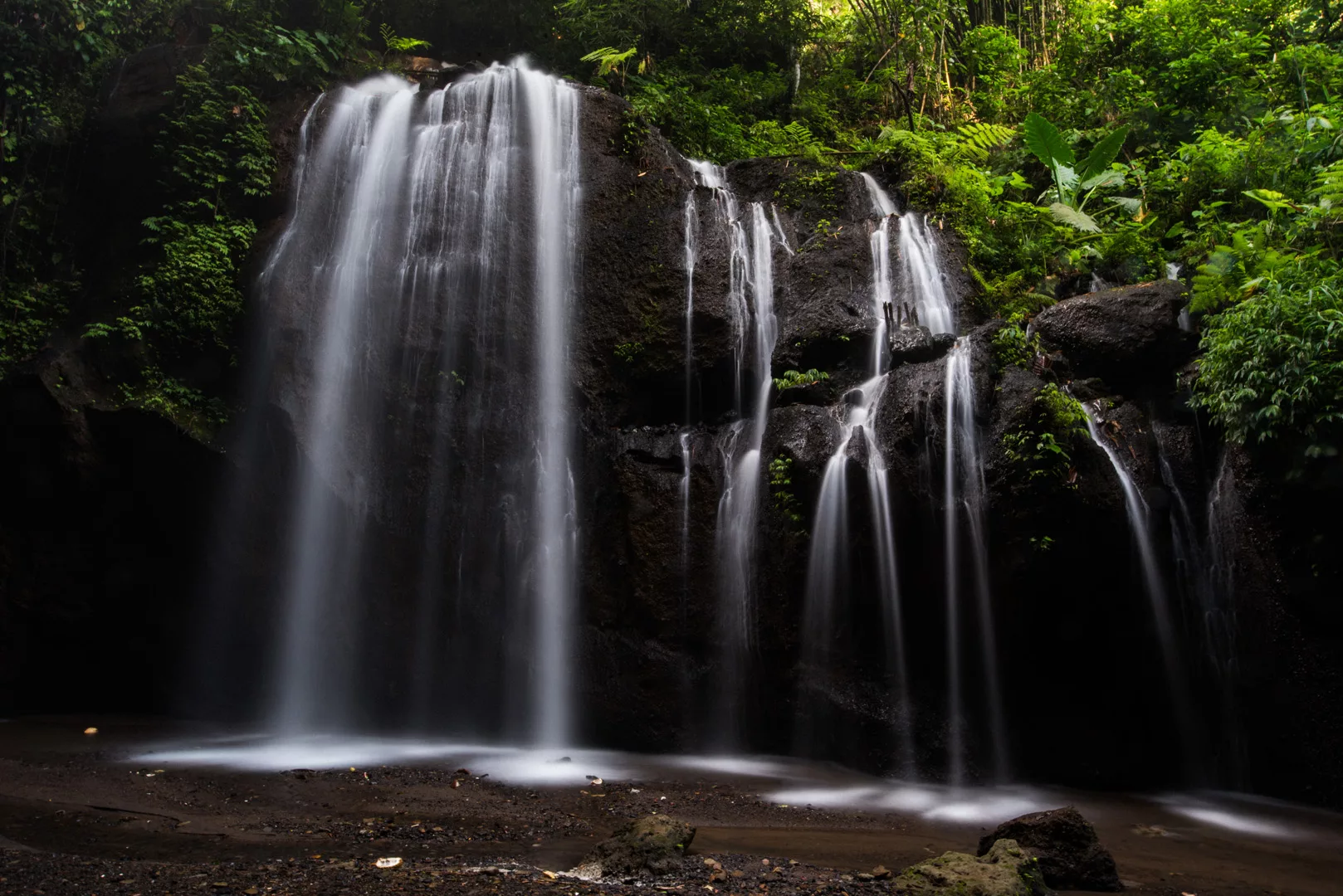
Tibumana waterfall (8°30′25″S 115°19′59″E)