 Landscape
Southern Bali
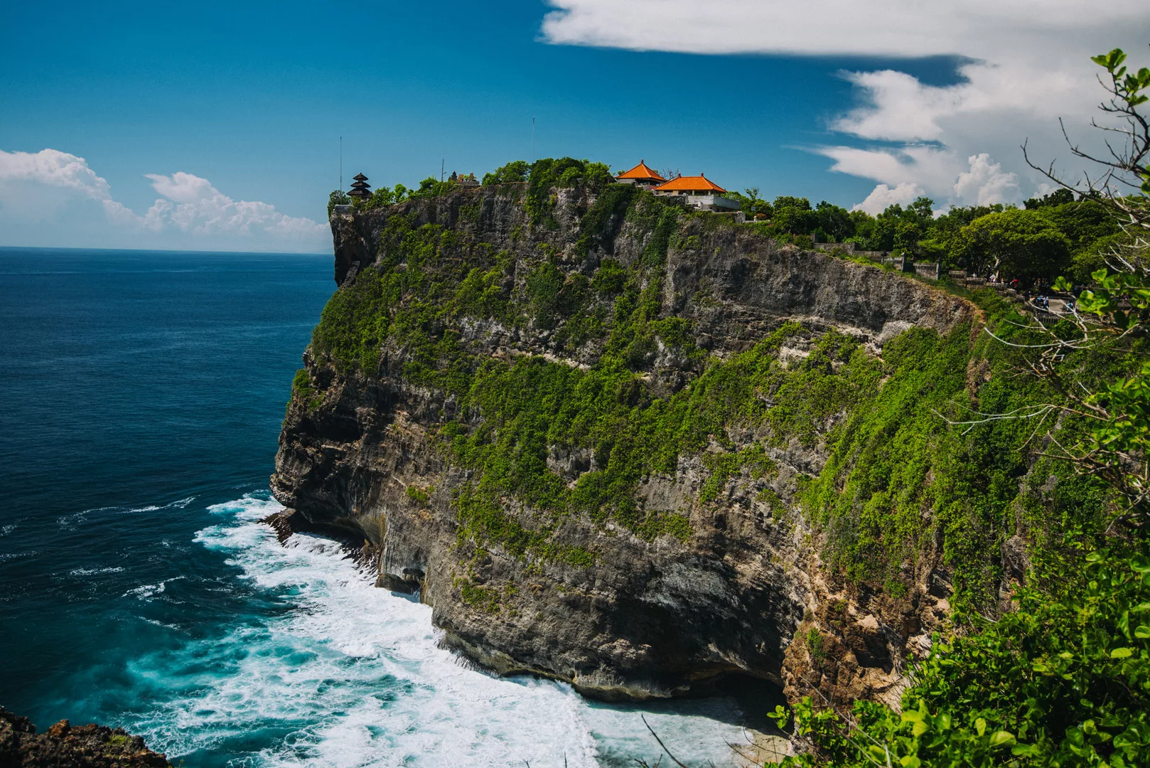
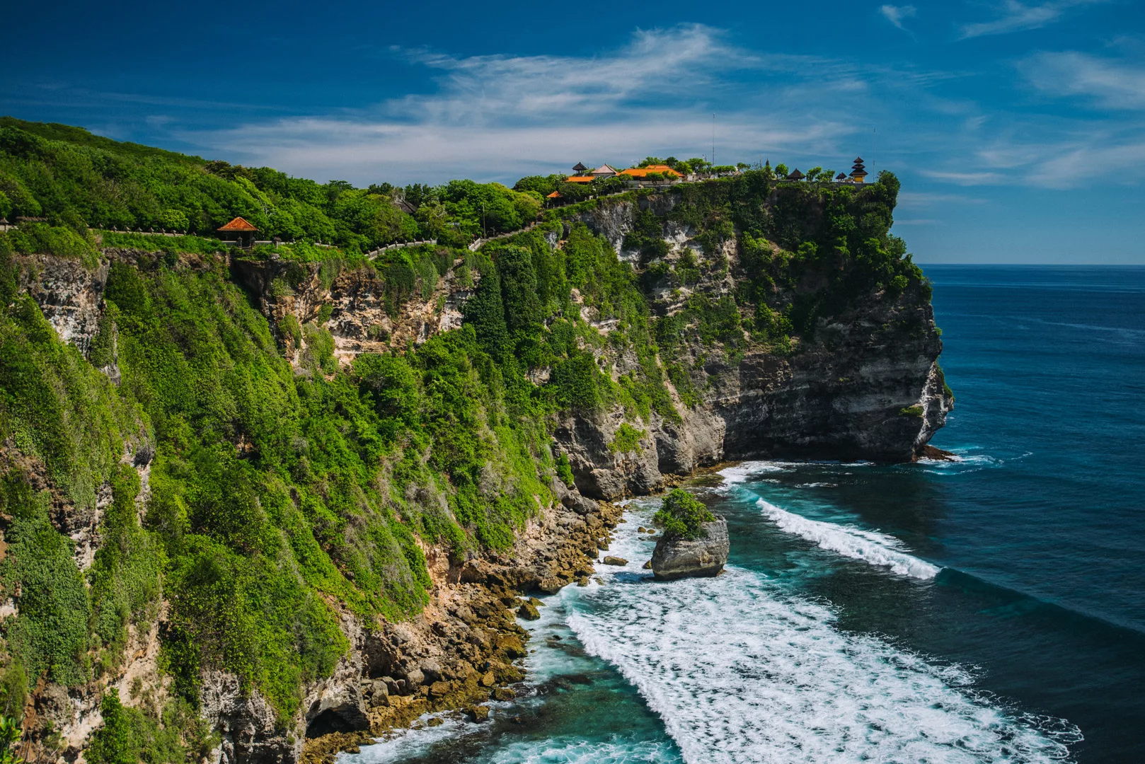
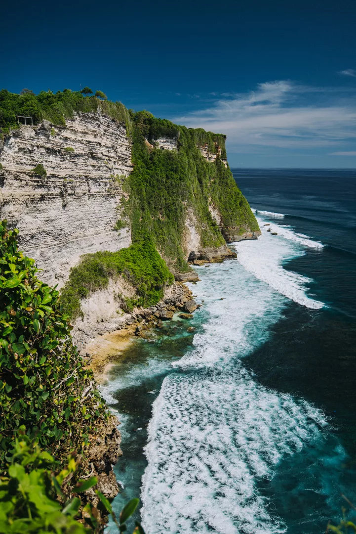
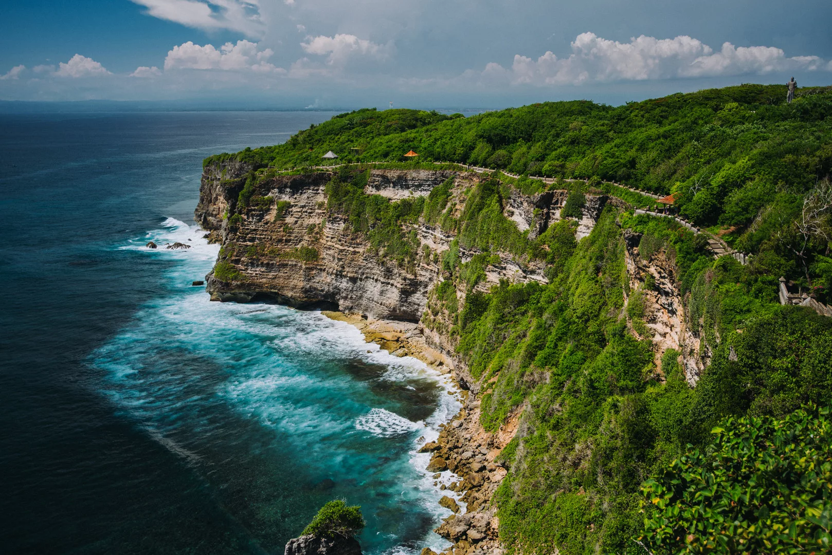
Uluwatu temple (8°49’44″ S 115°05’04″ E) is one of the Balinese temples, it’s situated on a high cliff.
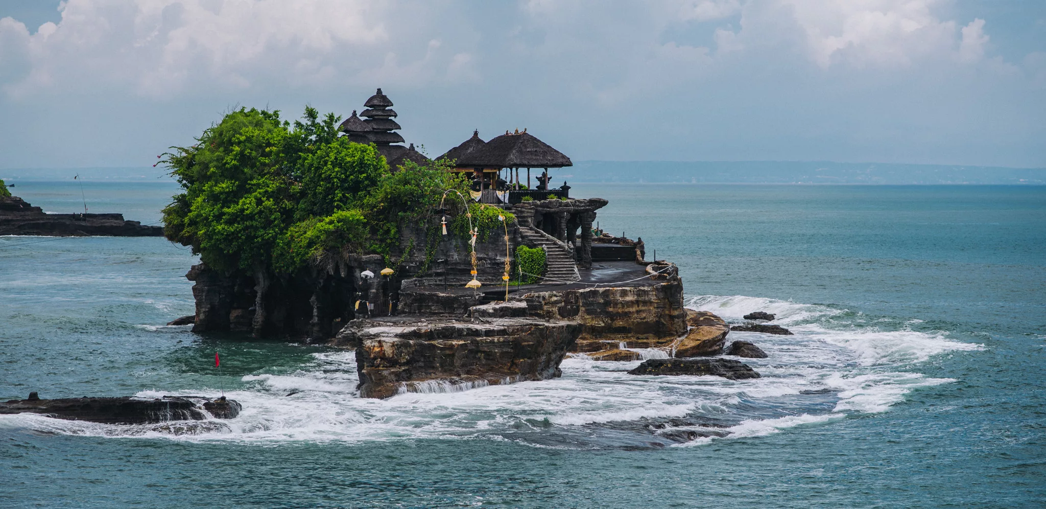
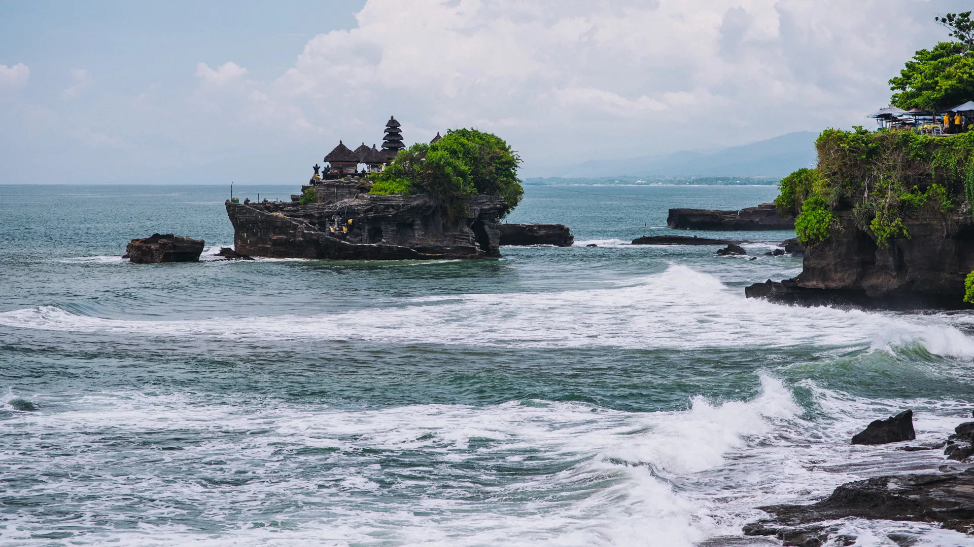
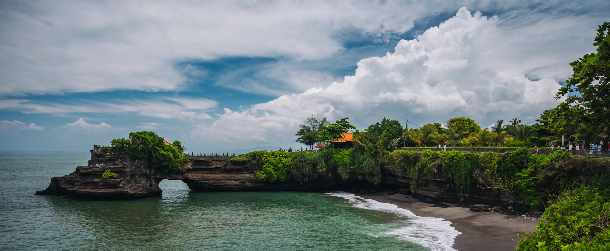
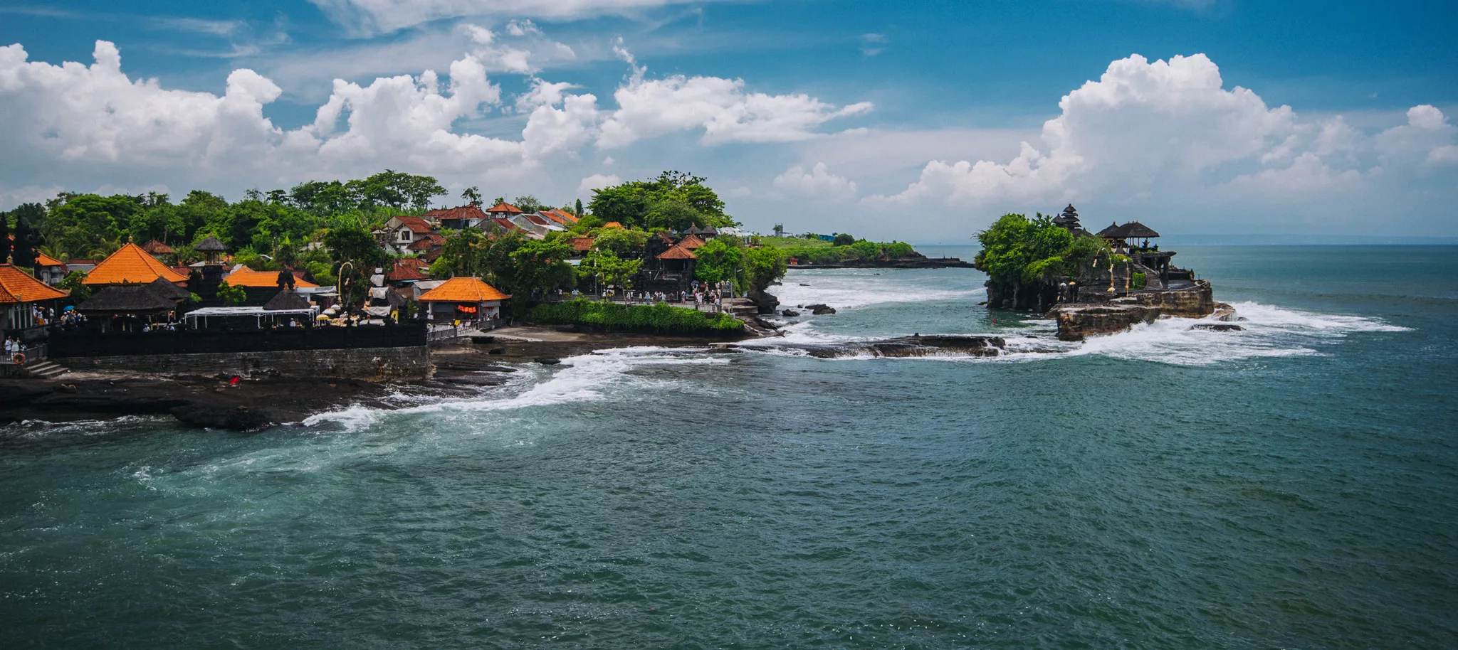
Tanah Lot Temple (8°37’16″ S 115°05’13″ E)
Tegenungan waterfall (8°34′30″S 115°17′26″E)
 Landscape
Uluwatu temple (8°49’44″ S 115°05’04″ E) is one of the Balinese temples, it’s situated on a high cliff.
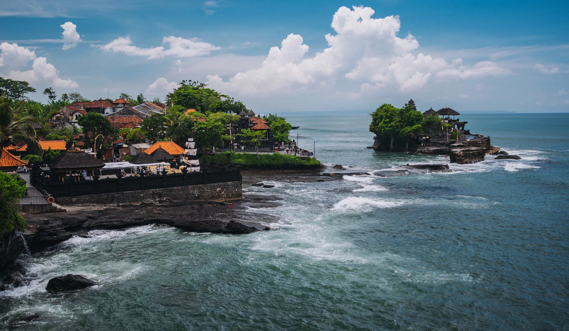
Tanah Lot Temple (8°37’16″ S 115°05’13″ E)
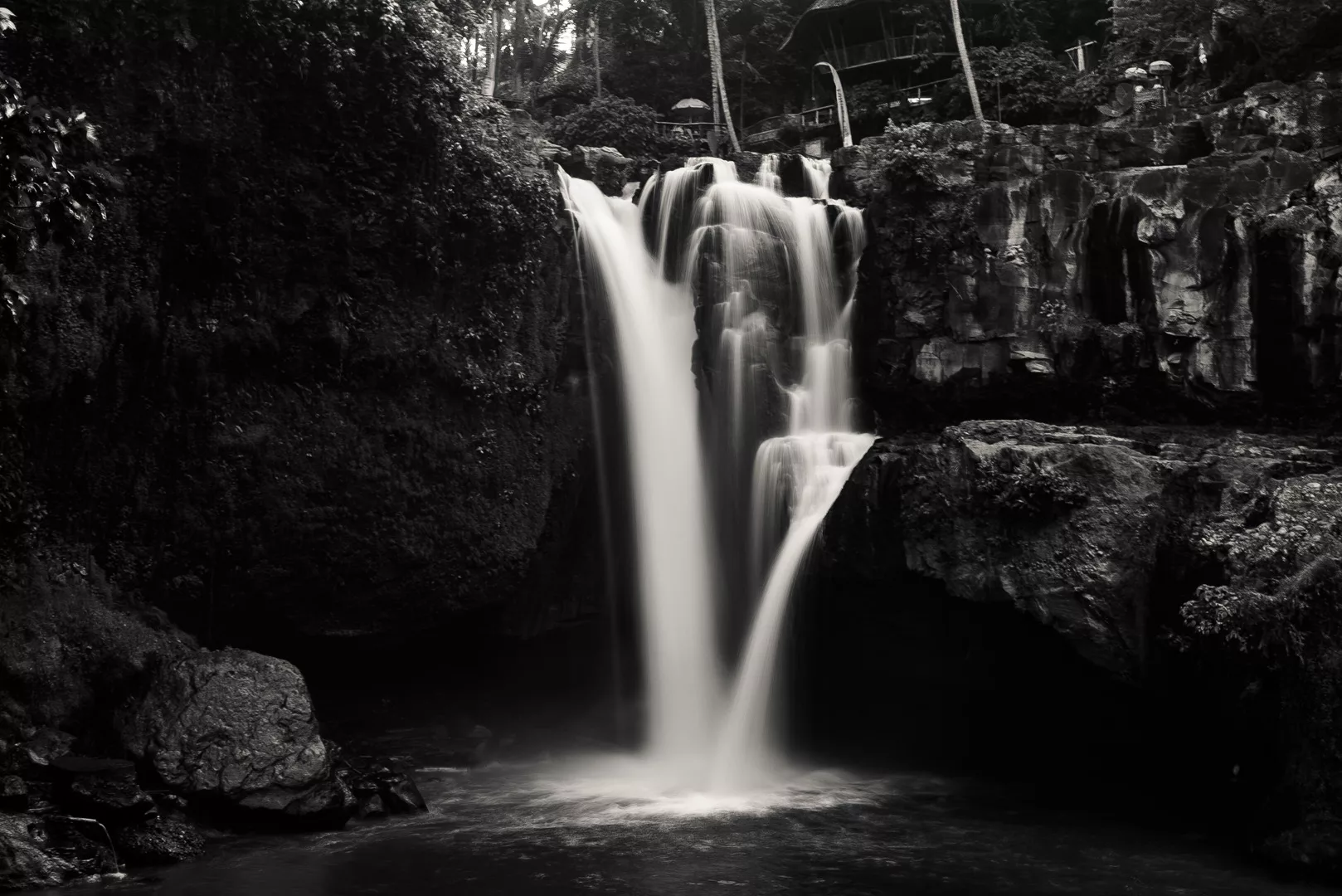
Tegenungan waterfall (8°34′30″S 115°17′26″E)
Landscape
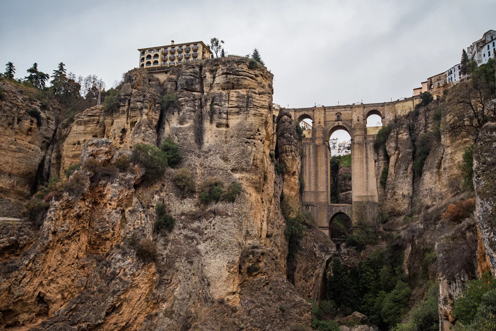
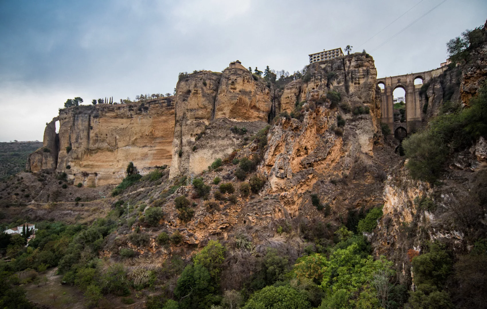
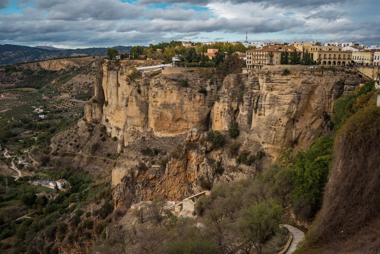
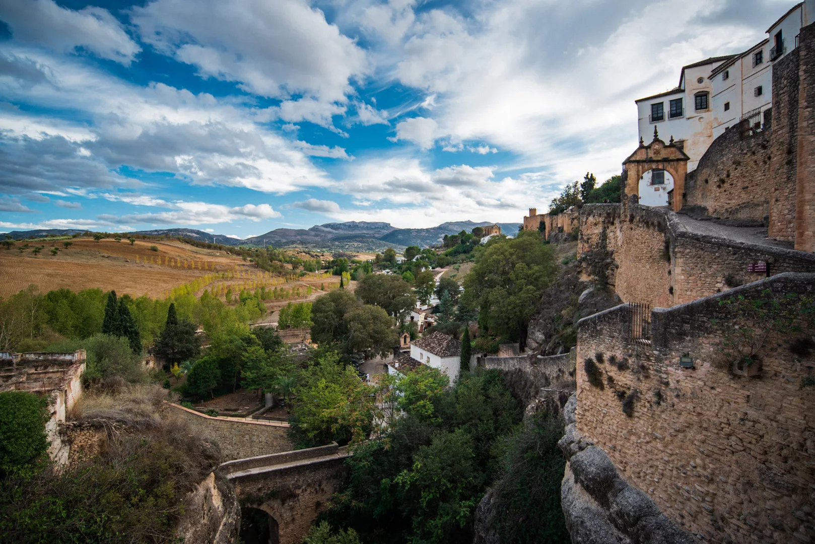
Ronda (36°44’38″ N 5°09’49″ W) is a city in Andalucia, that lies at a steep cliff with a canyon in the middle of a city with two bridges spanning across the canyon.
Cliff of Ronda and the new bridge connecting two parts of the city seen from a viewpoint (36°44’22″ N 5°10’06″ W).
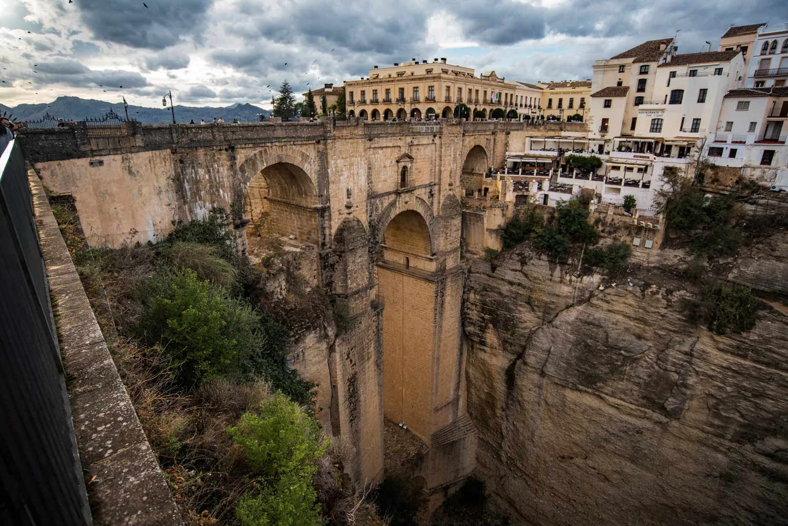
New bridge.
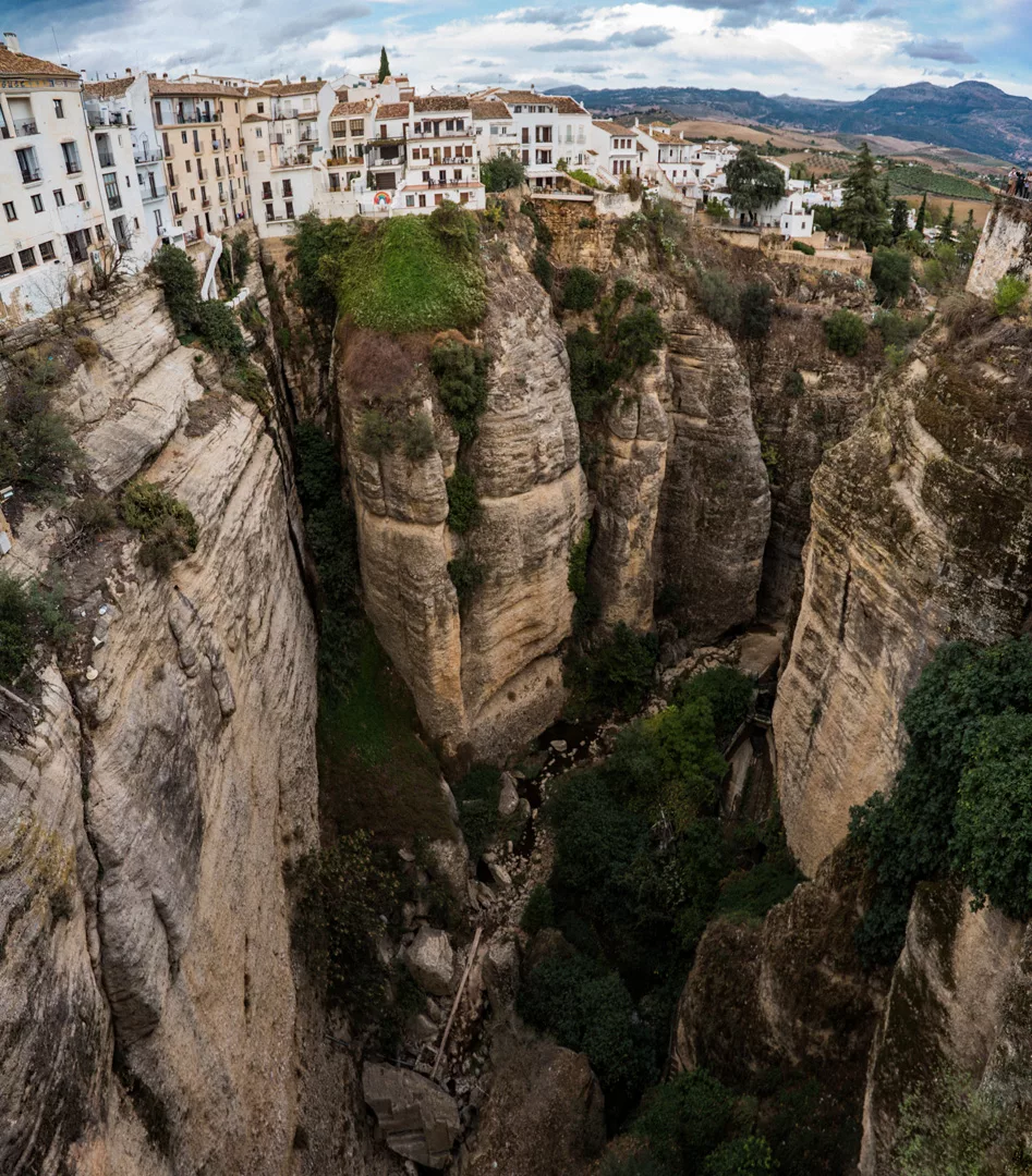
Canyon seen from the new bridge.
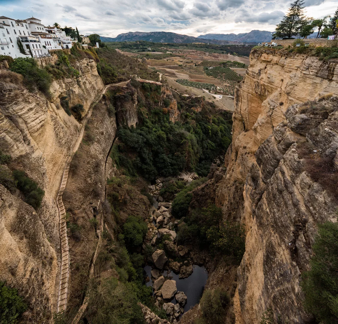
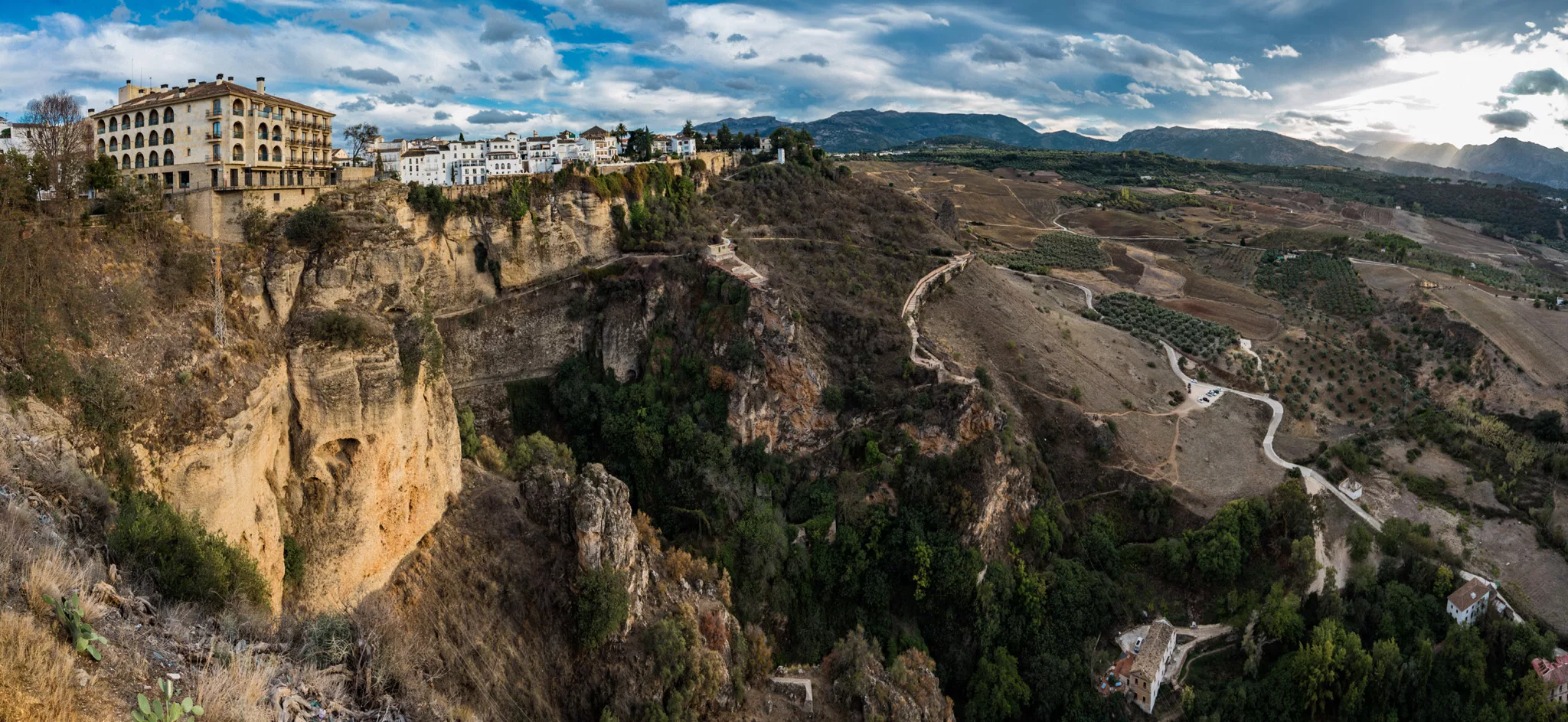
Cliff seen across the canyon, view on north.

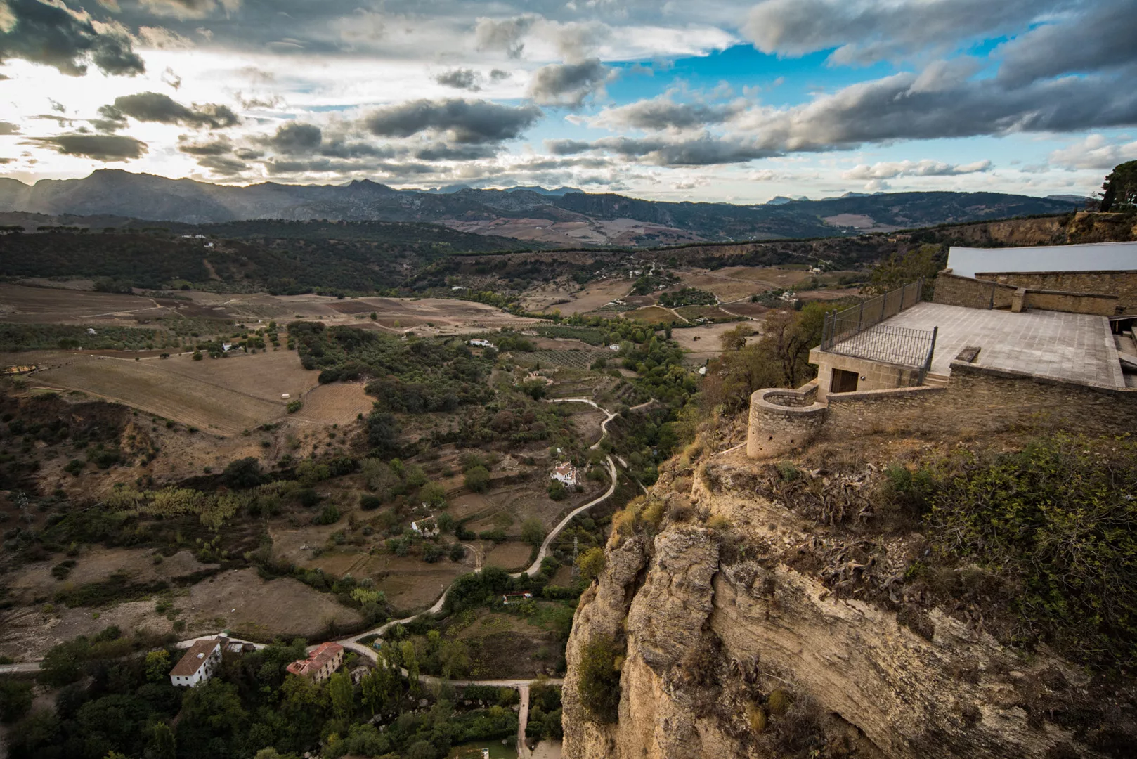
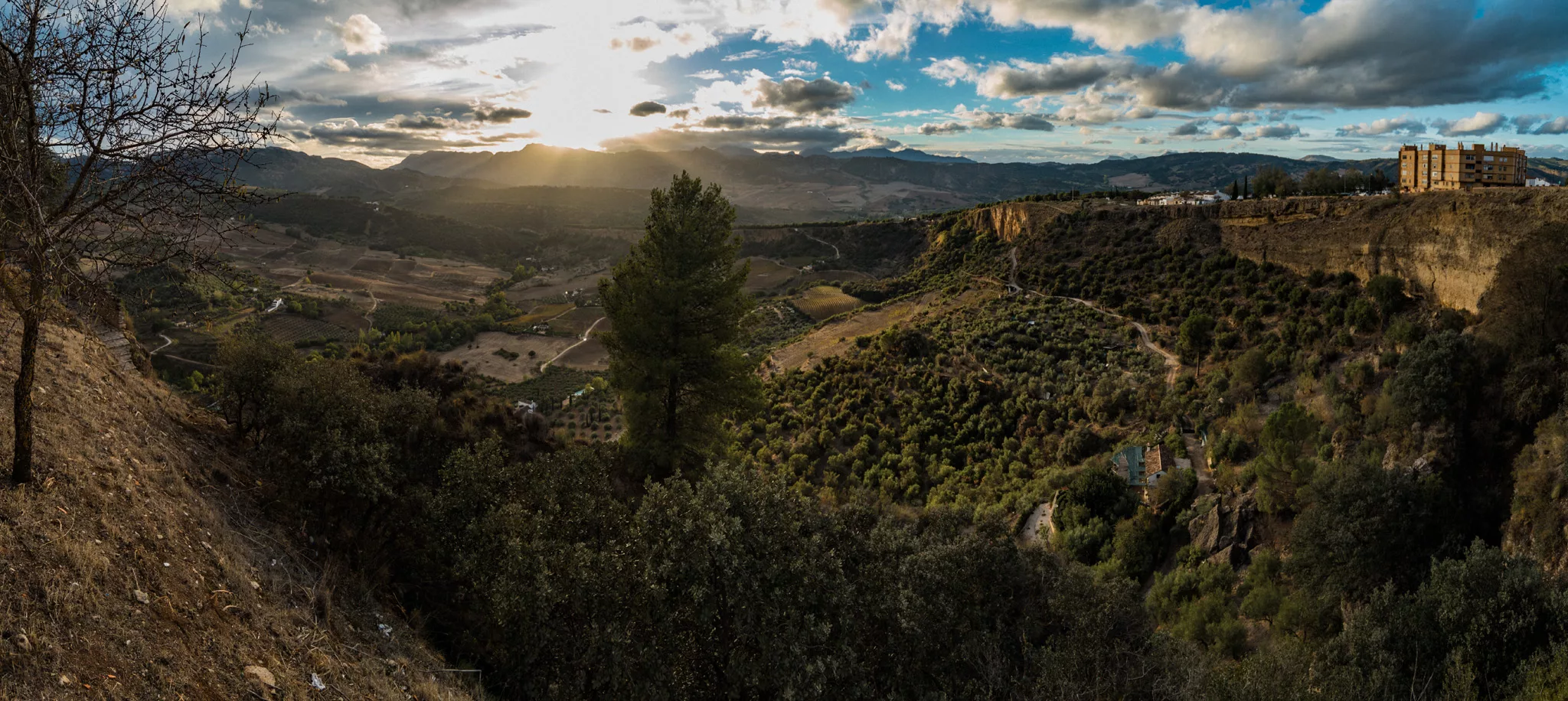
View on western side of Ronda.
View from Mirador de Ronda (36°44’28″ N 5°10’05″ W).
View from Mirador Virgen Del Rocío (36°44’55″ N 5°10’10″ W) to the south, on western side of Ronda.
And to the west.
View from the old bridge (36°44’23″ N 5°09’48″ W) to the south, across eastern side of Ronda.
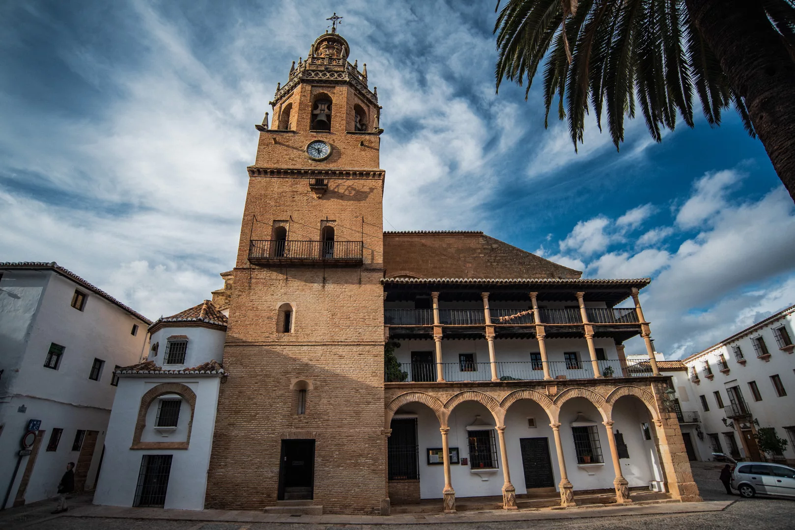
Iglesia de Santa Maria la Mayor (36°44’14″ N 5°09’55″ W).
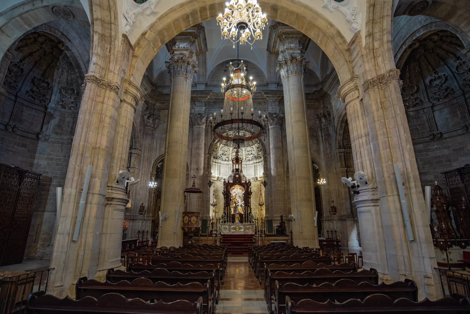
View on the city from the church.
 Landscape
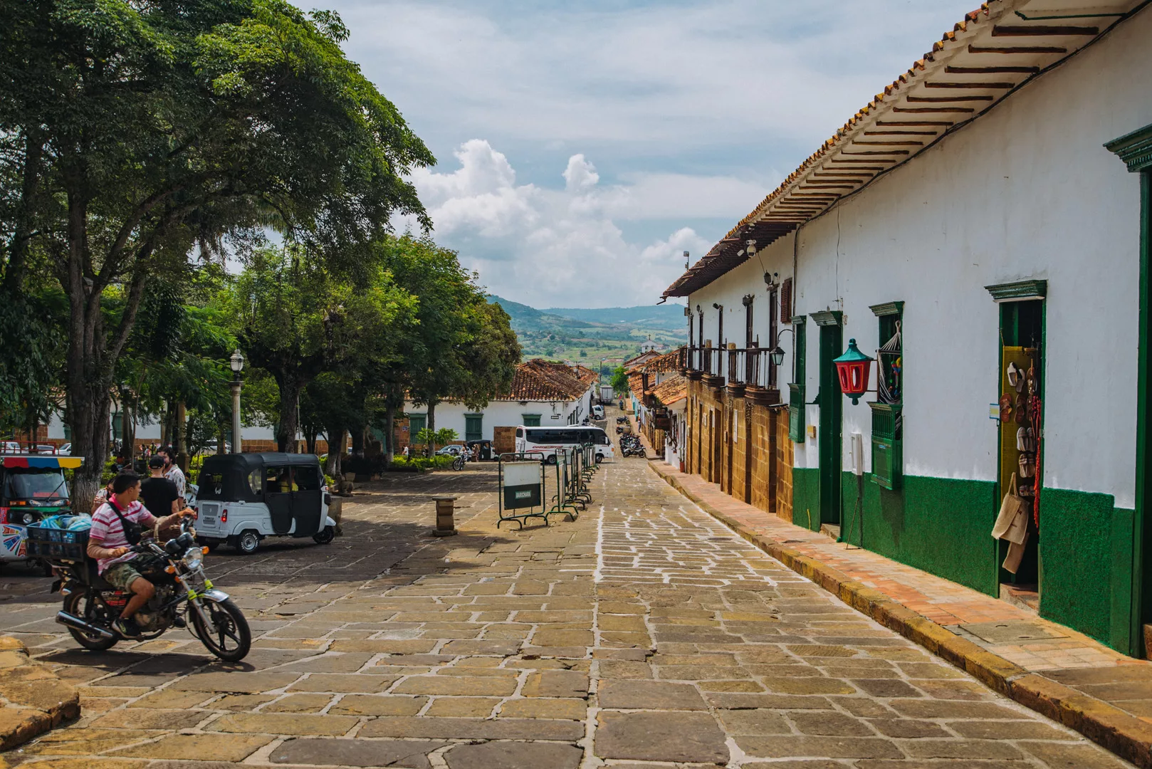
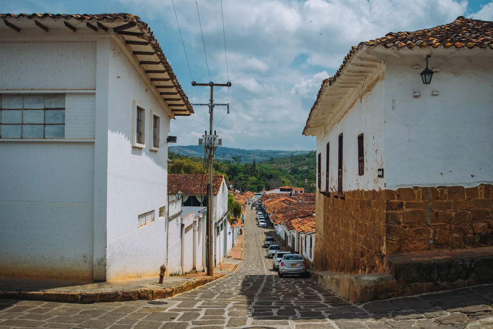
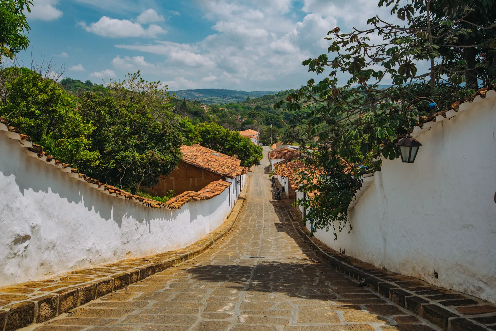
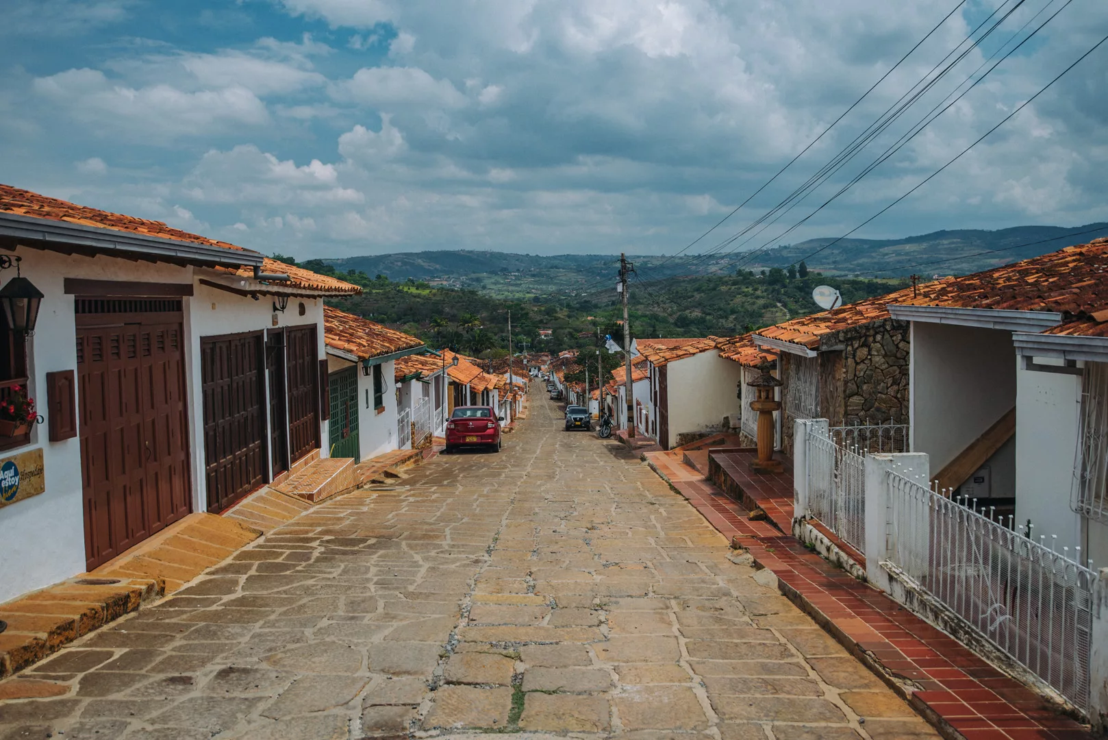
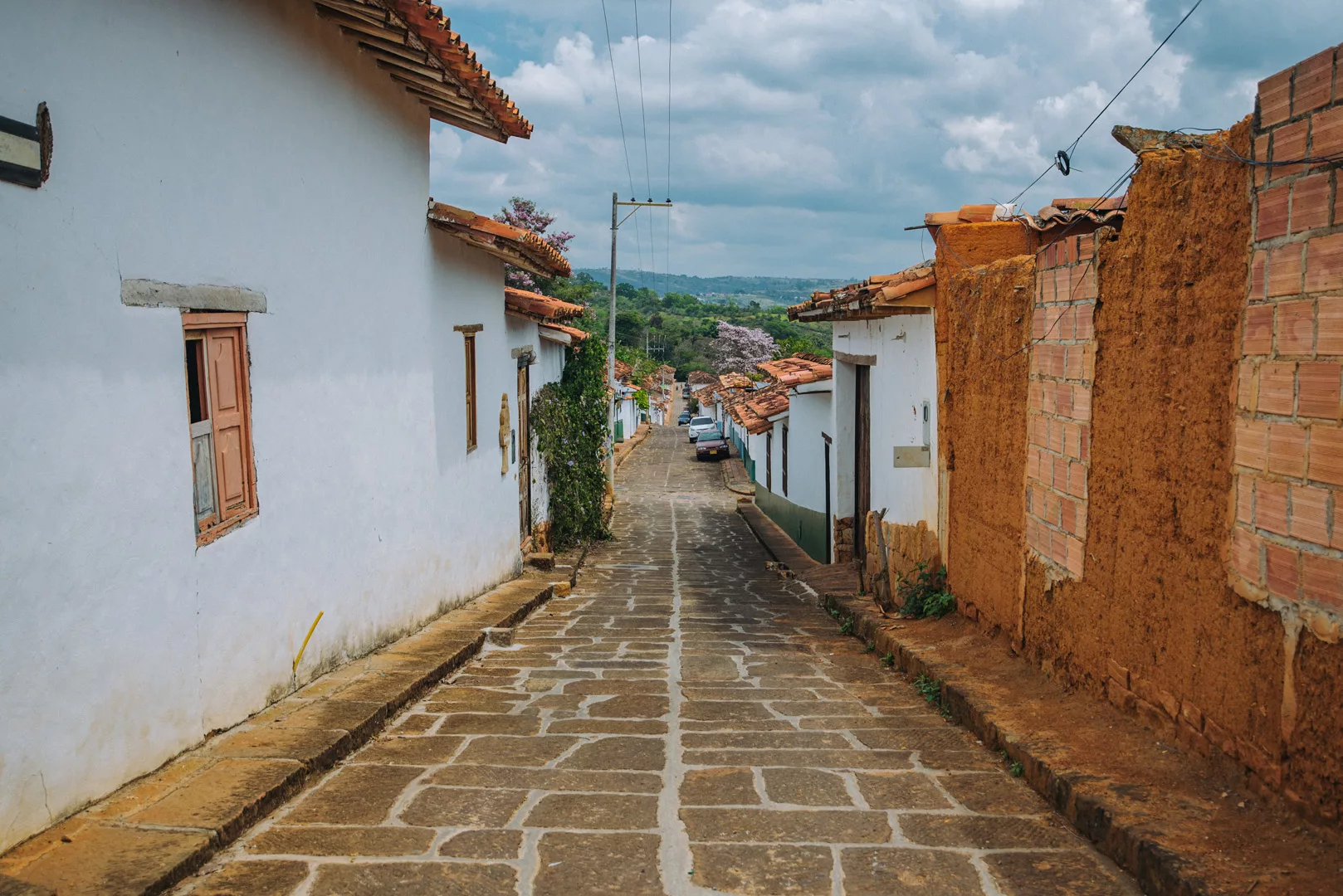
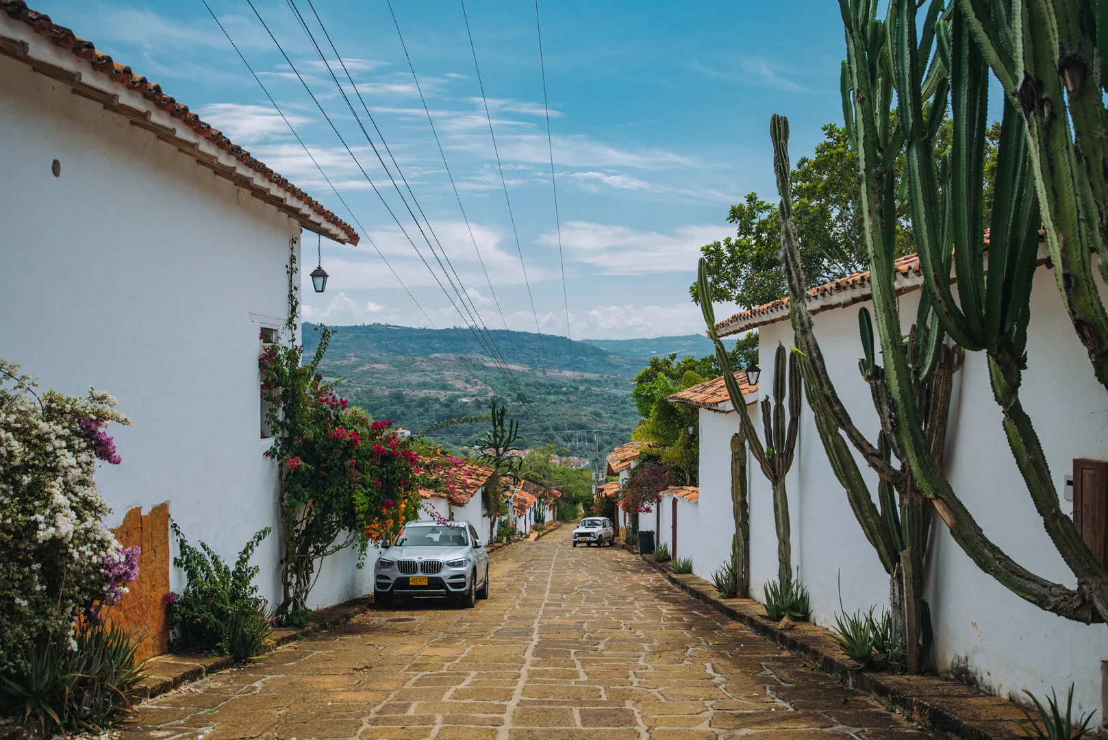
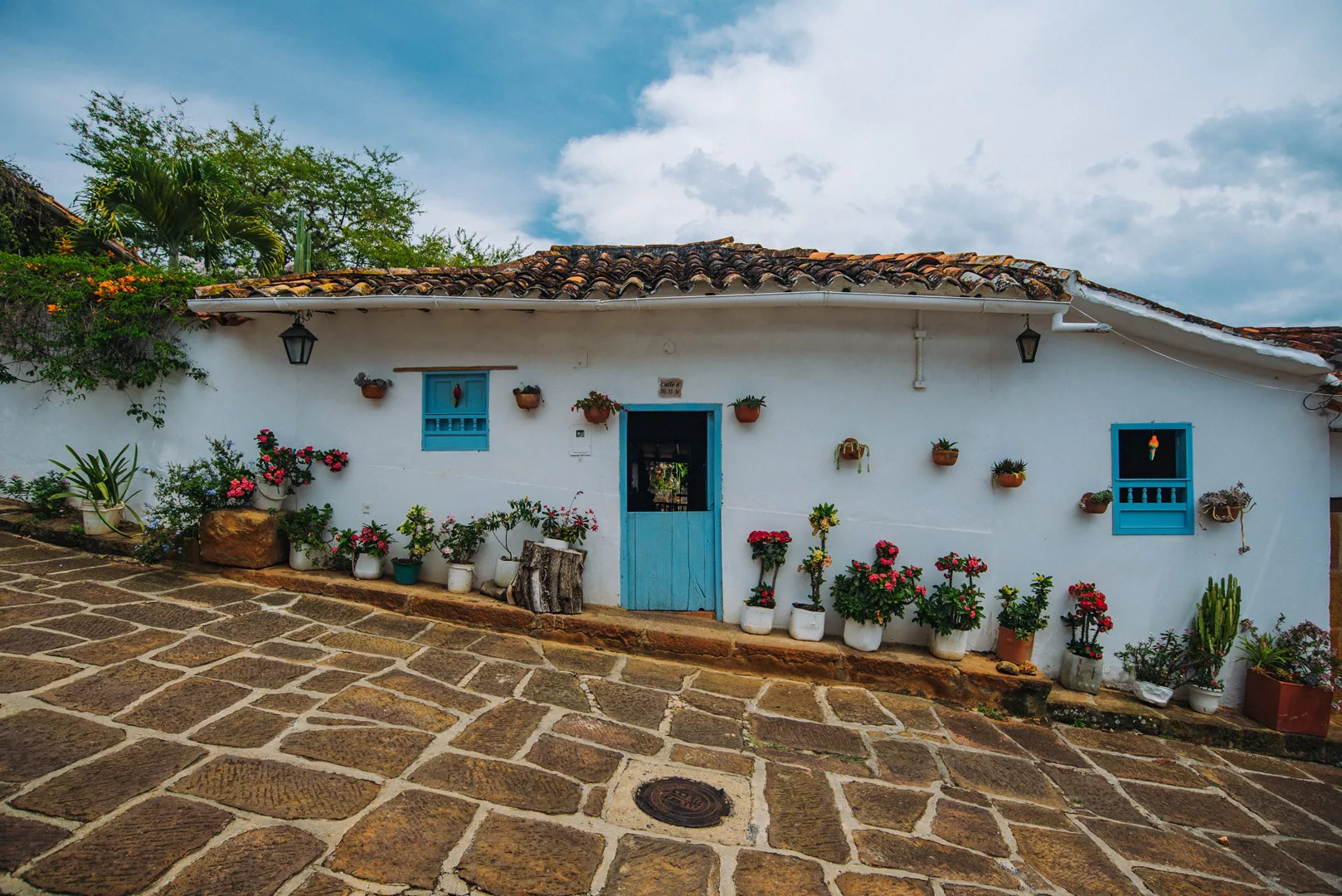
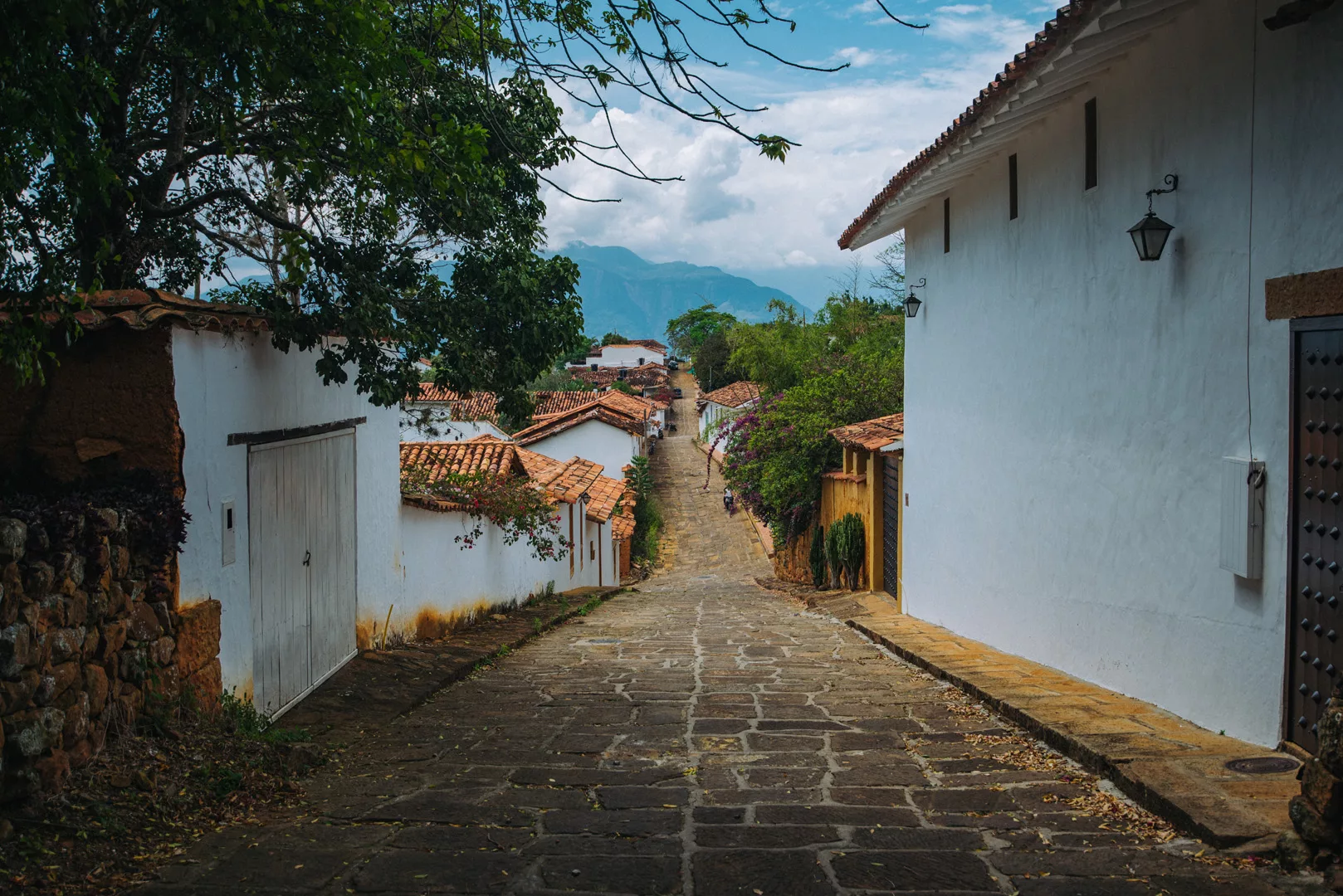
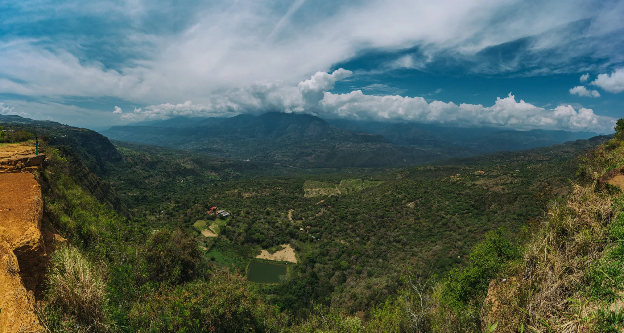
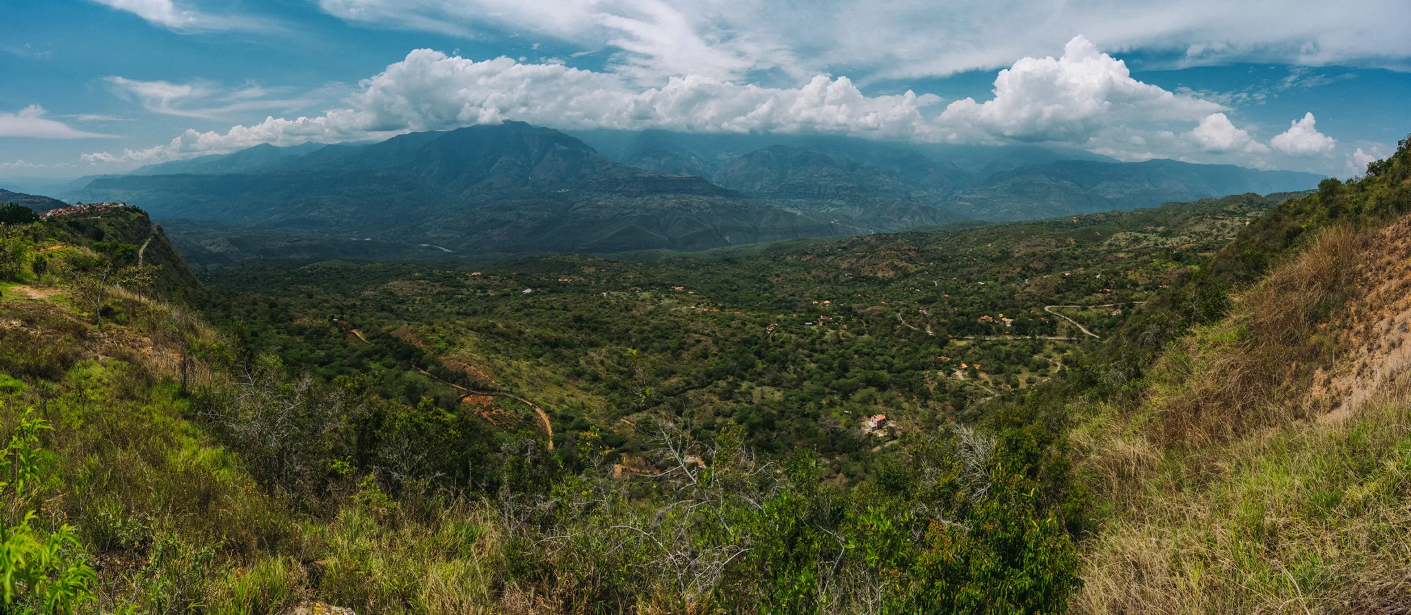
Barichara (6°38’05″ N 73°13’25″ W) is a small town 240 km north-east of Bogotá. It is known for it’s beautiful streets and viewpoints – 250 m cliff, which lowers to a valley 800 m lower than the city before raising to 3000 m.a.s.l. mountain range just 17 km from the city.
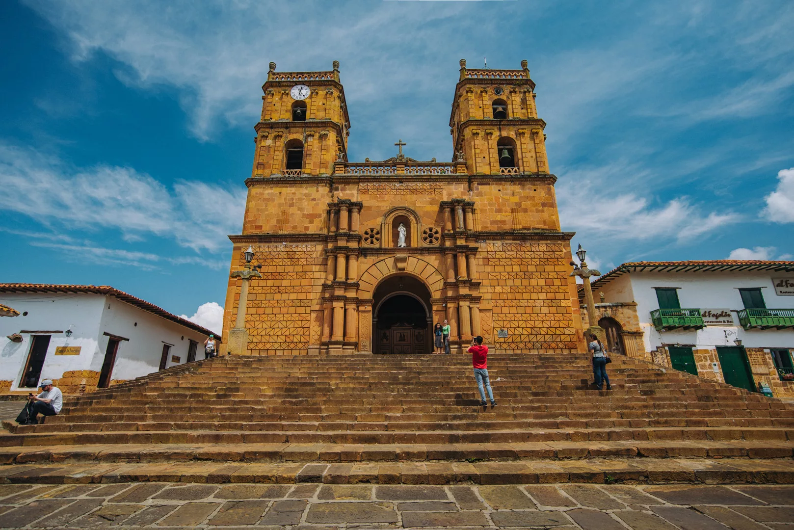
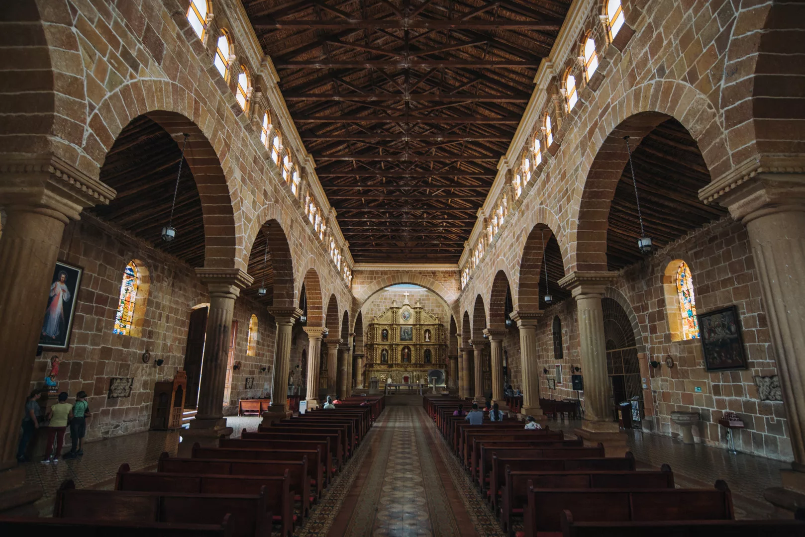
Catedral de la Inmaculada Concepción (6°38’10″ N 73°13’25″ W).
Viewpoint at 6°38’16″ N 73°13’31″ W.
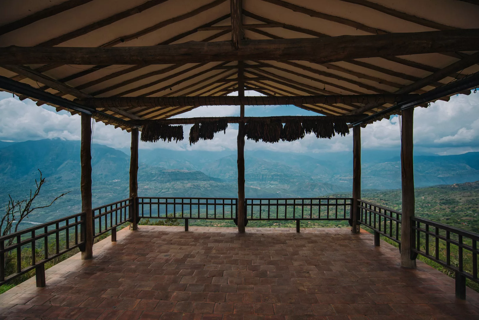
Mirador de Barichara (6°38’08″ N 73°13’39″ W).
A viewpoint in Bioparque Móncora (6°38’40″ N 73°13’19″ W). Barichara can be seen on the left.
 Landscape
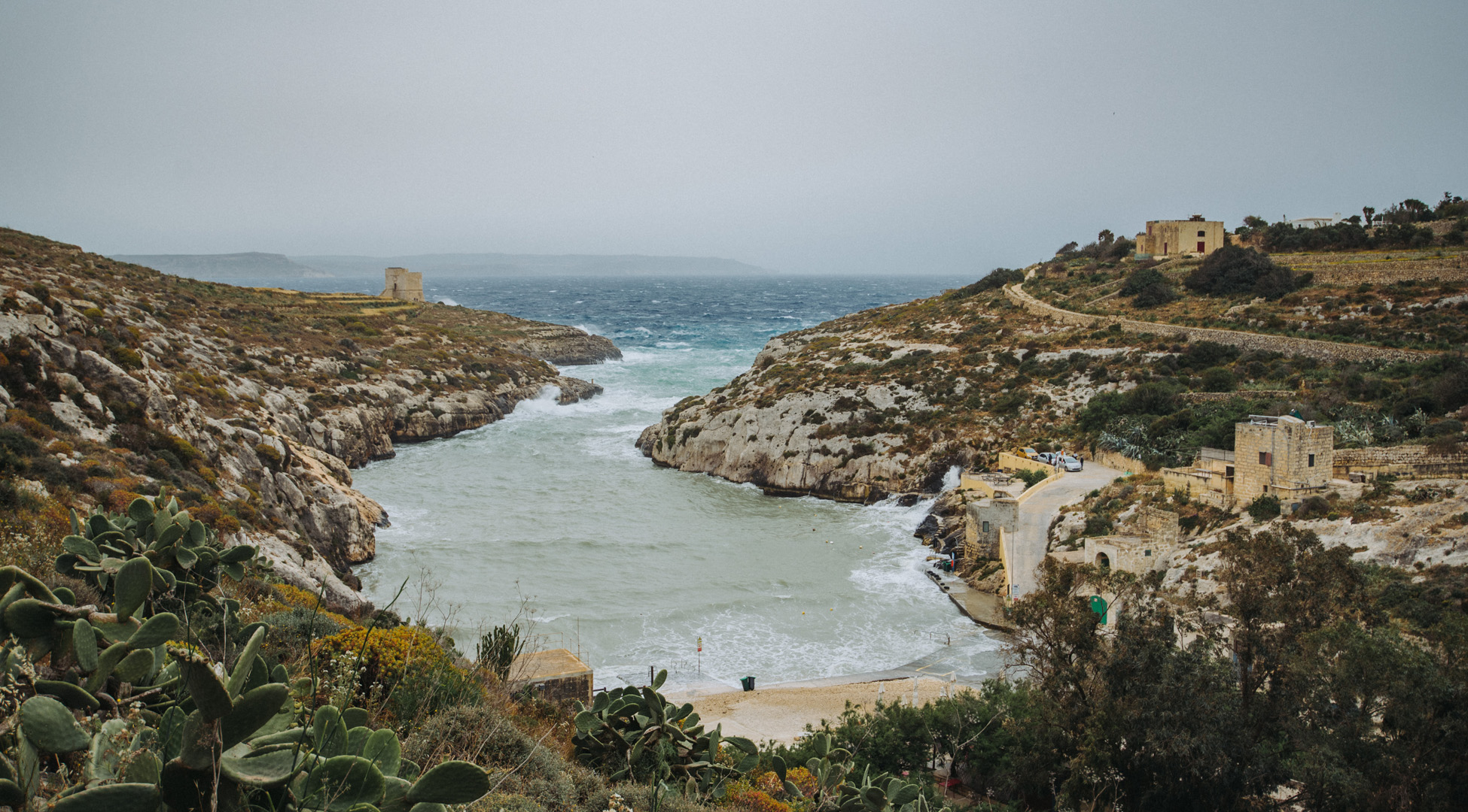
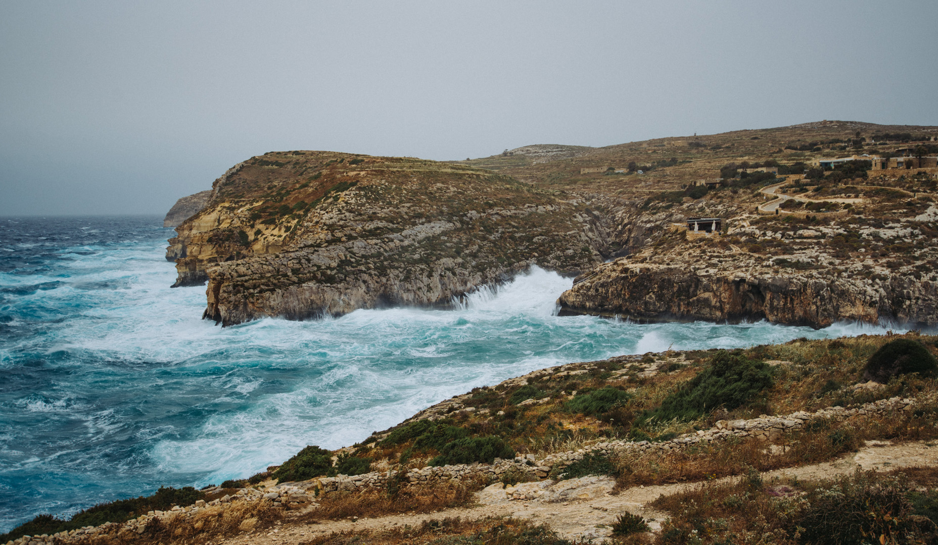
Gozo is the second biggest island on Malta, it has about 35 000 inhabitants.
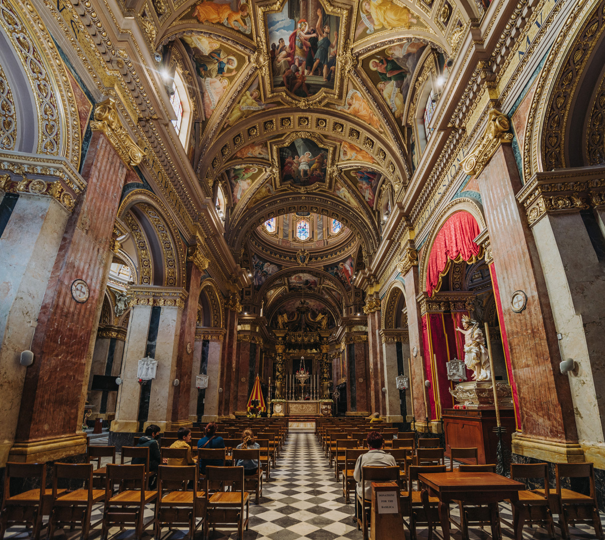
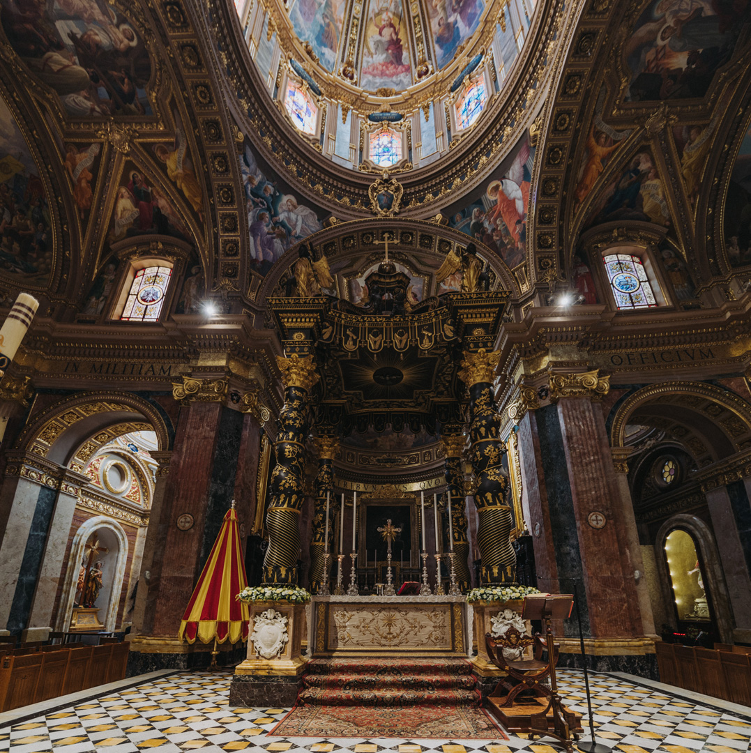
Basilica di San Giorgio (36°02’38″ N 14°14’21″E) in Victoria.
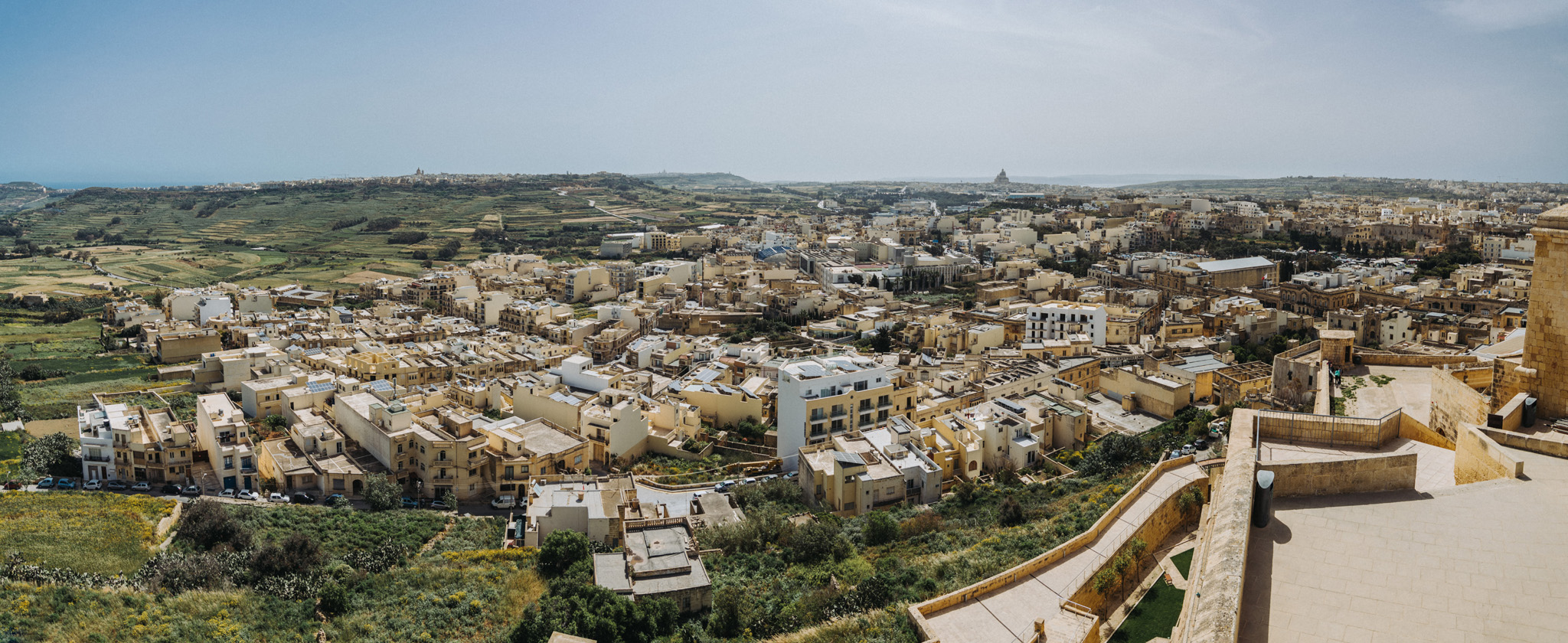
View from Citadella (36°02’47″ N 14°14’22″E) in Victoria.
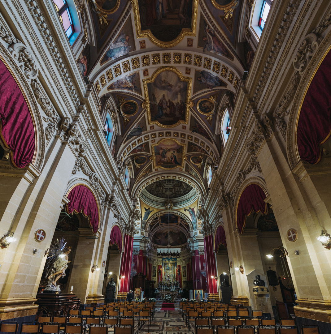
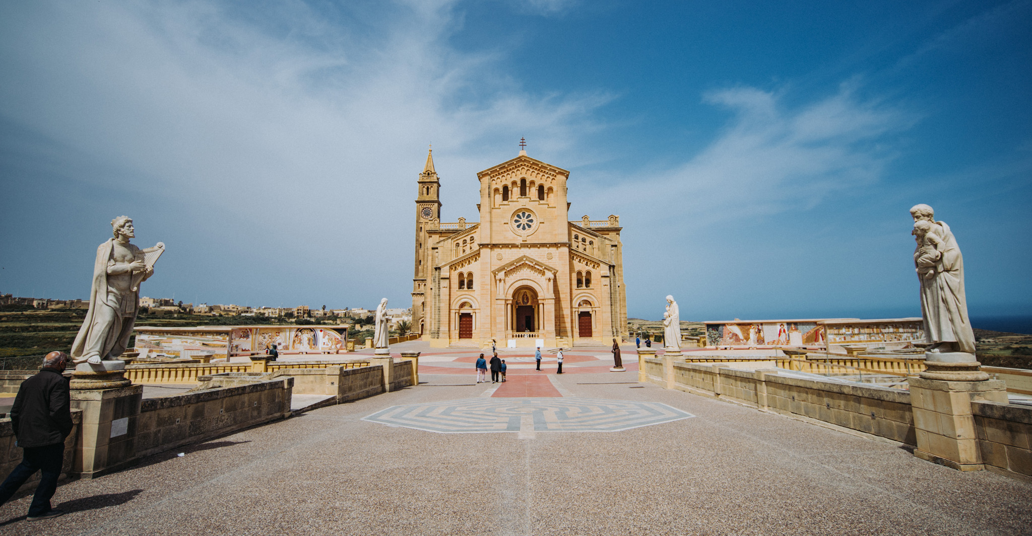
Ta’ Pinu Basilica (36°03’43″ N 14°12’54″E).
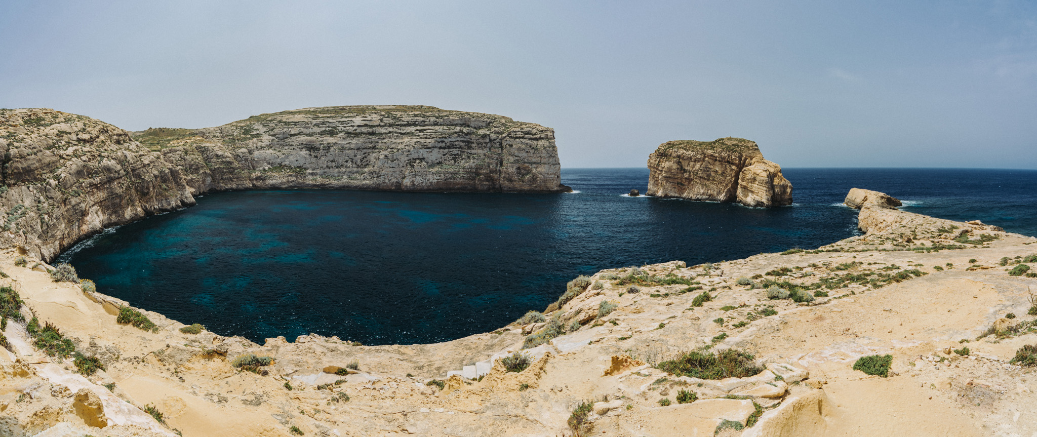
Dwejra Bay (36°02’49″ N 14°11’27″E) seen from around Dwejra tower (36°02’58″ N 14°11’31″E), the rock on the right side is called Fungus Rock (36°02’48″ N 14°11’20″E).
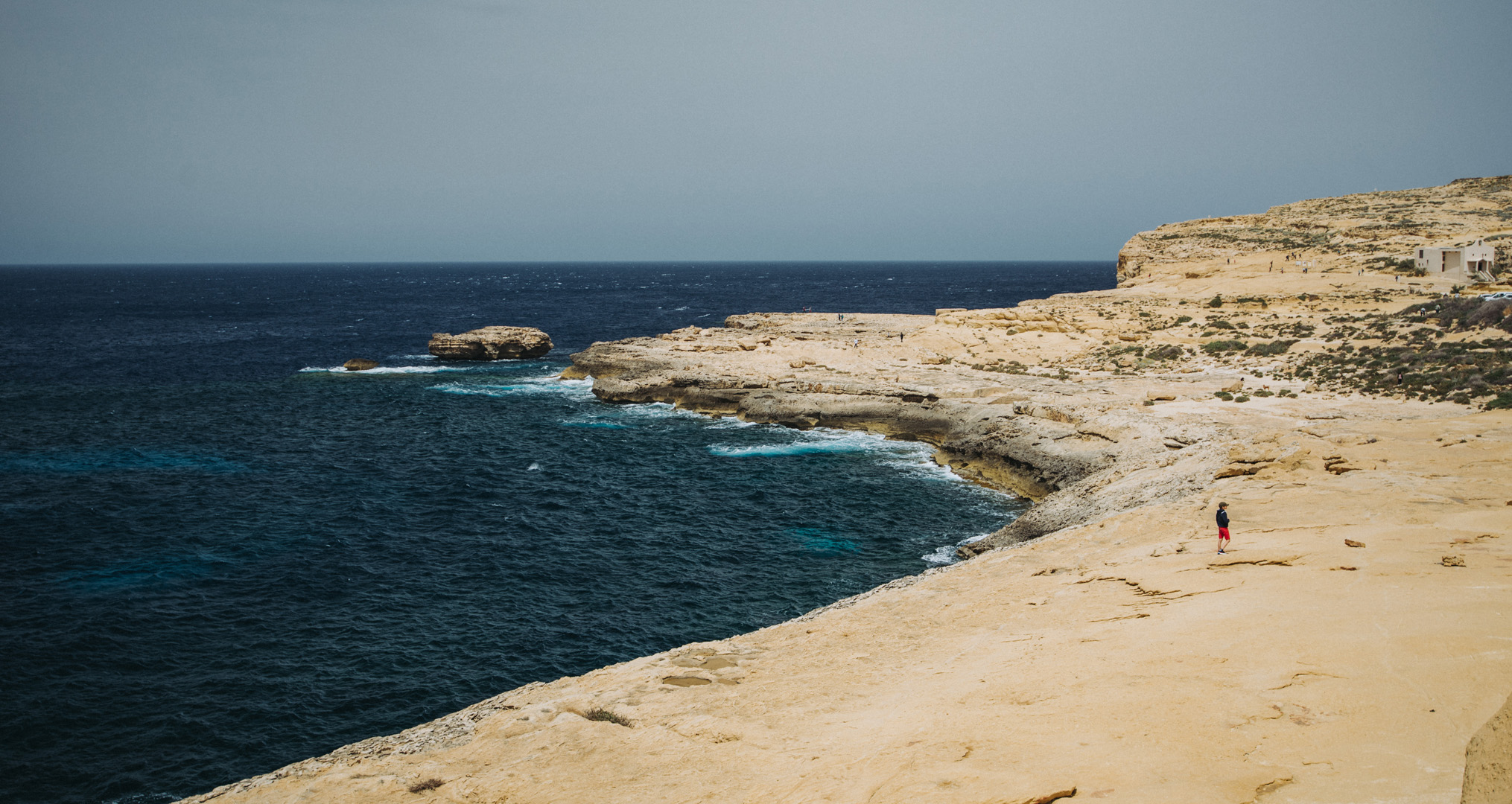
View from around Dwejra tower onto what was once Blue Hole.
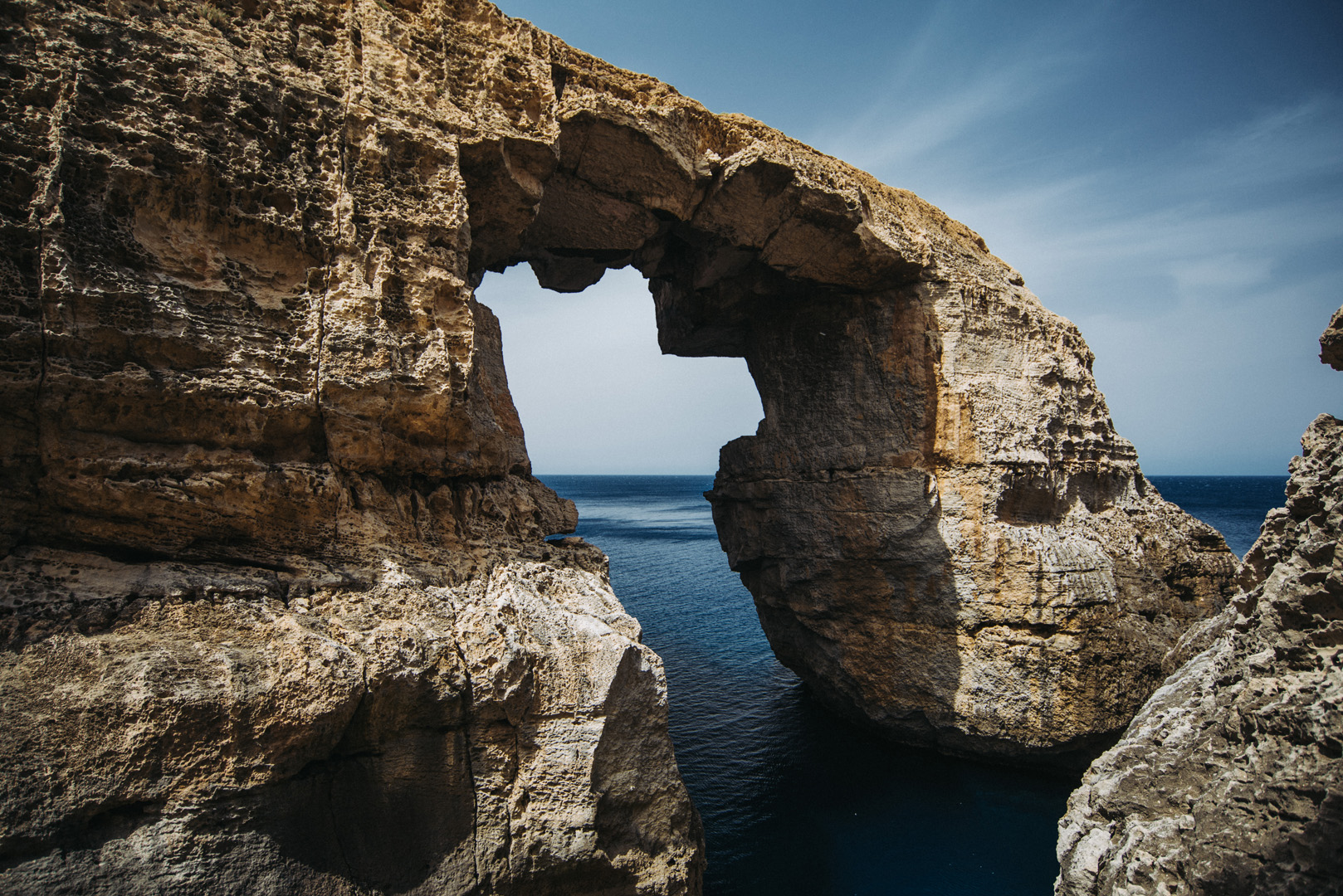
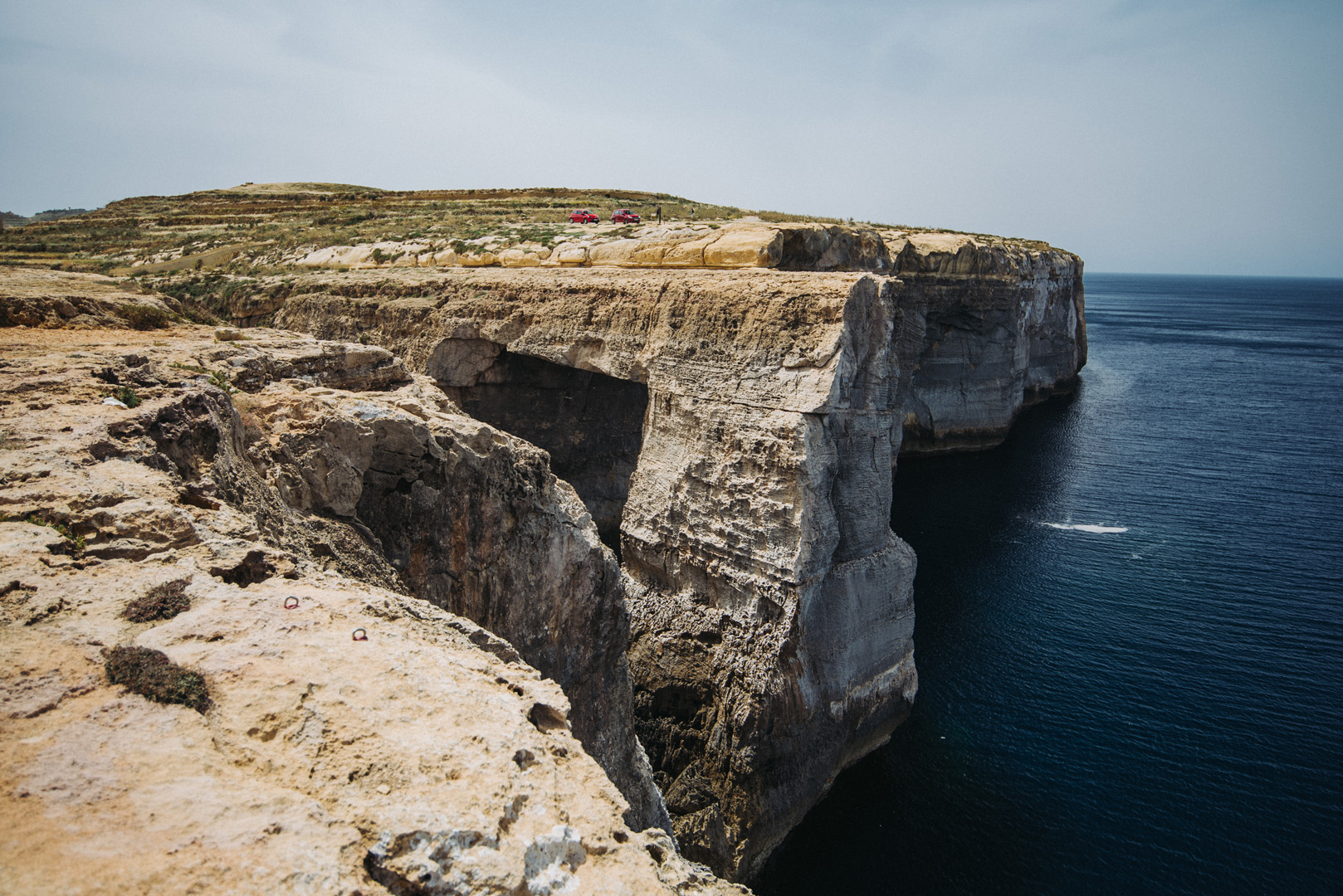
Wied il-Mielaħ (36°04’46″ N 14°12’46″E).
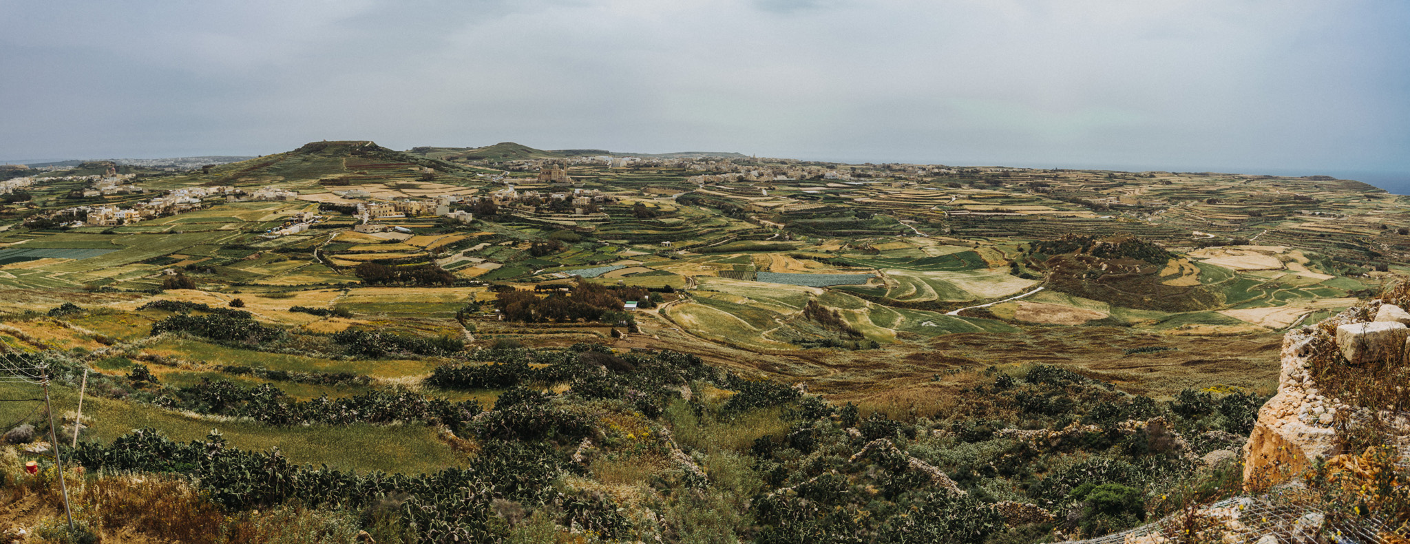
View from Giordan Lighthouse (36°04’20″ N 14°13’06″E) to the south. The highest hill on the picture (on the left side) is the Ta’ Għammar Hill (36°03’33″ N 14°13’12″E) and just on its right side there is visible Ta’ Pinu Basilica.
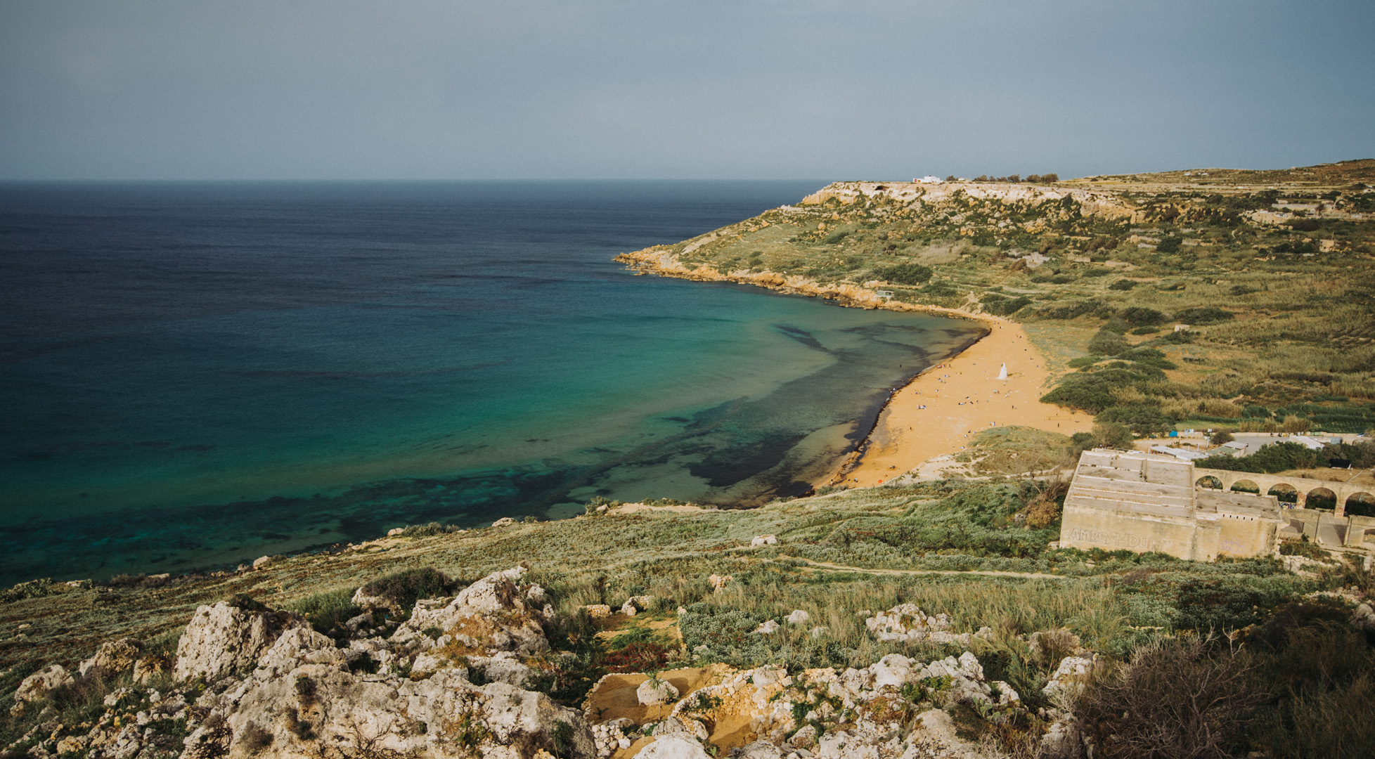
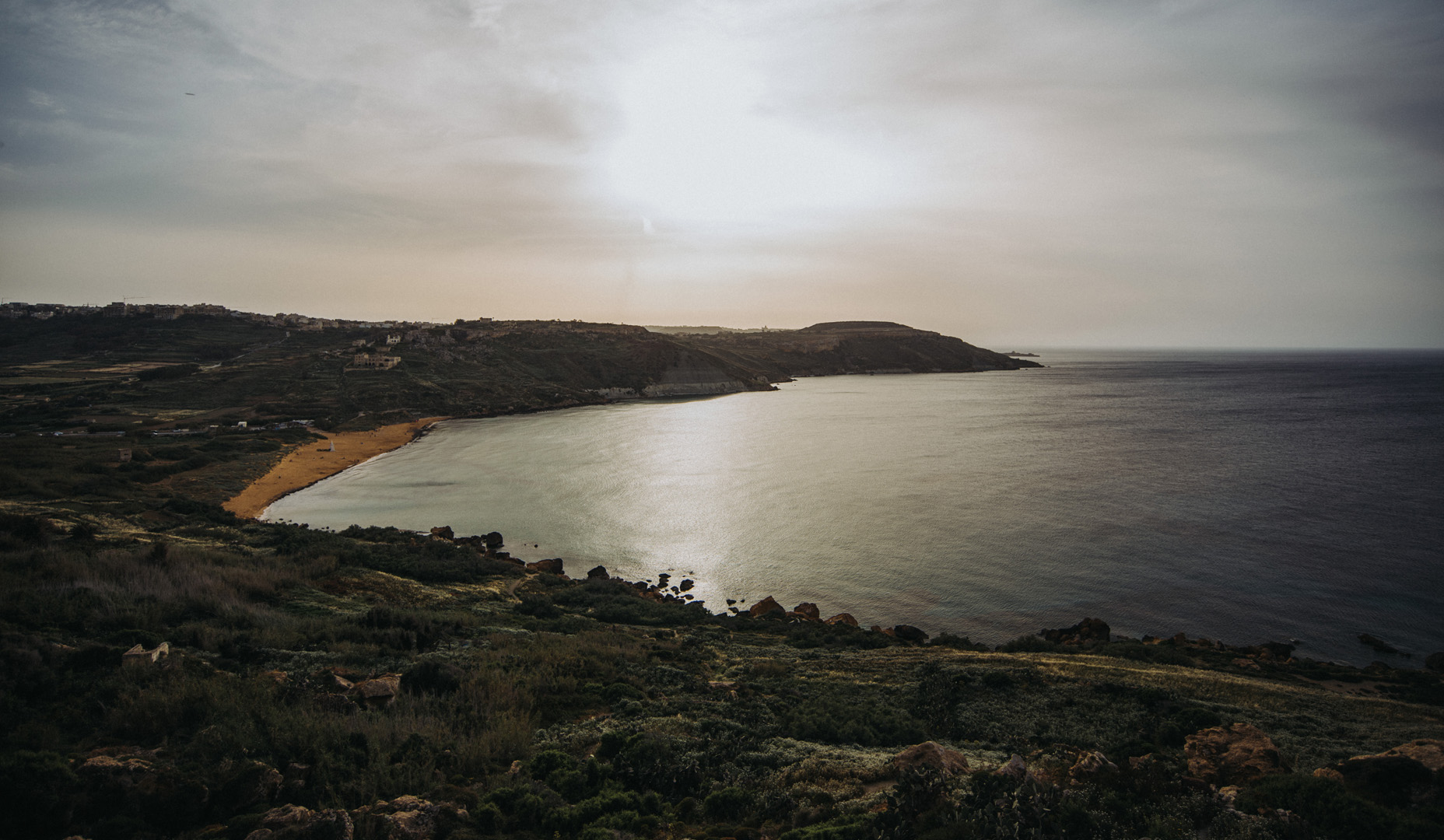
View onto Ramla Bay (36°03’41″ N 14°17’03″E) from viewpoint near Calypso Cave (36°03’38″ N 14°16’46″E).
View onto Ramla Bay from Tal-Mixta Cave (36°03’48″ N 14°17’22″E).
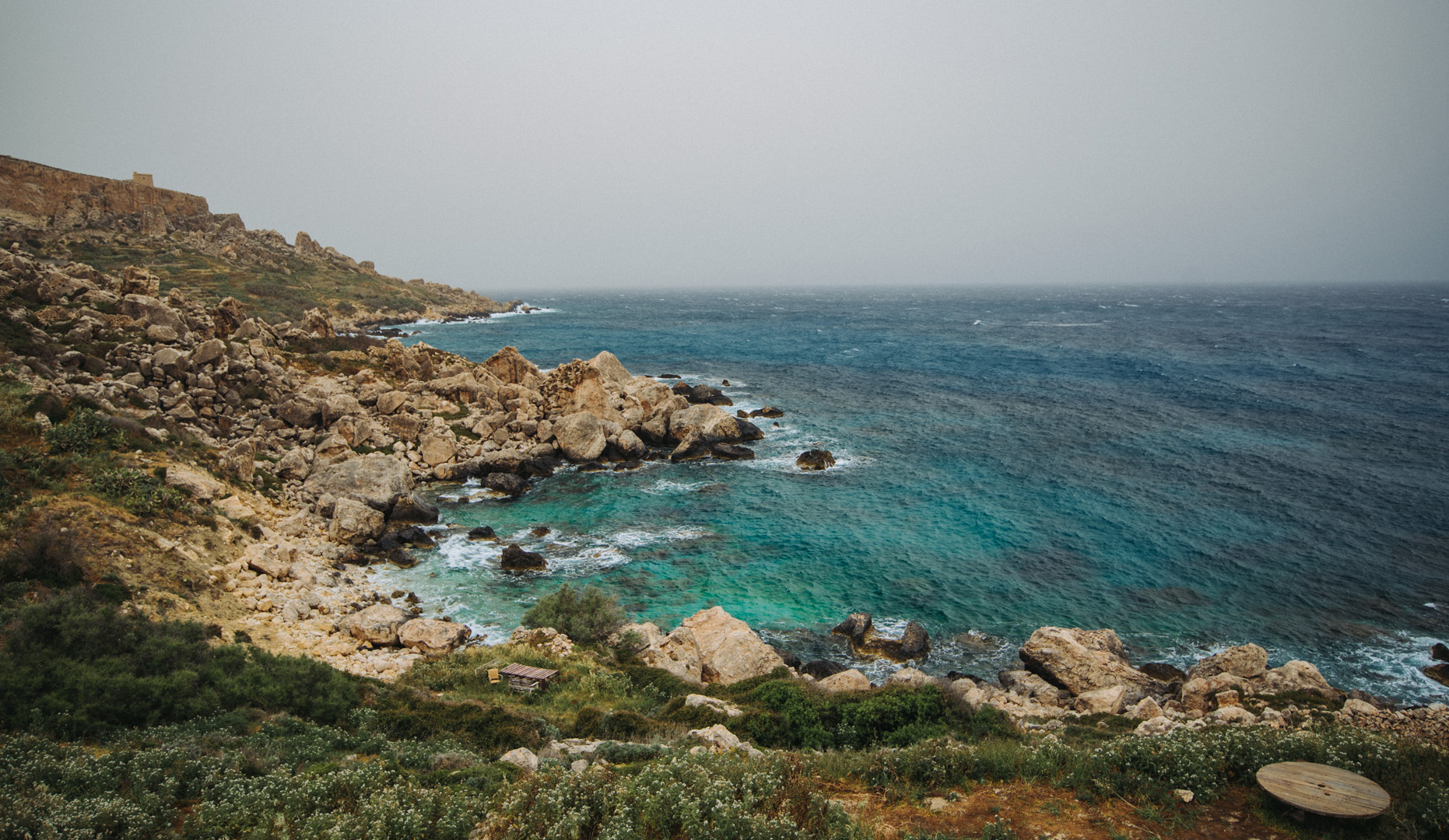
Sanap Cliffs Sunset (36°01’15″ N 14°13’21″E).
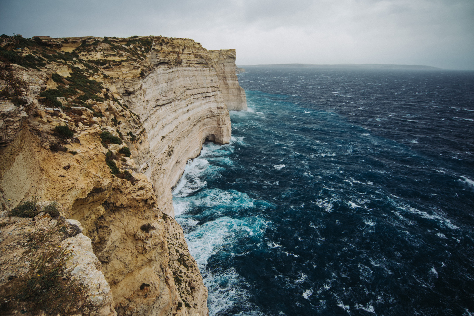
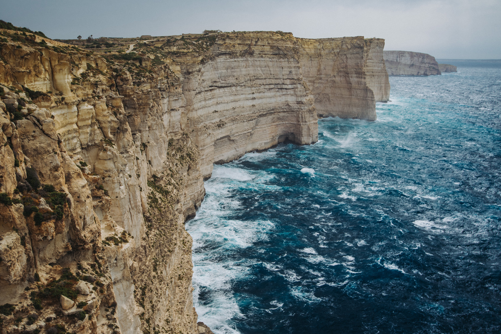
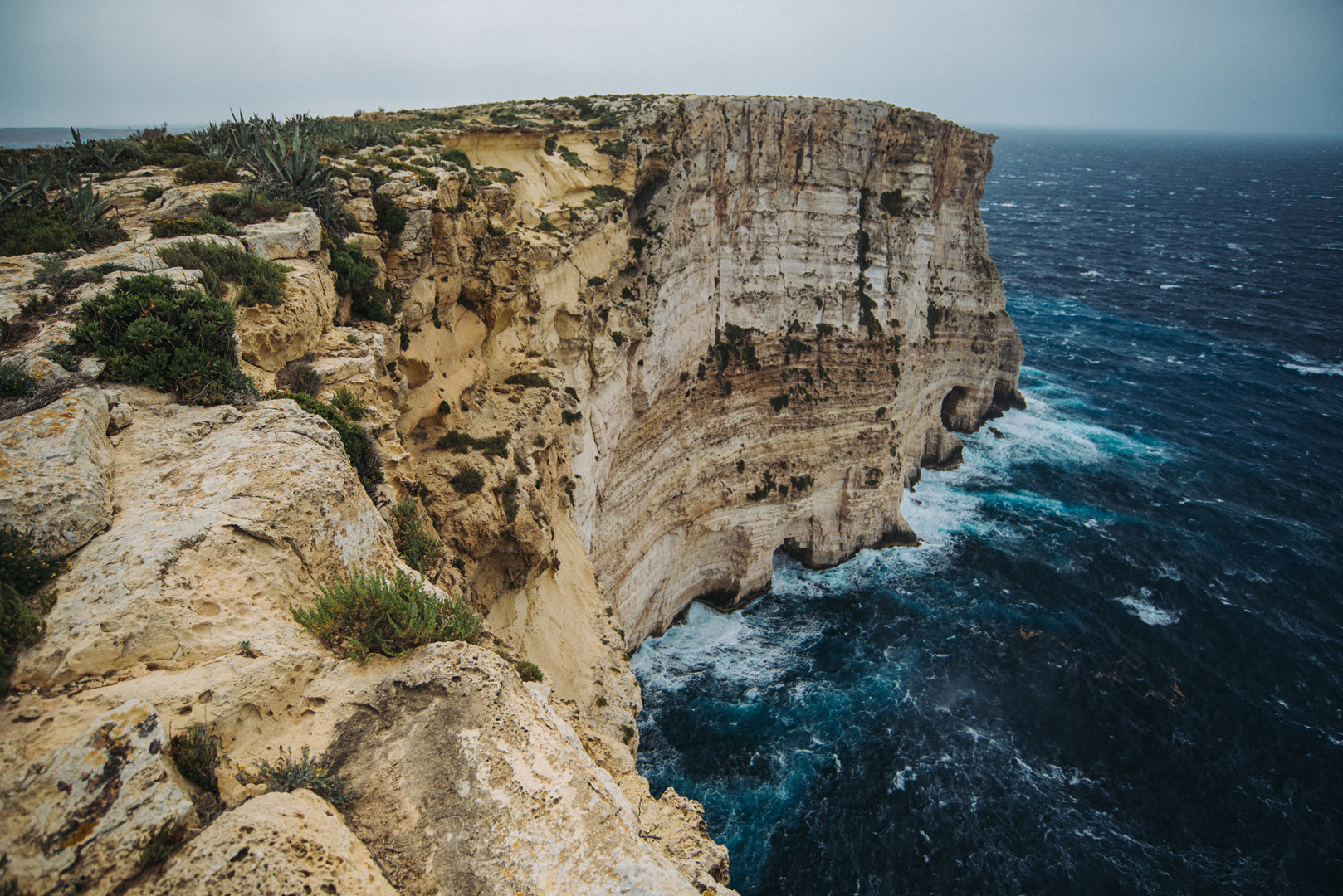
Ta’ Ċenċ cliffs (36°01’05″ N 14°15’09″E).
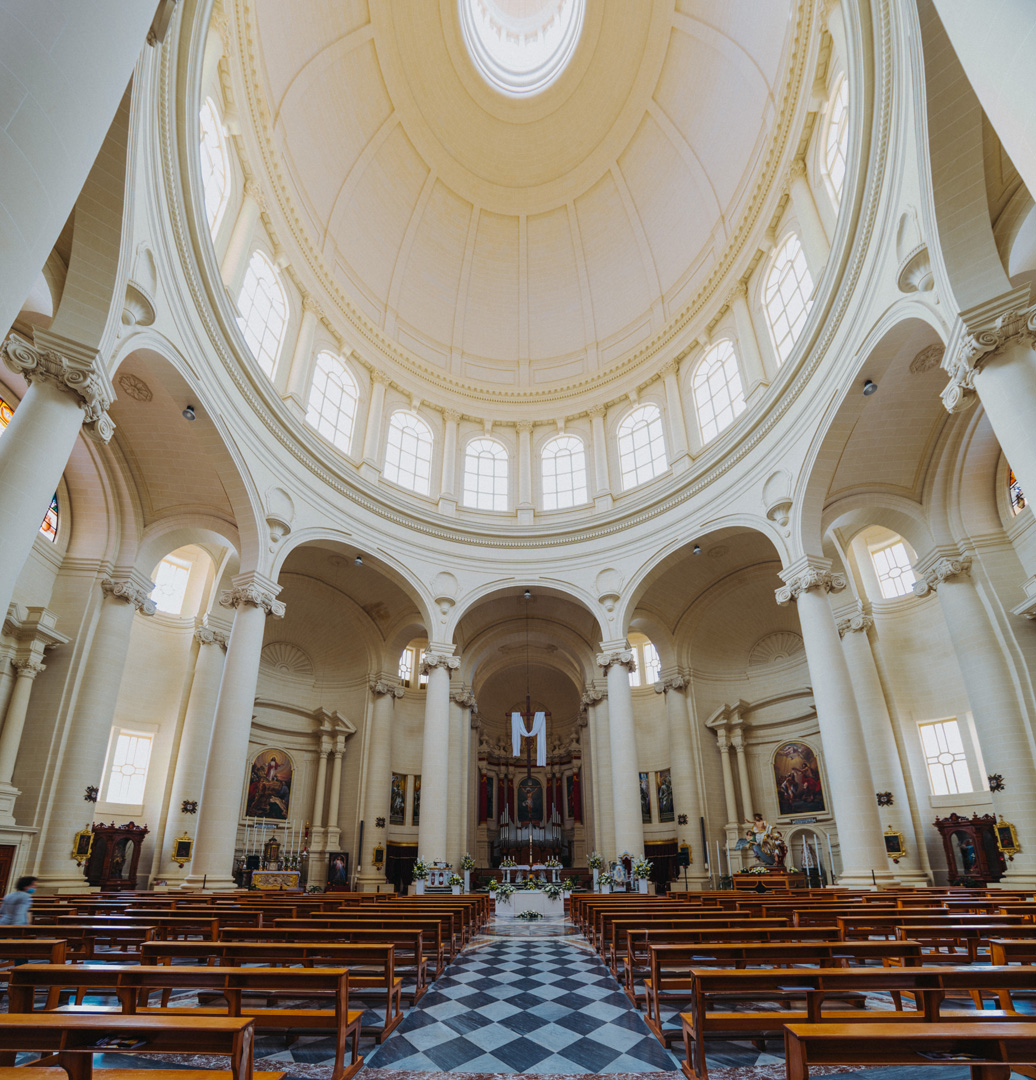
Rotunda of Xewkija (36°01’54″ N 14°15’40″E).
Mġarr ix-Xini beach and bay (36°01’13″ N 14°16’16″E).
View on Mġarr ix-Xini bay from Mġarr ix-Xini Tower (36°01’02″ N 14°16’28″E).
View on San Filip Beach (36°03’00″ N 14°18’52″E).